Use of biodiversity in modern agriculture

The use of biodiversity in modern agriculture is as important as it has ever been. Biodiversity has been and will continue to be an important part of agricultural practices worldwide. Biodiversity refers to the variety and variability among all forms of life within a given ecosystem or region. This includes genetic, species, and ecosystem diversity as well as the interactions among them.

Biodiversity plays a crucial role in maintaining ecosystem functions and services such as pollination, pest control, and soil formation. In addition to this, biodiversity also helps in improving the quality of food products by providing resistance to diseases and pests for crops. Biodiversity can be found everywhere in nature, including plants, animals, and microorganisms.

Biodiversity is important because it provides humans with many resources. The food we eat comes from plants and animals that have evolved over millions of years to meet our needs. Without biodiversity, we would not have food or shelter. Other resources provided by biodiversity include clean air and water, medicines to treat disease, clothing fibers, fuel sources such as biofuels and biomass energy, and more. This loss of biodiversity could have serious implications for human health, food security, economies, livelihoods, cultures, and much more. Biodiversity is important because it’s essential to the health of our planet. It helps maintain the balance between living things and their environment by providing food, fuel, and medicine. It also helps reduce environmental risks such as climate change, pollution, and natural disasters.

Biodiversity can be used in agriculture in many ways:

  • To improve crop yields through improved soil quality.
  • To make better use of water resources.
  • To help reduce the use of chemicals in agriculture.

In this article, we will discuss how biodiversity affects agriculture and regenerative farming practices to improve biodiversity.

How does biodiversity affect agriculture?

Biodiversity is the key to making agriculture more productive, sustainable, and profitable. Agriculture is a complex system that requires careful management to make sure we’re using our resources in the best way possible. To do this, we need to be able to identify what works and what doesn’t. For example, if you’re trying to grow blueberries in your backyard garden, you might first plant one or two varieties. But if you want your plants to thrive, you’ll want to plant more than one variety of plants so that at least some of them can survive when times get tough. And if you want to make sure that all of your plants are healthy and produce fruit well, it helps if they’re genetically different from each other so that they don’t all have the same weaknesses or vulnerabilities.

This is why biodiversity is so important for agriculture — because diversity allows us to better manage our resources and protect against pests or disease outbreaks by helping us maintain a healthy ecosystem with a variety of different species living within it.

There are numerous ways in which biodiversity affects agriculture. Here are some:

1. Biodiversity provides food for people—for example, through the cultivation of crops and livestock farming.
2. Biodiversity provides raw materials for manufacturing—for example, through the cultivation of cotton or timber production.
3. Biodiversity provides ecosystem services such as pollination and pests that enable production to continue without major problems (e.g., weeds or pests).

What is agricultural biodiversity?

Agricultural biodiversity is the diversity of crops, livestock, and other products. It includes genetic diversity within species, between species, and ecosystems. Agricultural biodiversity can also be referred to as the variability in crops, livestock, and other agricultural features, including varieties, breeds, species, and genes. It is important to maintain this diversity because it helps ensure that farmers can continue to grow food in the face of changing climate conditions and other challenges like pests and diseases.

Agricultural biodiversity is part of the wider biodiversity that includes wild plants and animals, as well as crop plants, livestock, and other food sources produced by humans. The term agricultural biodiversity can also be applied to agroecosystems – agricultural ecosystems that include crops and animals grown for food production (and other uses). Agricultural biodiversity contributes to food security by providing a wide range of foods for consumers, but it also has many other benefits. For example:

  • It provides us with nutritious food from healthy soils that are rich in nutrients like nitrogen, phosphorus, and potassium – these are essential for plant growth but cannot be added directly to the soil so must be sourced from elsewhere.
  • The diversity of wild plants growing on farms helps control pests such as weeds, pests, or diseases by competing with them for resources such as light, water, or nutrients.
  • Some wild plants can also act as ‘biological control agents’ (or natural pesticides), which can help reduce insect damage to crops.
  • Biodiversity impacts human health and well-being, economic growth, food and fiber security, climate change resilience, ecosystem services, and aesthetic enjoyment.
  • Biodiversity provides humans with a variety of goods and services including food, water purification, and climate regulation. The loss of biodiversity can have adverse effects on human health through increased exposure to infectious diseases.

Why is biodiversity important for agriculture?

1. Biodiversity is important to agriculture because it helps create healthy soils, pollinators, and pest control. When there is a high level of biodiversity in an area, the soil will be healthier and more nutrient-rich. This leads to better crops that contain more nutrients that are needed for human consumption.

2. Agricultural biodiversity ensures food security by providing many different types of foods in a single area so that if one type of crop fails due to drought or other conditions then others will still be available for harvest.

3. Biodiversity also helps provide pollinator species such as bees and butterflies that are necessary for pollinating plants such as wheat, soybeans, and corn. Without these species, our food supply would not be able to grow because there would be no way for them to reproduce and continue their life cycle. This would mean that we would not have enough food available for humans or animals alike.

4. Biodiversity is also important because it helps farmers understand how different species interact with one another in an ecosystem. This knowledge can help us understand how we can better manage our land so that we can sustainably grow our food supply for future generations.

5. Biodiversity also helps farmers understand how to manage pests and diseases so that they don’t affect their crops. For example, a farmer may have noticed that a certain type of pest has been eating his corn crop for years. By studying the differences between the pest and its natural enemies, he can learn how these enemies help control the pest population naturally without having to use pesticides.

6. Biodiversity also provides pest control services by keeping populations of harmful pests down so that they cannot destroy crops or spread disease among humans or animals alike. Without these species around, we would have much less food available to us than we do today.

7. Biodiversity is extremely important in agriculture. It helps farmers to understand how to better manage their farms. This includes understanding which crops need to be rotated, which crops will grow best in certain environments, and why some plants may not be growing as well as they should.

8. Biodiversity is important for agriculture because it provides us with food, fiber, and medicines.

9. Biodiversity also helps us adapt to climate change by preserving genetic resources that are resilient to environmental change.

Regenerative farming practices to improve biodiversity

Regenerative agriculture is a holistic approach to farming that focuses on the health of the soil, plant, and animal rather than short-term profits. It involves practices like crop rotation, cover cropping, composting, and integrated pest management. Regenerative farming practices can improve biodiversity by increasing the number of species in an area, helping them to thrive, and making it less vulnerable to climate change. Regenerative farming practices increase soil fertility because they restore nutrients to the soil instead of depleting them through chemical fertilizers or pesticides. This leads to healthier plants that produce more nutritious food that can be grown in less space. This means less land will be needed for agriculture which will support more wildlife habitats.

Regenerative farming practices to improve biodiversity

Here are some regenerative farming practices to improve biodiversity:

1. Cover crops

Cover crops are plants grown specifically for their ability to protect and improve soil health through nitrogen fixation (when a plant takes nitrogen from the air into its roots). They can also provide ground cover which prevents soil erosion as well as provide seeds for birds and insects during winter months when there is little natural food available for them. For example legumes such as clover fix nitrogen into nodules on their roots so that it becomes available.

Cover crops also build up nitrogen levels in soils by fixing nitrogen from the air into organic compounds that plants can use as fertilizer. This reduces the need for synthetic fertilizers that pollute waterways when they wash off fields during rainstorms or irrigation events. Regenerative farmers plant cover crops between seasons to reduce erosion, increase organic matter in soils, and provide food for beneficial insects. Cover crops provide shelter for many types of wildlife, including small mammals such as rabbits, voles, and mice, who use them as nurseries for their pups or dens while they are away hunting during the day.

2. Reduced tillage

Regenerative farmers use less tillage than conventional farmers, because it disturbs soil structure, reduces organic matter in the soil, increases erosion, and disrupts soil organisms such as earthworms. Regenerative farmers leave crop residues on the surface of the field to protect against erosion and increase organic matter in the soil.

3. Crop rotation

Rotating crops each year helps prevent pests from becoming resistant to herbicides or pesticides. This also allows for different plants to be grown on your farm which provides more habitat for beneficial insects and birds. Shorter rotations (two years) will allow you to plant many different types of crops in one field at once.

4. Rotational grazing

Regenerative farmers rotate their livestock through different pastures or paddocks so that each area gets time to rest from grazing pressure before being grazed again. This strategy promotes biodiversity by allowing weeds and native plants to regenerate after being grazed down. Rotating livestock through paddocks allows grasses to grow taller, which improves soil health and fertility by increasing organic matter in the soil and improving soil structure. Animals also deposit manure on the land, which provides nutrients for plants as well as carbon sequestration. Rotational grazing helps keep pastures healthy and reduces weed growth by reducing bare spots in the pasture where weeds thrive.

5. Hedges and buffer strips

Planting hedges and buffer strips help in protecting water sources from runoff, erosion, and pollution by increasing habitat for pollinators, birds, and beneficial insects.

6. Land conservation

Land conservation is also a key component of regenerative farming practices, which have been shown to improve biodiversity and carbon sequestration in agriculture landscapes. Land conservation practices are one way to help maintain biodiversity by protecting natural habitats, native plants, and animals from destruction or extinction. They can also help to improve soil quality through sustainable agriculture practices that reduce erosion and promote nutrient retention.

7. Conservation tillage

Conservation tillage is a type of farming practice where land is left undisturbed after planting seeds so that crops can grow with minimal disruption from mechanical equipment like tractors and plows. Conservation tillage can help control weeds by reducing their access to light so they cannot grow as easily. It also helps keep moisture in soils so they do not dry out too quickly during heat waves which can cause more evaporation from soil surfaces during hot weather periods (e.g., summer months). Conservation tillage preserves organic matter in soils.

Biodiversity is important to agriculture because it provides the raw materials for food production. Biodiversity makes it possible for crop plants to resist pests and diseases. This is because different types of crops have different levels of resistance and susceptibility to pests and diseases.

Also, biodiversity is crucial for human survival because it ensures food security, water supply, and climate regulation. Biodiversity provides a source of genetic variation that can be used in plant breeding programs. This can result in new varieties with improved disease resistance or higher yields. Finally, biodiversity also plays an important role in supporting agriculture through pollination by insects such as bees and other animals such as birds and bats.

Topography and nutrition content in soil and yield

The topography of the land, climate, and soil type can have a significant effect on the nutrient content of crops. It has been demonstrated that soil topography has a substantial effect on its fertility. The steepness of the slope and its inclination concerning the sun have a marked influence on the amount of radiant heat received by any given area, and the greater this is, the more rapidly plants will grow. The fertility of soils depends largely upon their composition, structure, and texture. Soils with a high proportion of sand in their composition are generally more fertile than those containing large amounts of clay; soils that are loose in texture are easier to cultivate than those which are compact; sandy loams are most suitable for growing cereals as they contain good quantities of humus. The chemical composition of soil depends largely upon what type of rock material it was derived from. Sandstones and shales usually form poor soils, while limestones give rise to rich loams which are well suited for arable farming. As an example, consider the following: The larger amounts of rainfall in wet regions allow greater biological activity in the soil. This biological activity leads to a more rapid breakdown of organic matter into soil nutrients. The higher temperatures also hasten decomposition. As a result, crops grown in wet regions tend to have higher concentrations of nitrogen and other plant nutrients than those grown in dry regions. Crops are grown at high altitudes generally have lower nitrogen concentrations because there is less biological activity at high altitudes and because air temperatures are cooler than those at lower altitudes.

What is topography?

Definition: Topography refers to the study and description of the physical features and characteristics of the Earth’s surface, including its landforms, such as mountains, hills, valleys, plains, plateaus, and bodies of water like rivers, lakes, and oceans. It examines the arrangement, elevation, and distribution of these features on the Earth’s surface. What is topography? It involves measuring and mapping the natural and artificial features of a specific area or region. It provides detailed information about the shape, relief, and slope of the land, as well as the location and extent of natural and man-made features. Topographic maps are created using a combination of ground surveys, aerial photography, and satellite imagery to accurately represent the three-dimensional characteristics of the Earth’s surface on a two-dimensional map. Its primary purpose is to understand and analyze the physical properties of the Earth’s surface, which can be essential for various applications. For example, it plays a crucial role in land development and urban planning, as it helps identify suitable locations for construction, assesses the feasibility of infrastructure projects, and determines potential flood zones. It is also vital in natural resource management, environmental studies, and geological research, as it provides valuable information about soil types, water drainage patterns, vegetation distribution, and geological formations. It is commonly used in disciplines such as geography, geology, civil engineering, environmental science, and urban planning. It allows scientists, engineers, and planners to comprehend the terrain, evaluate its impact on human activities, and make informed decisions regarding land use, resource management, and infrastructure development.

Why is topography so important in agriculture?

It affect the climate in that it influences wind patterns and weather patterns. For example, mountains block cold air from flowing over the warm ground below them, which results in warmer temperatures on one side of the mountain range than on the other side. It affects agricultural production because it affect how water flows through an area. For example, if water flows downhill quickly, it can carry away soil nutrients or leave crops too dry for optimal growth (depending on what type of crops are grown). If water flows slowly through an area, then it can provide moisture to plants over a longer period but also increase erosion by carrying away soil particles with it. Also, it affect agricultural productivity by determining how much sunlight reaches plants at different points within an area. In general, flat areas receive more sunlight than hilly areas because there are fewer obstructions between plants and the sun’s rays that could block them from reaching their leaves. The topography of a region has a significant impact on the agricultural activities that can be carried out there. In particular, it determines how much water is available to irrigate crops and how much rainfall will be received by different parts of a country. It affect agriculture because it determines if an area will be wetter or drier than another area and if a farmer wants to grow certain crops. It also affect how easily you can move around, which can have an impact on the types of crops that are grown locally. For example, if there are mountains or hills in your area, they may make it difficult for farmers to get their products to market because they would have to take a long time going up and down the hillsides with their produce. Such terrain would make it difficult for them to transport their produce quickly enough for it to reach consumers in time before it spoils. Importance of topography in agriculture 
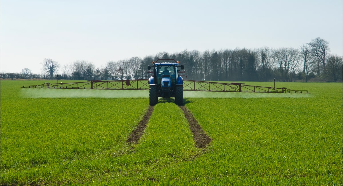
It can also affect what type of equipment and machinery will work best on a farm. For example, hillsides are often too steep for tractors so farmers must rely on their muscle power to get things done. Further, it affect how much labor it takes to run the farm. If the land is flat and smooth then it won’t take much effort for workers to move around during the planting or harvesting season but if it’s hilly or uneven then they’ll have to use more energy just to get around. Another reason that it is important in agriculture is that it affect how much rain each area gets each year. If an area has a lot of mountains around it, then it will receive more rain than an area with flat land because more clouds are forming over those mountains and releasing their water into those areas which makes them wetter than other places around them. Plant biologists use it as one factor in determining where plants are native to, or where they may be able to thrive and survive if planted in another location. This includes crops like wheat and corn that are grown widely around the world.

How does it affect the soil?

Soil profiles are controlled by five distinct, although interconnected, factors: parent material, climate, organisms, and time, according to soil study. These are referred to as soil formation factors by soil scientists. Soil profiles have different characteristics. Parent Material The substance from which soil originates is known as soil parent material, and it can be a rock that has disintegrated in place or material deposited by wind, water, or ice. The parent material’s character and chemical composition are essential factors in defining soil qualities, especially during the early phases of formation. Soils produced on coarse-grained parent material that is composed of weather-resistant minerals are likely to have coarse grain texture. When the parent material is made up of unstable minerals that weather quickly, fine-grained soil forms. Soil chemistry and fertility are directly influenced by parent material composition. Calcium, magnesium, potassium, and sodium-rich parent materials are easily dissolved in water and made available to plants. In humid areas, limestone and basaltic lava both contain a high amount of soluble bases and form productive soil. Water moving through the soil removes the bases and replaces them with hydrogen ions if the parent materials are low in soluble ions, rendering the soil acidic and unsuitable for agriculture. Soils formed on sandstone have low soluble bases and a coarse structure, making leaching easier. As parent material is transformed and the climate becomes more important, its influence on soil qualities tends to diminish over time. Climate Soils, especially on the global scale, have a high geographical link with climate. Physical and chemical reactions on parent material are highly influenced by energy and precipitation. Climate influences vegetation cover, which affects soil development. How does topography affect the soil? Precipitation has an impact on horizon formation elements such as dissolved ion translocation via the soil. Climate has become a more important influence on soil qualities over time, while parent material has become less important. Topography Because it impacts water runoff and its orientation affect microclimate, which in turn affects flora, it has a substantial impact on soil formation. To allow soil horizon processes to take place, the parent material must remain relatively undisturbed. Moving water across the surface removes parent material, preventing soil growth. On steeper, unvegetated slopes, water erosion is more effective. Organisms Plant and animal organisms play an essential part in the formation and composition of the soil. Organisms help decomposition, weathering, and nutrient cycling by adding organic matter. Climate has an impact on the richness and diversity of soil organisms and plant life that grow on the surface. Time Weathering mechanisms continue to work on soil parent material over time, breaking it down and decomposing it. The physical and chemical features of layers in the soil profile continue to be differentiated by horizon formation processes. As a result, older, more mature soils have a well-developed horizon sequence, but some may be weathered and leached to the point where visibly distinct layers are difficult to discern. This is a distinguishing feature of oxisols. Some geological processes prevent soil formation by constantly modifying the surface, preventing parent material from weathering for an extended length of time. For example, erosion of hillsides removes material regularly, preventing soil growth. New sediment is frequently deposited along river channels as the river rushes out onto its floodplain during floods. The process of soil formation is restarted by the constant addition of new material. During the soil growth process, climate and time interact. Warm and rainy temperatures speed up the development of soil, allowing it to reach maturity sooner. Weathering is slowed in cold climates, and soil growth takes significantly longer. 
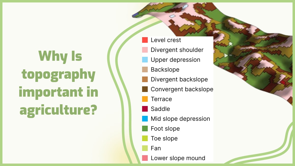
GeoPard is a new and innovative way to explore soil features and topography for better decisions and crop development. They are taking soil mapping to the next level by providing you with accurate information on soil types, soil quality, and crop suitability. GeoPard will help you make informed decisions about your farm. It’s like having your agronomist on hand. GeoPard uses advanced technology that allows you to collect data on-site which you can then use to create unique maps of your farm. These maps will show you exactly where your crops should be planted to maximize their productivity. GeoPard has all the necessary tools to create geospatial scenarios, perform spatial analyses, manage data, and visualize results. GeoPard uses different models that are based on actual field surveys, including regular elevation surfaces (with or without slope), and slope areas (with or without elevation). This technology helps farmers and agronomists to explore the soil features in a new way, create a digital terrain model (DTM) and produce maps of soil features such as rock outcrops, erosion gullies, sand dunes, canyons, slope gradients, etc.

Frequently Asked Questions


1. How does topography affect climate? How do mountain ranges take part? It has a significant influence on climate patterns. Mountains, for example, can block the passage of prevailing winds, causing the windward side to experience higher rainfall and the leeward side to be drier, creating a rain shadow effect. It also affects temperature, as higher elevations generally experience cooler temperatures due to reduced air pressure and thinner atmosphere. Moreover, it influences local air circulation and the formation of microclimates, leading to variations in temperature, humidity, and wind patterns across different slopes and valleys. 2. Which of the following crops is grown at lower elevations? Crops that are typically grown at lower elevations include those that prefer warmer climates and lower altitudes. Examples of such crops include tropical fruits like bananas, citrus fruits, and pineapples. Other crops commonly grown at lower elevations are maize (corn), soybeans, cotton, and various types of vegetables such as tomatoes and peppers. These crops thrive in regions with moderate to high temperatures and require longer growing seasons, which are often found in lower elevation areas. 3. How does altitude affect climate? Altitude has a significant impact on climate due to changes in temperature and air pressure. As altitude increases, the air becomes thinner, resulting in lower atmospheric pressure. This leads to a decrease in temperature, with temperatures dropping by about 0.6 degrees Celsius for every 100 meters increase in elevation. High-altitude areas also experience more intense solar radiation, cooler average temperatures, and greater temperature variations between day and night. Additionally, altitude influences precipitation patterns, with higher elevations often receiving more rainfall or snowfall due to orographic lifting. 4. How does topography affect soil formation? It plays a vital role in soil formation through various mechanisms. Slopes and gradients affect water drainage, leading to variations in soil moisture content. Steep slopes may experience faster erosion, leading to thinner soils, while gentle slopes allow for better soil development. Topographic features like valleys and depressions can accumulate organic matter and nutrients, contributing to soil fertility. Additionally, it influences the deposition of sediments, altering soil texture and composition. 5. How does the physical geography of a place help to shape agricultural practices? The physical geography of a place plays a critical role in shaping agricultural practices. Factors like climate, topography, soil type, and water availability directly influence the choice of crops and farming techniques. For instance, areas with fertile soil and ample rainfall are suitable for diverse crop cultivation, while arid regions may require irrigation systems or drought-tolerant crops. Understanding the physical geography helps farmers adapt their practices, select appropriate crops, manage water resources, and implement soil conservation measures for sustainable and efficient agricultural production. 6. How does topography affect economic development? It has a significant impact on economic development in various ways. It can influence the availability and accessibility of resources, such as minerals or water, which can drive economic activities like mining or hydroelectric power generation. Additionally, it can affect transportation infrastructure, with steep slopes or rugged terrain presenting challenges for road or railway construction. Coastal areas with favorable soil structure can support port facilities and maritime trade. Furthermore, topographic features like mountains or scenic landscapes can attract tourism, contributing to local economies. 7. Why is flat land good for farming? Flat land is advantageous for farming due to several reasons. Firstly, it provides ease of mechanization, allowing farmers to use machinery for various tasks such as tilling, planting, and harvesting. Flat terrain also facilitates efficient irrigation and water distribution, as water can flow evenly across the field without pooling or uneven distribution. Additionally, flat land allows for uniform sunlight exposure, promoting consistent plant growth and crop development. 8. What is a features of topography that can affect the local climate? Topographic features like elevation, slope orientation, and mountain ranges can influence the local climate. Higher elevations experience cooler temperatures, slope orientation affects sunlight exposure and temperature variations, and mountains can alter wind patterns and precipitation. 9. What do mountainous regions do to create flat land for farming? Mountainous regions create flat land for farming through various practices. One common method is terrace farming, where steps or terraces are carved into the slopes to create flat surfaces for cultivation. This helps prevent soil erosion and allows water to be evenly distributed across the fields. Additionally, mountainous regions may construct irrigation systems to divert water from higher elevations to lower areas, facilitating farming on flatter terrain. Moreover, some mountainous areas employ land reclamation techniques, such as filling in valleys or creating artificial plateaus, to create more level land for agricultural purposes. 10. Which of the following areas is most suited to farming? The suitability of an area for farming depends on several factors, including climate, soil fertility, water availability, and topography. Some types of areas that are generally well-suited for farming include:
  • Plains: Flat or gently rolling areas with fertile soil and favorable climate conditions for crop cultivation.
  • River Valleys: Areas adjacent to rivers that benefit from fertile alluvial soil and access to water for irrigation.
  • Coastal Plains: Low-lying areas along coastlines that often have fertile soil and benefit from maritime influences such as mild temperatures and moisture.
  • Deltas: Landforms formed at the mouth of rivers, providing nutrient-rich soil and ample water supply for agriculture.
  • Plateaus: Elevated flat or gently sloping areas with good soil fertility and potential for irrigation, particularly in regions with suitable rainfall.
However, it’s important to note that specific crop requirements and local climate variations can further determine the suitability of these areas for farming. 11. How big is a hectare vs acre? A hectare and an acre are both units of measurement used to quantify land area, but they differ in size. A hectare is a metric unit of measurement and is equivalent to 10,000 square meters or 2.47 acres. On the other hand, an acre is an imperial unit of measurement commonly used in the United States and is equal to approximately 4,047 square meters or 0.4047 hectares. 12. What are the five soil forming factors? The five soil forming factors are climate, organisms, parent material, topography, and time. Climate influences the weathering and decomposition processes that shape soil. Organisms, such as plants, animals, and microorganisms, contribute to the formation and transformation of soil through their activities. Parent material refers to the rock or sediment from which soil is derived. Topography influences water drainage and erosion patterns, impacting soil formation. Time is a crucial factor, as it determines the degree of soil development through gradual changes over long periods.

Variable-rate equipment and technology for weed control

It is anticipated that by the time the year 2050 draws to a close, the population of our planet will have increased to 9 billion people. In concrete words, what does this involve with regard to the manner in which they need to be fed?

As long as there is an increasing need for food, it is logical to anticipate that there will not be any additional expansion of land that is used for agricultural purposes. Because of this, it drives us to put in a higher amount of work and determination in the direction of increasing productivity and making the most effective use of resources possible.

The good news is that precision agriculture, which is a term that refers to a group of technologies, may help in the effort to achieve these requirements.

In precision agriculture, the use of variable-rate technology (VRT), in particular, may help to ensure weed control while also allowing for the most efficient use of herbicides and a smaller negative impact on the environment. These benefits can be achieved without compromising crop yields or quality.

While we are discussing herbicides, it is essential to point out that the treatment of herbicide levels may alter depending on the field and the application of the variable-rate formula. This is something that has to be had in mind at all times.

When the herbicide is redistributed to sections of the field where it is needed the most, considering the soil’s varying conditions, the degree of weed control that is achieved will remain consistent.

In a way that is comparable to this, the variable rate of spraying or application of herbicides will serve as the principal focus of the conversation that will take place throughout the length of this essay.

This will entail describing the variable rate at which herbicides are applied, the exact manner in which herbicides are applied, how the rate of application is determined, and how the application process itself works.

What is the variable rate of herbicide application?

It is recommended to use certain doses of herbicides over large areas; however, this recommendation does not take into account a variety of characteristics that contribute to the historically important and spatially diverse nature of traditional agriculture.

What is the variable rate of herbicide application

It is essential to bear in mind that a significant amount of the costs connected with crop production are attributable to the use of herbicides for the purpose of weed control. This leads to large financial losses whenever herbicides are employed at a steady rate (whether these losses are direct or indirect).

In addition, herbicides that find their way into rivers and groundwater may be the source of environmental pollution. With the use of technologies like variable rate application (VRA) and other precision agriculture practices, it is possible that these problems might be mitigated to some extent.

VRA takes into consideration a number of various variables while administering herbicides, including the location, area, type of infestation, soil conditions, and weed density in herbicide application, among other things.

As a direct consequence of this, we are better able to eradicate weeds and reduce our impact on the surrounding environment. The removal of overdoses and underdoses is facilitated by the variable-rate spraying of herbicides, which is achieved by integrating the sprayer system with the variable rate control system.

For the purpose of providing you with information, the primary components of the variable rate control system may include, but are not limited to, a terminal or display that is capable of supporting VR spraying, GPS equipment, and variable rate nozzle control (section control or each nozzle rate control).

What is the application of herbicides?

Here we are going to discuss different applications of herbicides:

  • Herbicides are an excellent tool for manipulating or managing vegetation that is undesirable. Herbicides, in their most basic form, are agricultural chemicals that are often used in row crop farming to increase crop protection and production by eliminating other vegetation. These herbicides may be administered either before or during the planting process.
  • In addition to this, using it on crops in the autumn makes it possible to improve harvesting, which is another benefit.
  • Herbicides are another tool that forest managers may use to get logged areas ready for replantation and ready for future growth. In comparison to farming, landscaping has a much larger total covered area and amount of material used. Despite this, the frequency of applications is not very high.
  • It is common practice in suburban and metropolitan regions to apply herbicides to golf courses, lawns, parks, and bodies of water in order to control the growth of aquatic weeds, as well as to other types of terrain.
  • Herbicides that are considered to be contact herbicides, such as sulfuric acid, paraquat, and diquat, are applied to just the parts of the plant that they come into contact with. On the other hand, translocated herbicides such as amitrole and picloram are useful when utilized for roots or other organs while traveling from above-the-ground treated surfaces (soil) to those organs. This is the case when the herbicides are transported to the target organs.
  • Herbicides may be broken down into a few distinct categories according to when they should be applied, the most common of which are pre-plant, pre-emergence, and post-emergence weed killers. For the record, pre-plant herbicides may be applied to the soil or the weeds before sowing agricultural seeds.
  • The application of herbicides to row farmland has become more user-friendly because of the development of specialized machinery such as sprayers, spreaders, and equipment for integrating herbicides into the soil. In addition to that, it has also substantially simplified the process of controlling weeds.
  • The jar technique is often used to apply certain herbicides, such as sodium arsenite. With this procedure, the tips of the weeds are folded over and then buried in jars containing a hazardous solution. The herbicide seeps into the remaining parts of the plant as well as any related plants, eventually causing death across the whole system.

How is the herbicide application rate calculated?

In order to achieve successful weed control, it is necessary to apply herbicides in a homogenous manner and in the appropriate amounts.

How is the herbicide application rate calculated

A very little variation in the pace at which herbicides, pesticides, or even other chemicals are applied might result in inadequate pest control, harm to the crop or the environment, and ultimately a loss of time, energy, and money. There are three different ways that herbicide rates might be expressed.

  • The active ingredient refers to the quantity of the acid herbicide included in a formulation per acre of land that was treated.
  • Pounds/volume of commercial product produced per acre.
  • The acid equivalent refers to the quantity of the acid herbicide included in a formulation per acre of land that was treated.

When it comes to applying them, herbicides are either spread out uniformly across the whole of the field surface in a process known as “broadcasting,” or they are administered in thin strips of herbicide that are concentrated over the row (in bands). Keep in mind that the space in between the rows in the latter scenario is not addressed in any way.

In the meanwhile, the transmission rate of the application should be the same as that of the band and the broadcast regions. The needed quantity of herbicide may be reduced by as much as two-thirds if the application is banded across the row and if mechanical cultivation is used to control the weeds in the center of the row.

For instance, whereas applying herbicide in 10-inch bands across 30-inch rows requires just one pound of herbicide, using herbicide in a broadcast application at a rate of three pounds per acre necessitates using three pounds of herbicide for each crop acre area.

In addition, you may calculate the total quantity necessary for the band application by multiplying the broadcast rate by the bandwidth and then dividing the result by the row width.

How does variable rate herbicide application work?

Precision agriculture makes use of a wide variety of technologies, including variable-rate herbicide treatments. These technologies include anything from satellites and drones to artificial intelligence and hyperspectral imaging.

How does variable rate herbicide application work

It is essential to have a solid understanding of the wide range of applications for the technology being deployed.

The administration of herbicides at varying rates is a common agricultural operation that may be entirely automated with the use of suitable variable-rate spraying technology (VRT). The following is an instruction for spraying herbicides using a VRT.

Zoning – management zones

The phrase “management zones” refers to discrete portions of a field in which various kinds of materials need to be treated at the appropriate times.

It is required to determine which zones the equipment should apply certain materials in order to perform precision agriculture and employ variable rate herbicide application. Both of these practices need the usage of variable rate herbicide application.

It is vital to first create acceptable management zones before applying herbicides using technology that enables variable-rate spraying or application. This is because variable-rate spraying or application can only be made effectively when proper management zones are in place.

In addition to this, it is of the utmost importance to enter these particulars as precisely as possible into the VRA system.

Map-Based vs. Sensor-Based VRA

The use of sensors or maps in the application of variable-rate herbicides are both viable options; however, it is up to you to choose the strategy that is going to work best in your specific environment.

Another element that might potentially have an influence is the limits of the technology that is used in the process of applying variable rates.

In order to use map-based VRT, you will first need to create a map of the terrain (either field potential maps, bare soil maps, or your very own unique index), and then you will need to input that map into the system.

Field potential maps and bare soil maps are two examples of the types of maps that can be used.

On the other hand, the approach based on sensors is able to instantly detect data that is used to aid it in selecting the appropriate herbicide to apply. It may, for instance, identify the status of the crop before making a judgment about what to do with it.

What data or imagery should be used

The very last thing that has to be done is to figure out what types of data the sensors should gather and what kinds of photographs should be utilized in the mapping. A large number of VRA solutions identify information about the scene by making use of drones or other photography equipment, such as a sensor that is integrated into the app’s physical hardware.

Aside from that, additional information that is crucial for the application of herbicides includes the conditions of the soil and the components that are in it, the sort of crop that is being grown, the average temperature, and the speed at which the vehicle is traveling.

By using the technologies that allow for variable rate spraying, one is able to get all of this information as well as additional specifics.

In conclusion, the primary function of the variable rate herbicide application technology is to detect the essential information about the intended landscape and then make judgments based on the information that has been recovered from the landscape.

The decisions that are made by variable-rate spraying technology systems help determine which kinds of herbicides should be employed in which kinds of land areas at what kinds of rates. These decisions may help prevent the spread of weeds and other unwanted plant life.


Frequently Asked Questions


1. What seeds to direct sow?

Direct sow seeds are those that can be planted directly into the ground where they will grow, without the need for transplanting. Examples of seeds that are commonly direct sown include beans, peas, corn, carrots, radishes, and lettuce.

These seeds are typically hardy and have a good germination rate, allowing them to establish well when directly planted in the soil. However, it is important to follow the specific instructions for each seed variety regarding proper planting depth, spacing, and timing to ensure successful direct sowing.


What is the best type of fertilizer?

The best type of fertilization always requires the use of the best fertilizers. The best type of fertilizer for your plants depends on what you are trying to grow, and what types of soil you have. If you are growing vegetables in your garden you will want to choose a fertilizer that has high levels of nitrogen, phosphorus, and potassium.

Nitrogen helps produce green leaves and stems, phosphorus helps produce root development, and potassium helps the plant withstand stress from heat or cold.

A good all-purpose fertilizer would be a 10-10-10 NPK (nitrogen, phosphorus, and potassium). This type of fertilizer will work well for most plants and soil types.

If your soil is sandy or clay-based then you may want to use a fertilizer that has more phosphorus as well as a higher NPK value such as 15-15-15 since sandy soils don’t hold nutrients well and often need more nitrogen than clay-based soils do.

If you are growing flowers or fruit trees then it is best to use a slower release type of fertilizer such as an Osmocote slow-release granular fertilizer which works great when used in conjunction with organic mulches like straw or pine needles which provide some extra nutrients while also holding in moisture around the base of your plant.

There are many different types of fertilizer available and each one has its strengths and weaknesses. For instance, liquid fertilizers work quickly but are often expensive and can be hard to apply evenly. Pelleted fertilizers are easier to apply evenly but may take longer for the nutrients to become available for the plants.

Organic fertilizers like composted manures and alfalfa meals can be beneficial but they need time to break down to work well. Some organic liquid feedings are beneficial for plants that need a quick boost of nutrients but these don’t last very long either.

When deciding which type of fertilizer might be best for your garden, it’s important to consider what kind of plants you have and what their needs are at this stage in their lives. There are numerous methods for delivering nutrients to your plants. Many gardeners employ a variety of fertilizers and strategies in their gardens.

To address minor deficiencies or immediately stimulate development, try employing granular goods or manures to offer the key nutrients and water. Understanding what nutrients your plants require is crucial when choosing a fertilizer. Plants require nutrients to flourish, which they acquire through their root system from the soil.

Fertilizers feed plants with the major nutrients (nitrogen, phosphorus, and potassium, as well as crucial minor elements). The soil’s productive capability decreases with each harvest unless nutrients are supplemented.

Types of fertilizer

In general, there are two common types of fertilizers. They include organic and inorganic fertilizers.

1. Organic fertilizers

These are made from natural materials such as manure, compost, and peat moss. Organic fertilizers are generally easier on the environment, but they are slower acting than chemical fertilizers and they can cost more money. Some organic fertilizers have special properties that help to condition soil and improve its structure over time.

Organic fertilizers are derived from plant or animal sources. They provide nutrients for plants through decomposition. The most common organic fertilizer is composting material from an animal source (such as manure or composted chicken litter). This type of fertilizer helps retain moisture in the soil and adds essential nutrients to it.

It also provides a habitat for beneficial insects like earthworms that aerate the soil and improve its drainage capacity by bringing down deep-rooted plants from the topsoil layer to the subsoil layer where it can be accessed by the roots of most plants.

Organic fertilizers are generally considered more environmentally friendly than synthetic ones because they don’t pollute the soil or groundwater like chemicals might. However, all fertilizer can be harmful to your plants if used incorrectly — you have to know how much fertilizer to use as well as when and how to apply it.

two common types of fertilizers

2. Inorganic fertilizers

These are made from chemicals such as nitrogen (N), phosphorus (P), and potassium (K). These chemicals can be found in many different combinations to match the nutrient needs of specific plants. Inorganic fertilizers can be very effective, but some people worry about using them because they may run off into local water supplies or damage soil organisms like earthworms.

Inorganic fertilizers are often used when planting new plants or seeds in soil because they help plants get established quickly. This means that plants can produce more fruit and vegetables per plant than if they were growing in soil without any additional nutrients added to it.

For example, if you’re starting a garden from scratch, you may want to use chemical fertilizers until your plants are big enough to eat organic food waste. Inorganic fertilizers can also be used as a supplement for organic gardening methods. Inorganic fertilizers do not contain any organic matter and can be used on all plants.

They are easy to apply and may be water-soluble or granular. They are less likely than organic fertilizers to burn plant roots, which makes them suitable for delicate plants like seedlings and houseplants. They are less expensive than organic fertilizers.

Types of inorganic fertilizers

1. Nitrogen fertilizers

In Europe, nitrate-based fertilizers are the most widely used direct fertilizers. Nitrate-based fertilizers such as ammonium nitrate (AN) and calcium ammonium nitrate (CAN), which are well adapted to most European soils and climatic circumstances, and urea and urea ammonium nitrate (UAN) aqueous solutions, which are widely used in other areas of the world, are the primary products.

Ammonium sulfate and ammonium sulfate nitrate, calcium nitrate, sodium nitrate, Chilean nitrate, and anhydrous ammonia are some of the other straight nitrogen fertilizers. Nitrogen is an essential plant nutrient, but too much of it can lead to “nitrogen burn,” which causes leaf discoloration and even death.

To avoid this, use a fertilizer that’s high in nitrogen (N) only on actively growing plants (check labels) and at half their recommended dosage.

2. Nitrogen fertilizers with inhibitors

Nitrogen immobilization, denitrification, volatilization, and leaching can all occur as a result of certain climate conditions and soil properties, lowering fertilizer efficiency.

As a result, the fertilizer industry has created specialized fertilizers to mitigate these consequences. Foliar, delayed, and controlled release fertilizers, as well as fertilizer additives like urease and nitrification inhibitors, are among them.

3. Phosphorus fertilizers

Single superphosphate (SSP), triple superphosphate (TSP), monoammonium phosphate (MAP), di-ammonium phosphate (DSP), and ammonium polyphosphate liquid are the most prevalent phosphate fertilizers.

For efficient application, different fertilizer formulations have distinct release profiles and require different spreader settings. Phosphorus is also essential for healthy growth, but it doesn’t move beyond the root zone as easily as nitrogen does.

Because phosphorus needs to be applied more frequently than nitrogen, choose a slow-release product that will provide a steady supply of phosphorus throughout the season.

4. Potassium fertilizers

Potassium is also found in a variety of fertilizers, including potassium chloride (KCl), potassium sulfate (K2SO4) or sulfate of potash (SOP), and potassium nitrate (KNO3), often known as KN, which contain potassium alone or in combination with two or more minerals.

Potassium is a secondary element that helps plants resist disease and improve overall vigor. Look for potassium sources like potash sulfate or muriate of potash on product labels; they’re usually listed as K2O or KClO3.

5. Calcium, magnesium, and sulfur fertilizers

Secondary plant nutrients such as calcium (Ca), magnesium (Mg), and sulfur (S) are necessary. They are frequently used in conjunction with the major nutrients N, P, and K rather than as standalone fertilizers. Straight N fertilizers like ammonium nitrate or urea frequently contain sulfur.

Single superphosphate (SSP), potassium sulfate (SOP), and potassium magnesium sulfate (Kainite) are further sulfur sources, with the last also containing magnesium. Kieserite is a magnesium sulfate material that is mined and used in agriculture as a fertilizer, mostly to treat magnesium deficiency.

Calcium is mostly used in the form of calcium nitrate, gypsum (calcium sulfate), or lime/dolomite (calcium carbonate), with calcium nitrate being the only commonly available calcium source in plants.

6. Micronutrient fertilizers

Currently, a wide range of specialized fertilizers is readily accessible to provide plants with essential micronutrients including iron, manganese, boron, zinc, and copper. These might be inorganic or organic chemicals, with the latter being separated into water-soluble and non-soluble varieties.

7. Inhibitors

In today’s EU, there are two major types of inhibitors available to farmers. Nitrification inhibitors are chemical substances that restrict the activity of Nitrosomonas bacteria in the soil, delaying the nitrification of ammonium. The goal is to keep ammonium in a soil-stable state while slowing its conversion to nitrate.

This temporarily lowers the proportion of nitrate in the soil, lowering the risk of nitrate leaching into water or the generation of N2O gas in the atmosphere. Urease inhibitors are chemical substances that prevent the hydrolysis of urea in the soil, which can result in NH3 emissions, from occurring before it is transformed into ammonium.

They help to drastically reduce ammonia emissions into the atmosphere, which is one of the major air pollutants. For a better grasp of nutrients and their health benefits, here’s a spreadsheet:

Table of Nutrients

Nutrient Where It Comes From What It Does
Nitrogen (N) The atmosphere Vital in protein formation
Phosphorus (P) Shallow rock deposits formed by the decay of ancient sea life Crucial for photosynthesis and other cellular processes
Potassium (K) Deep rock deposits left behind by evaporation of ancient seas Aids in the production of higher quality crops
Calcium (Ca) It can be found around the globe in rocks like dolomite and limestone Strengthens plant structure
Magnesium (Mg) China has substituted the United States as the biggest supplier Vital for the formation of chlorophyll
Sulfur (S) Commercial deposits are found in volcanic regions like Sicily, Indonesia, and Japan. It’s very important for the production of amino acids
Boron (B) Primary sources of borax ore are Turkey and the United States Important for healthy cell growth and pollen formation
Chlorine (CI) Salt deposits (sodium chloride) found around the world Assists plants in managing water stress
Copper (Cu) The largest producers are Chile, the United States, Indonesia, and Peru The essential catalyst for chemical reactions found in plant cells
Iron (Fe) The largest producers include China, Brazil, Australia, India, and Russia An important catalyst for chemical reactions within plant cells
Manganese (Mn) The most vital sources are Ukraine and South Africa Aids plants in making chlorophyll and regulates various important enzymes
Molybdenum (Mb) Key suppliers are China, Russia, the United States, Canada, and Chile. Aids plants in using N and P more efficiently
Nickel (Ni) Key producers include Canada and Siberia (Russia) Enables plants in regulating biochemical processes
Zinc (Zn) Large deposits in Australia, Canada, and the United States Assists plants in forming proteins, starches, and growth hormones

Organic fertilizers

Organic fertilizers consist primarily of crop leftovers, animal manures, and slurries. They are usually available on the farm and the nutrients and organic carbon they contain are recycled, despite their diverse nutritional worth.

Animal manures and slurries include a variety of nutrition sources with varying physical qualities and nutrient concentrations. Furthermore, its nutrient content varies by region and is dependent on the type of animals and farming technique used.

Organic fertilizers consist primarily of crop leftovers

GeoPard is a complete and easy-to-use crop monitoring and data analytics software that helps farmers and agribusinesses to organize better crop monitoring and provide better data analytics. If you are a farmer or an agribusiness, you know how important it is to collect information on your crops, fields, or farms.

For example, the weather forecast can help you decide when it should be planted, but it doesn’t show you the actual conditions in your field. You need more information about soil temperature, humidity, and other characteristics of your land.

The only way to get this information is through manual observations. This is time-consuming and costly for farmers.

GeoPard helps you organize better crop monitoring by collecting all types of data from different sources: satellite maps, weather forecasts, sensors located in your field (for example soil sensors), etc.

With GeoPard you can track any changes in your fields over time — for example changes in soil moisture or temperature — easily compare them with other fields (whether they have similar characteristics) or make comparisons with historical data from previous years.

With GeoPard, you can easily track the status of your crops, whether they are in the field or at home. You can also monitor the health of your crops and identify any potential problems before they become serious issues.

GeoPard is designed to help farmers gather all their data in one place so they can easily monitor their farm’s performance. The software also offers insights into historical data, so you can see how your farm has changed over time and make informed decisions about future activities.


Frequently Asked Questions


1. Which fertilizer is best for plants and is useful for gardening?

The best fertilizer for plants largely depends on their specific needs. Generally, a balanced fertilizer containing equal parts nitrogen, phosphorus, and potassium (NPK) can provide essential nutrients for overall growth.

However, it’s crucial to consider factors such as soil type, plant species, and stage of growth. Conducting a soil test and consulting with gardening experts can help determine the most suitable fertilizer, ensuring optimal plant health and productivity.

2. What are fertilizers? What they do for plants?

They are substances that provide essential nutrients to plants to support their growth and development. These nutrients include nitrogen, phosphorus, and potassium, as well as secondary and micronutrients.

They are typically applied to soil or directly to plants to replenish nutrient levels and enhance their health and productivity. They come in various forms such as granules, liquids, and powders, and can be organic or synthetic in nature.

3. What fertilizer has nitrogen phosphorus and potassium?

A fertilizer that contains nitrogen, phosphorus, and potassium is often referred to as an NPK fertilizer. This type of fertilizer is specifically formulated to provide a balanced combination of these essential nutrients. The proportions of nitrogen, phosphorus, and potassium can vary in different NPK fertilizers, depending on the specific needs of plants and their growth stages.

4. How does fertilizer work?

They work by supplying essential nutrients to plants. When applied to the soil or directly to plants, they release nitrogen, phosphorus, potassium, and other micronutrients that plants need for various biological processes.

These nutrients are absorbed by plant roots and used for functions like photosynthesis, cell division, and the production of proteins and enzymes. By replenishing nutrient levels in the soil, they ensure that plants have an adequate supply of nutrients to support their metabolic activities and achieve optimal health and productivity.

5. Is osmocote fertilizer organic?

It is not classified as organic. It is a synthetic or inorganic that is commonly used in gardening and agriculture. Osmocote is a controlled-release fertilizer that contains a balanced blend of nutrients encapsulated in a resin coating.

While it provides essential plant nutrients over an extended period, it does not meet the criteria of organic fertilizers, which are derived from natural sources like compost, manure, or plant-based materials.

6. What is fertilizer made of?

They are made of various components that provide essential nutrients for plants. They typically contain three main nutrients: nitrogen (N), phosphorus (P), and potassium (K). These nutrients can be derived from both organic and inorganic sources.

Inorganic fertilizers often use mineral salts as their sources, while organic are derived from natural materials such as compost, manure, or plant residues. Additionally, they may also contain secondary and micronutrients like calcium, magnesium, iron, and zinc, depending on the specific needs of plants and soil conditions.

7. What is 30-0-10 fertilizer used for?

A 30-0-10 fertilizer is primarily used for promoting healthy lawn growth. The numbers in this fertilizer represent the percentage of nitrogen (30%), phosphorus (0%), and potassium (10%) it contains.

With a high nitrogen content, it stimulates lush green foliage and helps with overall grass development. The absence of phosphorus suggests that the soil already has sufficient levels of this nutrient, while the potassium component supports root growth and enhances the lawn’s resilience to stress and diseases.

8. Is 20-20-20 fertilizer good for tomatoes? does it go bad?

It can be suitable for tomato plants, especially during their early growth stages. This balanced ratio of nitrogen, phosphorus, and potassium promotes healthy foliage, root development, and fruit production.

However, as tomato plants mature and start fruiting, a fertilizer with a higher phosphorus content may be more beneficial. Regarding whether fertilizers go bad, if stored properly and kept dry, most fertilizers have a long shelf life.

9. How often should i fertilize my lawn?

The frequency of lawn fertilization depends on several factors, including the type of grass, soil conditions, climate, and the specific type being used. As a general guideline, it is recommended to fertilize your lawn two to four times per year.

However, it’s crucial to follow the instructions on its packaging or consult with a local gardening expert to determine the best fertilization schedule for your specific lawn.

10. How to fertilize a plant?

Fertilizing a plant is a straightforward process. Start by selecting the appropriate fertilizer based on the plant’s needs. Follow the instructions on the its packaging for the recommended dosage.

Gently apply it around the base of the plant, avoiding direct contact with the leaves. Finally, water the plant thoroughly to help the nutrients penetrate the soil and reach the roots.

It’s important to follow the recommended fertilization schedule and adjust based on the specific plant species and growth stage for optimal results.

11. How to make soil acidic?

To make soil acidic, you can take a few steps. First, test the pH of the soil using a soil testing kit. If the pH is higher than desired, you can add amendments such as elemental sulfur or peat moss to lower the pH. These materials release acidic compounds when they break down.

Mix the amendments into the top layer of soil and water thoroughly. Repeat the process periodically, monitoring the pH to maintain the desired acidity level for plants that thrive in acidic conditions.

Farm/Crop Yield Data Monitoring and Calculation in Agriculture

In agriculture, yield mapping is a method that uses GPS data to assess factors, including farm/crop yield and moisture levels in a particular field. It may also be referred to as yield monitoring.

It was created in the 1990s and used a mix of GPS and tangible sensors such as speedometers to monitor farm yields, grain elevator performance, and combine speed all at the same time.

Meanwhile, monitors of yield are a vital component of many different site-specific management strategies. Yield maps, also known as yield monitors’ visual and analytical outcomes, inspire innovative research and may offer trustworthy answers to properly executed on-farm experiments.

Yield monitors (also known as yield gages) measure the amount of crop produced. The feedback provided by yield maps allows for determining the impacts of controlled inputs like fertilizer & lime, seed & pesticides, and artistic techniques like tillage, irrigation, and drainage.

When utilized in conjunction with a combine that is also fitted with a differentially-corrected global positioning system (DGPS) receiver, a yield monitor is at its most effective.

The yield monitor data system concurrently records yield, grain moisture, and position data. These are the fundamental crop yield data that are required to make yield maps.

A yield map will include a variety of colors and shades, and each one will reflect a diverse range of productivity or crop production. Yield maps help gain a more excellent knowledge of the magnitude and position of yield variability within a field.

Investigating the qualities of the soil and the field’s other aspects should be done since there are patterns of variability. “Yield maps validate the recollections that you should have had” is a phrase that has been repeated several times.

What is Yield in Agriculture?

The quantity of seeds or grains that may be harvested from a particular land area is referred to as the yield. The most common units of measurement for it are kilos per hectare or bushels per acre.

Using an indicator such as the average farm yield per acre helps examine a farmer’s agricultural production on a specific field over a certain length of time.

Because it represents the outcome of all of the labor and resources put by agrarians in the growth of plants in their fields, it is regarded as perhaps the most essential gauge of each farmer’s competence.

A permanent and visible record of the harvested yields may be provided through yield maps. On the other hand, the variability in yield from a single year does not give sufficient information to identify long-term patterns in productivity.

During the analysis process, it is necessary to consider variables such as the fertility of the soil, the amount of rainfall, and the weed pressure.

Ensure you save the raw crop yield data used to create the maps in at least two different secure locations.

Although you have previously created a map, you may need the original data again while either implementing new management and decision-making software or updating computer systems.

As more years of data become accessible, there will be more confidence in comprehending the factors that produce variability, and the value of historical data will skyrocket.

The examination of long-term production records may help evaluate the productivity and viability of soil and the suitability of the cultural methods employed to cultivate a crop.

Even while variations in soil types or soil qualities are often the cause of yield variance within a field, weather patterns typically significantly influence variability.

The first three to five years of yield data collection should be deemed to have limited significance since not enough information will have been gathered to account for the variability in yield caused by weather.

How Is Farm/Crop Yield Calculated In Agriculture?

Typically, farmers would count how much of a specific crop has been harvested from a particular area before estimating the crop’s yield. After that, the crop that has been gathered is given a weight, and the crop yield of the whole farm is projected from that sample.

Suppose a wheat farmer recorded 30 heads per foot squared, and each head included 24 seeds. Now, if they assumed that 1,000 kernels weighed 35 grams, then the yield approximated using the simple method would be 30 times 24 times 35 times 0.04356, which equals 1,097 kilograms per acre.

Again, remember that this estimate is based on the assumption that the weight of 1,000 kernels is 35 grams. In addition, since one bushel of wheat weighs 27.215 kilograms, we calculated that the expected yield would be 40 bushels per acre (1097 divided by 27.215).

The term “crop yield” may also refer to the number of seeds produced by the plant. For instance, if one grain of wheat resulted in three other grains of wheat, the yield would be 1:3. “Agricultural production” is also sometimes used interchangeably with “farm/crop yield.”

Note: In a global economy, this data is essential to determine whether or not the crops that are grown will sufficiently offer food for a state’s food supply, animal feed, and energy sources.

Farm/Crop Yield Data Features

Here we discuss some of the significant farm yield data features.

The More Comprehensive Analyses

To carry out multi-layer analysis, you must first compile numerous layers of data into a single map and then search for connections between the various data layers.

It should be possible to produce combined productivity zones by using vegetation indices derived from satellite images, topography, and data from equipment, including yield, electrical properties, moisture levels, and others, as well as the findings of agrochemical analysis and 3D maps.

Automatic Visualization

To provide a better comprehension of the field’s variability and the development of management zones, the raw crop yield data should have been transformed into a gradient uniformly distributed picture.

Each of the yield file characteristics may be seen in graphical form, including moisture, yield mass, yield volume (wet and dry), downforce, fuel consumption, etc.

How Is Farm and Crop Yield Calculated In Agriculture?

Correction of Raw Data

A unique point in the field may get smoothed out (for instance, working over a portion of the combined header that is less than its whole width). You should be able to adjust isolated zones and polygons while producing farm yield data based on zones.

Construction of Prescription Maps

Prescription maps give input rates for specific zones of a field. These maps are derived using various spatial data, like soil nutrient concentrations and historical yields.

Closing Remarks

It is only possible to illustrate yield variability via yield maps. Their accuracy is only as good as the data used to create them. To collect reliable data, monitors need to have their settings properly configured and be reviewed often.

To understand the factors that contribute to variability, the crop yield data from maps, along with those from soil tests, scouting notes, and other observations, should be utilized.

Farmers are equipped with the information necessary to make better management choices, which have a good impact on the environment and result in increased production and profitability. This knowledge may get achieved via site-specific crop management.

What is the process of soil testing?

Soil testing is a process of determining the chemical, physical and biological properties of soil. It is used to determine the suitability of soil for different agricultural applications, such as crop growing and food production.

First, the soil sample is collected, weighed, and then placed in a container to preserve the moisture content. The sample is then taken to a laboratory where it is analyzed for pH, nitrogen, and phosphorus levels, among other things.

Soil samples are often taken from areas that have been affected by erosion or runoff from fertilizers. This can include areas near streams, creeks, and rivers, which can impact water quality if not addressed properly.

The data collected from soil tests are used to determine how much fertilizer should be added to an area to ensure proper nutrient levels are maintained throughout the growing season.

What Is soil testing?

Soil testing is a process that can help you determine the composition and fertility of your soil. Soil is made up of many different components, such as minerals, organic matter, and water. These elements interact with each other in a complex balance that affects how plants grow.

What does a soil test tell you?

The goal of soil test is to determine these balances so that you can adjust them to grow healthy plants. Also, soil tests helps you to find out what nutrients are missing from your soil. This allows you to add fertilizer or compost to supply those nutrients.

It can also tell you if you have too much of a certain nutrient and need to remove it from the garden. You can also test for pH levels, which will help determine whether plants need more acid or alkaline.

Different types of tests can be done on your soil. The most common test is for nutrients such as nitrogen (N), phosphorus (P), and potassium (K). These are called NPK tests because they measure all three elements at once with one test kit.

Other tests include calcium (Ca), magnesium (Mg), sulfur (S), and micronutrients such as iron (Fe), manganese (Mn), zinc (Zn), and copper (Cu). Soil test is often done by a professional who can analyze the results and give you recommendations for what you need to do to improve.

This may include adding fertilizer or other nutrients, planting certain plants in certain areas, removing weeds, and more.

You can also do your soil tests at home by buying a kit from a gardening store or online. It will provide instructions on how to collect soil samples from different parts of your yard and then send them off for analysis. If you want more information about how these tests work and why they’re important, continue reading.

Why should farmers get their soil test?

It is a critical component of good farming. It can be one of the most valuable tools at your disposal. It can help you determine what nutrients are lacking in your soil, which plants would benefit from these nutrients, and how to best supply them.

There are several reasons why farmers should get their soil tested. Here are some of them:

  1. To know the condition of your soil before planting or seeding so you can maximize yields and minimize costs.
  2. Improve crop performance by knowing the nutrient levels in your soil so you can supplement as necessary.
  3. Maximize profitability by making sure your crops are receiving all the nutrients they need to thrive.
  4. Soil tests can help you determine whether your crop needs nutrients, and how much fertilizer to use.
  5. Getting your soil tested can also show you what kind of crops you should grow in your soil, so you don’t waste time and money trying to grow things that won’t thrive there.
  6. Soil tests also help farmers understand what nutrients are missing from their soil, so they can make sure their crops get everything they need for optimum growth.
  7. Determining if your soil has toxic levels of heavy metals or other elements that can be harmful to plants.
  8. Determining what crops grow best in your area. For example, if your soil tests low on nitrogen but high on phosphorus, then it’s probably best to plant grass instead of vegetables like carrots or tomatoes that need lots of nitrogen. But if the pH level is too acidic or alkaline for certain plants to grow well, then you can add lime or sulfur to adjust the pH level.
  9. It is an important management tool that helps farmers make informed decisions about their land during every season of the year.
  10. Identifying sources of contamination in your soil (for example, from nearby factories).

Types of soil testing

1. Soil moisture testing

Water is necessary for plant growth because plants cannot develop properly if there isn’t enough moisture in the ground. Although it is visible when the field’s surface is dry, correct water rates are measured in the laboratory.

A soil moisture content test determines if plants have enough water or are dehydrated. The usual soil moisture test involves high-temperature moisture evaporation from samples. The moisture rates in the samples are calculated by comparing their mass before and after evaporation.

To produce excellent yields, it’s critical to keep track of the moisture in the field before seeding and during the season. EOS Crop Monitoring allows you to check the moisture levels on the surface and in the root zone from afar.

Furthermore, historical data demonstrates the moisture level at each stage of crop development. Farmers can forecast moisture deficits and make informed judgments based on this information.

Furthermore, the NDMI index on EOS Crop Monitoring aids in the identification of important zones, and soil moisture analysis of these areas will reveal whether they are dehydrated.

2. Soil salinity test

Plants in salty fields experience osmotic stress as a result of poor water absorption. Soil salinity testing aids in determining if a piece of land is suitable for agricultural use. The following methods can be used to determine the salinity of a field:

  • total soluble salts (TSS) evaporation from groundwater extract.
  • A saturated paste extract or a distilled water-earth dilution’s electric conductivity (EC) is measured.
  • A test for electric conductivity can be done in the field or a laboratory.

3. Soil nutrient testing

Within precision agriculture installations, useful advice on nutrient content enables accurate fertilization to fulfill plant needs. This is why the most frequent soil nutrient test is a chemical test.

Soil tests are primarily used to determine the levels of nitrogen (N), phosphorus (P), and potassium (K), the three most critical nutrients for crops.

Calcium (Ca), sulfur (S), and magnesium (Mg) are the secondary nutrients to look at (Mg). Minor elements such as iron (Fe), manganese (Mg), boron (B), molybdenum (Mo), and others are included in an extended test.

To determine the nutritional content of the soil, a sample is combined with an extractant solution (usually by shaking). The liquid content is then strained and tested for the presence and concentrations of chemical components (converted to dry matter). The soil-test index is the result of the calculation.

4. Testing soil for pesticides and contaminants

Pesticides aid in the management of any harmful organisms that wreak havoc on crops. Weeds are efficiently suppressed, crop diseases are managed, and pests are effectively combated with chemicals. Simultaneously, similar toxins poison non-target creatures and damage the environment.

Highly aggressive compounds leak into groundwater, persist in the environment for many years, and cause harm to humans and animals by accumulating in food.

Chemical pollutants lower yield quality, thus it’s critical to test soil for pesticides before sowing and schedule subsequent crop treatments depending on previous field operations and productivity.

5. Soil acidity test (pH)

In the field, proper pH is critical for plant productivity, and either too high or too low pH will harm crop growth. One calculates the hydrogen ions in soil by testing its pH. The pH scale can go from 0 to 14.

The neutral value is 7, with lower values indicating acidity and higher levels indicating alkalinity. Fields that are acidic or alkaline are treated differently. Lime, for example, can be used to elevate pH, and an accurate pH test can assist estimate how much is needed.

6. Physical soil testing for texture and structure

Agricultural soil test examines the soil type as well as physical features such as texture, structure, and wetness, in addition to the chemical content.

Clay, sand, and slit are the key components, and their quantities determine the texture of the ground and its ability to hold nutrients and moisture. Sandy fields, for example, dry faster than clay fields, thus a soil texture test might aid with irrigation and fertigation planning.

The size of its portions and pore spaces, which affect the passage of water and air in the ground, are described by soil structure. Clay fields are finer, with smaller pore spaces. As a result, they are prone to compaction and require aeration regularly.

How to test soil quality by Yourself? Tips

1. pH Test

Your soil’s pH (acidity level) has a big impact on how well your plants develop. pH is measured on a scale of zero to 14, with zero indicating extreme acidity and 14 indicating extreme alkalinity.

The pH of most soils should be between six and seven for most plants to thrive. Plants will not grow as well as they should if the pH level is lower than five or higher than eight.

pH test kits are available at every home and garden center. Most of these kits are reasonably accurate, but you must follow the testing instructions to the letter. You can start correcting the problem after you know whether or not your soil pH is a problem.

Do-It-Yourself soil tests tips

2. The Worm Test During Soil Testing

Worms are excellent indicators of your soil’s general health, particularly in terms of biological activity. If you have earthworms, you’re likely to have all of the helpful bacteria that help your soil stay healthy and your plants grow strong. To do the worm test, follow these steps:

  • Make sure the soil has reached a temperature of at least 55 degrees Fahrenheit and is moist but not dripping wet.
  • Make a one-foot-wide, one-foot-deep pit. Using a tarp or a piece of cardboard, place the soil.
  • As you return the soil to the pit, sift through it with your hands, counting the earthworms as you get further.
  • Your soil is in good shape if you detect at least ten worms. Less than that suggests that your soil may be lacking in organic matter, or that it is too acidic or alkaline to maintain a robust worm population.

3. The Percolation Test

It’s also crucial to figure out whether or not you have drainage issues. If the roots of some plants, such as culinary herbs, are too damp, they will eventually die. To check your soil’s drainage, do the following:

  • Make a six-inch-wide and one-foot-deep hole.
  • Fill the opening halfway with water and let it drain.
  • Fill it up with water once more.
  • Keep track of the amount of time it takes the water to drain.
  • You have poor drainage if it takes more than four hours for the water to flow.

4. The Squeeze Test

Take a small amount of moist (but not wet) soil from your garden and squeeze it firmly to ascertain your soil type. After that, extend your hand. There will be one of three outcomes:

It will keep its shape, but it will collapse if you touch it lightly. You’re in luck because this indicates you have rich loam! When probed, it holds its shape and sits stubbornly in your hand. This indicates that you have clay soil. As soon as you open your hand, it will fall apart. This indicates that your soil is sandy.

You can focus on enhancing your soil now that you know what type it is. If your plants are still failing after you’ve completed all of these tests and amended the soil as needed to fix the problems, the next step is to call your local cooperative extension agency.

They will instruct you on how to take a soil sample and send it to their laboratory for analysis. They’ll provide you with a report that details any mineral shortages in your soil as well as how to address them. These tests are simple and cheap techniques to make sure your garden has the finest possible foundation.

Testing your soil is one of the best ways to ensure that you are growing healthy plants. It can also tell you how much fertilizer to add, whether or not your soil needs lime, and where there’s a problem with pests.

Soil tests can also help you figure out whether there are any nutrient deficiencies in your soil, and what steps you need to take to correct them.

You can easily test your soil at home with a simple kit. There are two types: the kind you mail away for and the kind that you get at the store. The former can be more accurate, but both methods will give you a good idea of what type of nutrients are in your soil.

When testing your soil, it’s important to know that levels of nutrients vary from year to year as well as from season to season. You should test it every three years or so if you’re using organic methods or annually if using chemical fertilizers. We hope this guide was able to help you figure out how to test your soil.


Frequently Asked Questions


1. How can a farmer determine the nutrient content of a field?

To determine the nutrient content of a field, a farmer can collect soil samples from various locations across the field. These samples can then be sent to a testing laboratory for analysis.

The laboratory will provide detailed reports indicating the nutrient levels in the soil, including essential elements like nitrogen, phosphorus, and potassium.

2. Which of the following would be used to test for minerals in a soil sample?

To test for minerals in a sample, various methods can be employed. One common technique is using chemical extraction methods, where specific reagents are added to the soil sample to extract and quantify the minerals of interest.

Another approach is using spectroscopic techniques like X-ray fluorescence (XRF) or inductively coupled plasma (ICP) analysis, which provide detailed elemental composition information.

Additionally, the kits that utilize colorimetric assays or test strips can also be used to assess mineral content qualitatively. These methods help farmers assess the mineral composition of their soil, aiding in proper nutrient management for optimal plant growth.

3. What are five things that a soil sample report will tell you?

A soil sample report provides valuable information to farmers and gardeners. Here are five things that a soil sample report typically reveals:

  • Soil pH: The report indicates the acidity or alkalinity of the soil.
  • Nutrient levels: It shows the levels of essential nutrients like nitrogen, phosphorus, potassium, and other micronutrients.
  • Organic matter content: The report indicates the amount of organic material present in the soil, which influences soil fertility.
  • Soil texture: It describes the soil composition, whether it is sandy, loamy, or clayey.
  • Recommendations: Based on the analysis, the report provides recommendations for soil amendments, such as lime, fertilizer types, and application rates.

4. How to tell if soil is good?

Good soil can be identified by its balanced texture, adequate moisture retention, presence of organic matter, and active soil life such as earthworms. These indicators suggest a fertile and well-structured soil that supports healthy plant growth.

5. How to test soil for nutrients without a kit?

To test for nutrients without a kit, you can perform a simple DIY soil test using vinegar, baking soda, and water. Start by collecting soil samples from different areas of your garden.

Mix a small amount of soil with vinegar, and if it fizzes, it indicates the presence of carbonate. To test for acidity, mix it with water and baking soda, and if it bubbles, it suggests acidic soil.

Additionally, observing plant growth, conducting a visual soil assessment, or consulting with local agricultural extension services can provide insights into soil nutrient levels.

6. Which soil has the finest texture?

The soil with the finest texture is called clay soil. Clay particles are the smallest among the three main soil types, which also include sand and silt. Clay soil has a smooth and sticky texture when wet, and it can hold moisture and nutrients well.

However, its compact nature can lead to drainage issues and make it challenging for plant roots to penetrate.

7. How to determine NPK of soil?

To determine the NPK (nitrogen, phosphorus, and potassium) levels, you can conduct a soil test. Soil testing kits or sending samples to a laboratory are common methods.

The results will provide you with the NPK nutrient levels in the soil, allowing you to adjust fertilizer application and meet the specific needs of your crops.

8. How to test soil salinity at home?

To test soil salinity at home, you can follow these steps: 1) Collect a sample from the desired location. 2) Mix the soil with distilled water to create a saturated soil extract.

3) Use an electrical conductivity meter or a soil salinity testing kit to measure the conductivity of the soil extract. 4) Compare the measured conductivity value with a salinity chart or consult with a local agricultural extension office to determine the salinity level of the soil.

This simple test can help you assess the salt content in your soil and make informed decisions regarding irrigation and crop selection.

9. Does soil need to be dry for testing?

It generally requires a slightly moist soil sample rather than a completely dry one. It is recommended to collect the soil sample when the soil is at field capacity, meaning it has enough moisture that it holds together when squeezed, but is not overly saturated.

This allows for better mixing and analysis of the soil sample, providing more accurate results for nutrient and pH levels.

10. How to measure soil composition?

To measure soil composition, you can use a few simple methods. One approach is to perform a visual inspection, observing the color, texture, and organic matter content of the soil.

Another method is using a soil test kit or sending a sample to a laboratory for analysis.

Additionally, soil composition can be assessed through measuring its moisture content and conducting a sedimentation check to determine the percentage of sand, silt, and clay particles.

11. What weeds tell you about your soil?

Weeds can provide valuable insights about soil conditions. Different types of weeds thrive in specific soil conditions, such as nutrient deficiencies, compaction, or pH imbalances.

By observing the types and abundance of weeds in a field, farmers can gain indications of underlying soil issues. Weeds can also serve as indicators of poor soil fertility or inadequate management practices.

Analyzing weed presence and characteristics can help farmers tailor their soil management strategies and address underlying soil health concerns.

12. How to check soil moisture by hand?

Checking soil moisture by hand is a simple and effective method. Start by inserting your finger or a small garden trowel into the soil about 4 to 6 inches deep. Then, feel the soil texture and moisture content. If it feels moist and forms a loose ball, the soil has adequate moisture.

If it feels dry and crumbles easily, the soil is likely dry and needs watering. Regularly checking soil moisture helps ensure plants receive the right amount of water for optimal growth.

Variable-rate seeding: how does it work?

Variable-rate fertilizer is the gold of the agricultural industry because it is more thoughtful and safer to invest in Variable-rate technology to produce healthier and more yields. The acceptance of VR technology also brought about the use of VR seeding rates.

VR fertilizer and seeding share the same concept by smoothening outfields inconsistency to produce a more uniform and consistent crop establishment in various managing zones. The productivity of these managing soil zones is based on the seeding rate, i.e., the seeding rate of a highly productive zone will be very different from a soil zone with more subordinate productivity.

In the simplest term, variable rate seedling aims to produce more even crops because land varies and the nutrient portion in one section differs from the other. Since variable-rate fertilization has been accepted and used for years, why is there an argument over variable-rate seeding?

GeoPard, an independent precision agriculture powerhouse, uses the current mapping system to produce solutions for crop consultants and growers.

These Management zone maps are developed through layering in real-time kinematic elevation, water flow paths, soil organic carbon, electrical conductivity maps, and topography features. Although variable rates don’t just work by starting all at once, it takes precision, beginning at the suitable zones, and a vast understanding of the responses of crops to inputs in each specific zones.

Considerations for variable-rate seeding

The field’s potential for VR seeding is more significant than its yield variability. Before considering a variable seed rate as an option, the seeding rate must differ by more than 3,000 seeds per acre, and you need to consider the information you have on management zones.

The yield maps are usually the best starting place when developing management soil zones. Management soil zones mean areas with consistent soil performance for more extended periods. On the other hand, it is tougher to manage a field whose performance varies yearly. An example is an area with varying rainfall and dry season.

Soil series information is another crucial factor in considering variable-rate seedings because they are used to develop management zones. Still, the level of accuracy of the zone is not solely determined by soil series. Soil series information must be used with either soil electrical conductivity or remote sensing imagery for a more accurate mapping in creating management zones.

The evaluation process

The evaluation process determines the adjustment made when prescribing seedings for the following year. This process involved test strips to monitor the planting rate via variable seeding rates and soil zones.

The test strips are gathered and then compared to calculate the overall profit, yield, and seed rate, determining if raising the VR will increase its output or if reducing the VR will have no effect compared with the test strips.

Benefits of variable-rate seed technology

Variable-rate seed (VRS) technology introduced variable-rate seeding and variable-rate fertilizer to aid in the reduction of the input cost of crops in sections suffering from low productivity and strengthen these sections for high productivity by upgrading their production.

With VRS, we can now maximize seeding inputs with the combination of managing soil zones with higher productivity and plant populations. But this can only be accurately achieved with a variable rate-capable cultivator.

Identifying and understanding the field of variable-rate seed technology through several plant populations is the first and most significant step to effectively creating a variable-rate seeding prescription.

The prescription determines the variation, and once identified, it is then divided into management zones containing data such as; past yields, soil topography, properties of the soil, and aerial imagery, all known as Yield Data.

Using past data on the same crop is an intentional process. It is a method to accurately depict the yield data because the VRS prescription is greatly dependent on the accuracy of the yield data. Multiple years of data are gathered and recorded using calibrated yield monitor.

If the data is recorded, results in stable yield production are most accurate and ideal for use. The identification of zones produces enough information for an agronomic response for each zones seeding rate.

This will result in lower input costs for a higher yield. These seeding rates are used for the variable-rate prescription and can be customized for different zones. For example, the seeding rates in maize crops are higher in the high productiveness zone and vice versa.

On the other hand, the seeding rate of soybean has the opposite result compared to maize’s seeding rate, i.e., its seeding rate reduces in high-productivity areas but increases in low-productivity zones.

Although, it is common for fields to have about three to five zones because the width and number of the management soil zone depend on how large the field is, the variability, and the size and capability of equipment.

Conducting check strip trials on the farm is better to monitor and detect the response of plant yields to the VR seeding in a field. Spatial or geographical yield analysis tells if variable-rate seeding is a good form of investment. Always validate variable-rate prescriptions as many times as possible, so the targeted seed rates produce an optimized return.

Do not undermine the evaluation from strips because the prescription accuracy depends significantly on comparing the check ribbons and standard practice seeding rates because it determines the seeding rates that will produce maximum returns.

GeoPard is an agrotech company that uses mapping in its different forms with variable-rate technology to produce a defined data layer for a better and more accurate form of soil sampling, topography, and variable-rate seeding.

GeoPard improves the variable-rate seeding by aiding planning stages with inputs on management zones before, during, and after field operations for a better harvest and to save money. GeoPard mapping and satellite imagery improve the planning and tracking of farming productivity.

It remains one of the best all-in-one cloud platforms for collecting farm data through sensors, topography, remote sensing, soil sampling, and yield.

Increasing farm profitability with farm data analysis & satellite imagery has gotten even better with working features for evaluating management zones, productivity, and yield. You can even monitor its progress with or without cellular connectivity on all your devices.

You can predict post-harvest analysis with the information provided, and it can be used to analyze profits and improvements for the next season with 30+ years of history.

GeoPard’s features include single-and-multi layer analytics for evaluating management zones, Field Stability maps, Field Potential Multi-year maps, Cross-layer maps, Zones adjustments, VRA maps like Variable Rate Seeding (Planting) Maps, and many more to define field zones and improve productivity, variability, and farm operations through mapping.

A unique feature of GeoPard Is the heterogeneity index it has on all fields. This means that it can show the variability or heterogeneity of your fields. GeoPard precision technology aims to make users understand variable rate technology and its various means of application. You can even save on chemical sprays once you understand heterogeneous fields.


Frequently Asked Questions


1. What is seeding rate or seed rate?

Seeding rate refers to the amount of seeds sown per unit area of land during planting. It is an important factor in determining the optimal density of plants for a specific crop.

The seeding rate is influenced by various factors, including crop type, desired plant population, seed quality, and environmental conditions.

Adjusting the seeding rate helps achieve the desired plant spacing, ensuring adequate plant competition, maximizing yield potential, and optimizing resource utilization in agriculture.

2. How to calculate seeding rate or seed rate per hectare? 

To calculate the seed rate per hectare, you need to consider the desired plant population and the thousand grain weight (TGW) of the seed.

First, determine the desired plant population per square meter based on your crop and farming practices.

Next, convert the desired plant population to plants per hectare by multiplying it by 10,000 (since there are 10,000 square meters in a hectare).

Then, divide the desired plant population per hectare by the TGW of the seed. This will give you the seed rate per hectare in kilograms.

Finally, if the seed rate is given in grams, convert it to kilograms by dividing it by 1000.

Remember to consider factors like seed quality, germination rate, and field conditions when calculating the seed rate per hectare.

How does hyperspectral satellite imagery help precision agriculture?

The use of hyperspectral satellite imagery in agriculture has transformed the way how farmlands are managed to meet the increasing demands of the expanding population in the face of the changing climate.

The advancement and commercialization of this tool in recent times have translated into affordable understanding and monitoring of not only large farms but also small farms everywhere.

It is important to understand the concept of hyperspectral satellite imaging and its beneficial implications for farmers and farmlands as well as the way to use them.

How satellite imagery is useful for agriculture?

For the most time in human history, agriculture has been a strictly land-based science and practice. However, the scope of agriculture today has expanded to great heights, reaching satellites that orbit the earth. But how actually do satellites affect the way we grow crops and produce food?

The answer lies in the factors that agriculture depends upon, namely soil, weather, temperature, rainfall pattern, crop development, topography, and so on.

Satellites or space-based technologies allow us to easily measure and monitor these factors from the convenience of our computer screens and the information thus obtained can be used to plan appropriate farming interventions.

The use of satellites in agriculture is a rapidly growing practice. It has evolved from just gathering information to actually performing precise farming operations, for example, the use of GPS-mounted tractors for harvesting.

It is important to note that satellites are used mainly for generating precise geospatial data of objects of interest- farmlands, and crops in our case. This is achieved by using a combination of more than three satellites and a concept known as trilateration.

Moreover, to measure and monitors the factors mentioned above, satellites are fitted with various types of highly capable sensors. It is by the combination of these mechanisms, satellites have become so useful in modern agriculture.

What is hyperspectral imaging in precision agriculture?

Hyper-spectral imaging is the process of obtaining data about an object by capturing the different spectral signatures from the whole electromagnetic spectrum of the light and not just the band of light we can see that is reflected by striking the object.

The capturing of those spectral signatures is done with the help of specialized camera sensors aboard the satellites.

In agriculture, hyper-spectral imaging relies on the fact that almost all types of crops show different spectral signatures under different stages of their lifecycle and different physiological conditions. These differences can be attributed to either expected or unexpected observations.

For unexpected results, the differences can be attributed to several environmental or management factors that have altered the physiological conditions of the plants. This can be helpful in the detection of:

  • Soil moisture level
  • Several Diseases
  • Crop composition for multi-cropping systems
  • Weed infestation
  • Soil Nutrient Level, etc.

By carefully studying and analyzing these findings, a farmer can easily adapt his interventions for optimal production over time and space. In a way, hyper-spectral imaging allows the farmers to understand what the crop wants.

The actual imaging process in agriculture is achieved either from the ground level or by air. For ground level, imaging is done with robots or vehicles fitted with hyper-spectral sensors. For aerial hyper-spectral imaging, drones(UAVs), as well as satellite imagery, are used.

Since the working mechanism of hyper-spectral imaging involves precise measurement of light and its spectral bands, even a small movement or irregularity in the system can largely skew the results and can cause more harm than good.

So, it is vital to use reliable and accurate systems and services for any hyper-spectral imaging farming operations. Finally, the application of hyper-spectral imaging in agriculture is best realized when it is used regularly over multiple crop cycles so that understanding and monitoring of the crops is more precise and accurate.

How does satellite spectral imagery help precision farmers?

Satellites and their associated technologies aren’t just helping farmers manage their farms effectively; they are changing the way how farming is done across the globe.

Satellites give farmers vision and insight of their entire farmlands from a viewpoint that they could have never dreamt of just a few decades ago. The different ways that satellites help farmers manage their farms effectively and sustainably are as follows:

  • Mapping: The initial step in precision agriculture with the use of satellites involves a thorough mapping of the entire parcel of land. This is especially beneficial in cases of large farmlands which enable the farmers to identify and prioritize their land-based on spatial characteristics.
  • Measuring and studying: Multi-spectral cameras and sensors fitted into the satellites directly or indirectly give a measurement of a vast array of important farmland characteristics like crop health, nutrition, soil water stress, plantation stage, weather patterns, diseases, and so on.
  • Executing and Monitoring: Moving on, satellite data and their functionalities are useful in performing automated technological machinery and allow for varying rates of fertilizer application and varying irrigation patterns precisely. Moreover, as the images pile up one after another with time, they reflect the pattern of the farmland characteristics as well as the environment. This helps t predict future events and plan and prepare in advance to have the greatest chance of minimizing extreme loss events from factors like droughts, climate change, disease outbreaks, etc.

Its use in agriculture, including hyperspectral images comes under the broad umbrella of precision farming. So satellite images are rarely used in isolation and are rather one of the elements in the Internet of Things (IoT) used in precision agriculture.

Satellite imageries, combined with ground-based data, artificial intelligence, big data analytics, and dissemination of data up to farmers’ level using smartphones and application services.

Satellite imagery helps to precision agriculture

More precisely, High-spectral imagery in agriculture is an enabler for the following:

1. Crop Health Detection:

Different types of vegetation indices calculated from the multi-spectral satellite imagery are used to understand, detect and monitor the health of the crops. As mentioned earlier, different health conditions or their vigor cause different wavelengths of light to be absorbed or reflected.

The sensors capture and calculate the indices and the best one can be used in near-real time to generate appropriate management strategies. To understand more about the different types of vegetation indices and which one to choose, read this GeoPard blog.

2. Soil Status & Properties:

Just like how the crops and their foliage show distinct spectral signatures in different health conditions, the variations in soil and its properties also translate into a different spectrum of light reflected by the airborne sensors.

For instance, Soil Brightness Index is one such index used to measure and map soil properties. Since soil properties like moisture, nutrient levels, texture, erodibility, and pH play a massive role in the overall success or failure of the entire agricultural system, it is important to map, manage and monitor soil status accurately and regularly.

Systematic soil sampling can provide a more accurate description of the soil properties but can be costly and ineffective in large areas.

As a result, the best approach combines hyper-spectral imaging with systematic grid sampling of soil to obtain an accurate and reliable map of the different soil properties.

This can be used further to apply VRA fertilization. This approach is the one used by the Soil Data Analytics solution provided by GeoPard Agriculture.

3. Crop Growth & Crop/Variety Types Detection

The application of multi spectral satellite imagery in understanding and monitoring crop growth as well as the crop composition is essential in cases of multi-cropping systems on large farms.

In large farms, different patches of land can have localized environmental factors causing a deviation from the normal growth pattern. Moreover, unwanted plants like weeds can grow in areas that degrade the growth of major crops.

To monitor all these problems and to make sure that the entire plot of land will produce optimum results, multi spectral satellite imagery produces data layers that you can compare and make informed decisions.

Besides these common applications of HS imagery, other applications include early flood detection and warning, wildfire detection, livestock monitoring, and so on.

To sum up, hyperspectral satellite imagery has massive potential and applications in agriculture and its transformation into an advanced practice to cope with the growing challenges of the 21st century.

There are numerous ways that farmers can benefit from this powerful tool and make their agronomic practices easier, effective, sustainable, and most importantly, profitable.

However, it is also clear that its application requires a high level of precision and knowledge and farmers need to make sure to use a reliable agro-service provider platform with high operational efficiency and technical expertise.

GeoPard agriculture has a wide range of agri-solutions all fully utilizing the scope of multi spectral satellite imagery like Landsat, Sentinel, and Planet.

The technologies used boast a very high accuracy with a high resolution of 3m and an image database of several years to establish vegetation trends and management zones for your farmlands.

Other opportunities of the powerful GeoPard engine include near-real-time Crop Monitoring and Yield Data using the latest imagery which you can easily visualize on the web and mobile-based cloud platforms.

Using all these information and data layers, GeoPard analyzes the overall farmland productivity characteristics and prescribes variable rates of input like fertilizer, irrigation, or crop species for your farmland with the aim of enhancing your agronomic practices from a sustainable and financial perspective.


Frequently Asked Questions


1. How to get satellite imagery for farm?

To obtain imagery for your farm, start by researching reputable providers that offer agricultural-focused services like GeoPard. Select a suitable service plan based on factors like image resolution and frequency of updates. Once subscribed, access the imagery through the provider’s platform or tools and download the images for your farm area. Use these images for monitoring crop health, identifying areas of concern, and making informed decisions to optimize farm management practices.

2. Why is satellite imagery helpful to understanding food webs?

It is helpful in understanding food webs due to several reasons. First, it provides a broad-scale view of the Earth’s surface, allowing researchers to observe and monitor large areas and ecosystems. This imagery can help identify key habitat features, such as vegetation patterns or oceanographic processes, that influence the distribution and abundance of organisms within food webs. Additionally, it aids in tracking changes in land cover and climate variables, which are important factors affecting food web dynamics.

Why nitrogen use efficiency is important?

Nitrogen use efficiency has been a widely used concept in agricultural research for decades. NUE is often described as the ratio of crop yield to the amount of nitrogen fertilizer applied or taken up by the crop.

What is Nitrogen Use Efficiency?

Nitrogen use efficiency (NUE) is a term that is used to describe the efficiency of a plant in using applied or fixed nitrogen for biomass production. It is further defined as the ratio between crop yield and the amount of nitrogen absorbed from the soil through roots or from the atmosphere through fixation by bacteria.

NUE is an important trait in crop breeding programs, which aims to improve crop yield while reducing input costs, such as fertilizers, and at the same time keeping nitrogen out of the environment. Reducing fertilizer inputs would lead to fewer greenhouse gas emissions and less nitrate leaching into the groundwater and surface water.

Increasing NUE can help reduce farmers’ input costs, and increase profits. A high nitrogen use efficiency means that more of the applied nitrogen is taken up by the crop and has a positive impact on both the environment and farmers’ profits.

Furthermore, it is a measure of the amount of nitrogen (N) taken up by a crop compared to the amount applied. It is an important indicator of environmental sustainability and economic efficiency in crop production because it shows the relationship between N inputs and crop yield.

A nitrogen use efficiency of 50% means that half of the applied nitrogen remained in the crop after growth was completed.

For example, if you have 100 pounds of N fertilizer available for corn production and you apply it all at once before planting, but only 70 pounds are taken up by the crop during the growing season, your agronomic NUE is 70%. This means that 30 pounds were lost to the environment due to denitrification and leaching.

It can be expressed as either a percent (e.g., 50%) or a ratio (e.g., 1:1). In both cases, the units are equal to mass units such as pounds per acre (lb/acre), kilograms per hectare (kg/ha), or grams per square meter (g/m2).

A high agronomic NUE means that more of the N supplied to a crop is used by it – a desirable situation for profit margins, environmental concerns, and sustainability. It can be confusing to try and understand the difference between nutrient use efficiency and agronomic nitrogen use efficiency (NUE). Fundamentally, nutrient use efficiency can be defined as any measure of how well a plant utilizes nutrients.

It is a subset of this that relates to the likely increase in crop yield when additional N fertilizer is applied by farmers. The focus on crop yield is what differentiates agronomic NUE from other measures of plant nutrient uptake.

It uses the ratio of grain produced (or increase in grain production) by the amount of fertilizer applied. For example, if you apply 200 lb/acre of N and get a 50-bushel increase in corn yield, then your agronomic NUE would be: 200 lb/acre / 50 bu/acre = 4 lb grain per pound of N fertilizer applied.

It is a key parameter for describing an agroecosystem’s nitrogen (N) balance. Thus, it can be used to evaluate the sustainability of a cropping system and to guide Nitrogen management practices.

Agronomic NUE is the ratio between crop N uptake (CropNUptake) and the amount of N applied to the crop (FertilizerN + ManureN + BiologicalNfixation). It can be expressed as: AgronomicNUE = CropNUptake / FertilizerN + ManureN + BiologicalNfixation

For example, if a farmer applies 100 kg/ha of fertilizer N to a wheat crop and at harvest, 30 kg/ha of N are recovered in the grain, then AgronomicNUE = 0.30.

It provides a measure of the effectiveness of all available N inputs in producing crop yield, as well as providing a means by which to compare and contrast different N management strategies.

Agronomic NUE has been defined as the ratio of crop biomass per unit amount of applied or recovered fertilizer N or the total amount of N fixed by legumes.

Agronomic NUE = Crop biomass / Total plant-available N inputs

It is the proportion of applied fertilizer N that is recovered in the target crop. The ideal efficiency, which is rarely achieved, would be 100%, meaning that all the N applied is recovered in the crop.

The term agronomic does not refer to the farming practice but to the actual amount of N that is used by a crop. This may be less than what was actually applied or supplied and can be due to various factors such as losses through leaching or denitrification or immobilization of fertilizer N by microorganisms in the soil.

The importance of NUE

There are several reasons why nitrogen use efficiency is important in the soil. Here are some of them:

  1. It reduces economic losses from low yields and poor quality.
  2. It improves the sustainable use of natural resources.
  3. It reduces pollution from nitrogen fertilizer.
  4. Lower costs are associated with applying a lower amount of nitrogen fertilizer that is still sufficient to achieve crop-yield targets.
  5. Lower environmental impacts, particularly on water quality, due to reduced leaching and volatilization losses of nitrogen.
  6. Higher protein content in grain crops. This can increase the economic value of grain and improve the animal’s ability to convert feed into meat or milk.

How to calculate nitrogen use efficiency

NUE is calculated using the following formula:

The equation for NUE can be found by dividing grain yield by the total amount of N available to the crop.

g/ha grain yield (crop dry matter) ÷ g/ha applied N.

How to calculate nitrogen use efficiency

For example, consider a crop yielding 3.5 t/ha of wheat with a total N content of 0.24%. The measured amount of N in the grain is, therefore:

3.5 × 0.24% = 8.4 kg/ha.

If the crop has been supplied with 100 kg/ha of N (including soil mineralization), then the crop’s NUE is 8.4%.

How to increase the nitrogen use efficiency

Here are some ways farmers can improve it:

1. You can improve it by choosing the right type of fertilizer. Organic fertilizers are great. When these organic fertilizers are applied to the soil, they release nutrients slowly with the help of microbes present in the soil and thus enhance the NUE.

2. Using appropriate cultivation methods.

3. Planting suitable varieties.

4. Applying the right amount of fertilizer at the right time. Fertilizer should be applied before sowing or during sowing whenever possible in order not to waste crops as much as possible.

5. It can also be improved by crop rotation and cover crops. When used together, these practices can help reduce the negative environmental effects of conventional farming practices where farmers apply excess nitrogen to ensure all plants get enough nitrogen.

The traditional approach of applying adequate amounts of nitrogen is costly and inefficient. Cover crops and crop rotation can help reduce this cost by improving the NUE in your fields, which means that you will be able to produce more with less nitrogen fertilizer application.

When it comes to crop rotation, remember that not all rotations are created equal. Some rotations can decrease NUE compared to a straight corn-soybean rotation. For example, planting corn after soybeans will generally improve NUE compared to planting soybeans after corn.

Cover crops have been shown to increase NUE because they take up nitrogen from the soil; a process known as immobilization. Nitrogen immobilization is when microorganisms use organic sources of nitrogen in the soil and convert them into new living tissue (microorganisms).

The microorganisms then die and release this organic nitrogen back into the soil for plants to use. However, cover crops do require management, including proper termination methods and dates.

How can GeoPard help to increase nitrogen use efficiency?

GeoPard is a precision farming solution that provides farmers with the necessary data and information to produce crops more efficiently. GeoPard provides plant-specific insights into the yield potential of each field, and the status of nitrogen, potassium, and phosphorus in the soil. Below are ways GeoPard help to increase it:

1. They provide a full cycle of calculation (how much nitrogen is already in the soil, how much should be added, how much is left at the end of the season) and do planning for the next season.

GeoPard helps to increase NUE by providing precise recommendations on how much fertilizer to apply and when to apply it. It helps farmers reduce the amount of fertilizer that is applied without affecting crop yield. This means that farmers will spend less money on fertilizer and reduce their environmental impact at the same time.

GeoPard recommends precise amounts of fertilizer that should be applied based on soil characteristics, historical weather data (to estimate how much water will be lost to evapotranspiration), and current weather data (which can be used to predict when a good window of opportunity will appear to apply the recommended amount).

2. They make analyses based on Infographics (Data from machinery (As-applied fertilization, as-planted, Yield, Protein)

The most important aspect of GeoPard is its ability to analyze information in a user-friendly way. This system provides the data in an easily understandable fashion, allowing for better decisions in the future. The information that is gathered by GeoPard includes the following: As-applied fertilization, as-planted, yield, and protein.

This information is gathered using machinery and using a simple process, providing the farmer with all of the most important data in one place. The data can then be used to help make important decisions about what needs to be done to improve nitrogen use efficiency on their farm.

3. They provide analytics (Equations to calculate N uptake on each sq m)

One of the main benefits of the GeoPard Crop Management System is that it provides growers with an effective tool for understanding and analyzing crop growth. The GeoPard Crop Management System uses advanced analytics to help growers with their NUE.

The system provides analytics for each square meter, which enables growers to understand the required amount of nitrogen needed for each area. By using this information, growers can avoid over-fertilization and save money by minimizing their fertilizer costs.

Analytics are provided in a simple form: equations that tell you how much nitrogen you need on each square meter.

4. They create Agronomic Planning for the next season based on accurate data and GeoPard modeling

GeoPard provides you with vital information about each part of the field and maps out areas where nitrogen is needed most. Based on this information, growers can plan the number of fertilizers to be applied in particular parts of the field, which saves time, money, and resources.

It is the ratio of crop nitrogen uptake to the amount of nitrogen applied. It is a major determinant of crop productivity and profitability, and an important indicator of sustainable agricultural practices.

The less amount of nitrogen that is used by a crop the more efficient it can be considered to be. Furthermore, the NUE is affected by many factors including soil properties, management practices, and environmental conditions.


Frequently Asked Questions


1. What are the benefits of increasing nitrogen use efficiency?

Increasing it brings several benefits. It enhances crop productivity, reduces environmental impact, saves costs, and promotes sustainable agriculture.

Efficient nitrogen use ensures optimal plant growth, minimizes nitrogen runoff and greenhouse gas emissions, lowers input expenses, and supports long-term soil fertility. By prioritizing it, farmers can achieve better yields, protect the environment, save money, and contribute to sustainable farming practices.

2. How much fertilizer per square meter?

The amount of fertilizer per square meter varies depending on the crop, soil conditions, and nutrient requirements. It is best to conduct a soil test to determine the specific fertilizer recommendations for optimal plant growth. Soil testing provides accurate information to determine the correct amount of fertilizer to apply per square meter, ensuring efficient nutrient supply for the plants.

3. What are two strategies for increasing nitrogen use efficiency?

There are two effective strategies for increasing NUE:

  • Split Application: Splitting the nitrogen fertilizer application into multiple doses throughout the growing season allows for better synchronization between plant demand and nutrient availability. This approach minimizes nitrogen losses and ensures that plants receive nitrogen when they need it most.
  • Enhanced Nutrient Management: Implementing precision nutrient management practices, such as using site-specific application techniques and adjusting fertilizer rates based on soil and plant needs, can significantly improve it. By tailoring nutrient inputs to specific areas or zones within a field, farmers can optimize fertilizer usage and minimize nutrient wastage.

These strategies contribute to maximizing the effectiveness of nitrogen fertilizers, reducing environmental impacts, and improving crop performance while maintaining sustainable agricultural practices.

4. Which crop is the most efficient user of nitrogen?

Among various crops, legumes are considered the most efficient users of nitrogen. Leguminous crops, such as soybeans, peas, and lentils, have the unique ability to form a symbiotic relationship with nitrogen-fixing bacteria in their root nodules.

This enables them to acquire nitrogen directly from the atmosphere, reducing their dependence on external nitrogen sources like fertilizers. As a result, legumes have a higher nitrogen use efficiency and can contribute nitrogen to the soil, benefitting subsequent crops in a rotation system.

5. How much nitrogen does wheat need per acre?

The nitrogen requirements of wheat per acre vary depending on several factors, including soil fertility, environmental conditions, and the specific growth stage of the wheat crop. On average, wheat typically requires approximately 100 to 150 pounds of nitrogen per acre.

6. How much water does wheat need per acre?

The water requirements of wheat per acre depend on various factors, including climate, soil type, and growth stage of the crop. On average, wheat requires approximately 20 to 30 inches of water throughout its growing season. However, it is essential to consider the specific water needs of the wheat variety being grown and to monitor soil moisture levels regularly.

7. How much fertilizer per acre for wheat?

As a general guideline, wheat crops typically require around 100 to 150 pounds of nitrogen per acre. Phosphorus and potassium requirements vary depending on soil test results, but a common recommendation is to apply approximately 50 to 80 pounds of phosphorus and 40 to 60 pounds of potassium per acre.

Importance of drone technology in agriculture

It’s very difficult for you to check out any sector of the economy without noticing the use of drones. In the agricultural sector, drones are used for a variety of tasks, which include spraying fertilizers, aerial surveillance, crop monitoring, land inspection, mapping, inspecting for damaged or rotting crops, and many more.

Drones of various types are being examined to see which has the greatest potential in gardening, agriculture, and farming. Due to their multi-rotors, drones like quadcopters are the best choice for crop fertilization. Fixed-wing drones are ideal for crop fertilization, but their huge structure, which necessitates a big landing area, gets in the way.

Some reports* revealed that they expect the drone industry in the agricultural sector to grow from USD1.2 billion in 2019 to a whopping USD4.8 billion in 2024. All data obtained by the drones in farmlands is mostly used to make better agronomic** decisions, which makes it part of the “precision agriculture” sector.

The use of drones has become a crucial part of large-scale precision farming operations in several areas. The data gathered from what the drones record helps farmers make better plans for planting and treatments to yield the best possible harvest.

According to some reports, making use of precision farming systems has the tendency of increasing yields by up to 5%, and that’s a significant increase in a market that has slim profit margins.

Spraying of Fertilizer

The ability of drones to move around quickly to their intended destinations is one of the top uses of drones in agriculture. Drones having this capability can spray insecticides and fertilizers on crops to nourish them and give them the nutrients they require.

Crops can be healthy and thrive with such supplements. Drone controllers have complete control over the drone spraying nutrients to keep worms, pests, and insects at bay and extend crop life.

Monitoring the soil health

Drones’ powerful capabilities aid in the labor-intensive process of analyzing the health of the soil. UAVs gather and analyze data from monitoring systems that may be used to monitor, modify, and maintain the nature and health of the soil.

Drone tech can also help the soil get the nutrients it needs to increase its health. Drones accomplish this task of monitoring the health of the soil through their data processing operations and 3D mapping.

Seeding process

Agriculture is a labor-intensive and time-consuming industry by definition, as it necessitates a high level of ability to carry out its activities. Seeding, in particular, necessitates human work because it’s a process that consumes time.

Drone technology is used to sow the seeds of several varieties of crops to make this laborious task easier. Lasers, sensors, tanks, and other features built into drones enable them to plant seeds swiftly and cleanly.

Examining the flaws

Another fantastic advantage of using drones to fertilize crops is their ability to assess, diagnose, and survey these crops for any inadequacies. Their cameras of high resolution and sensors, which are also equipped with lasers, aid in the speedy completion of various tasks.

Unmanned Aerial Vehicles are also used to map these flaws in real-time, and the information gathered and processed can be utilized to make additional crop decisions.

Drones for fertilizing crops

Drones and their uses have helped to simplify the time-consuming process of agricultural fertilization in general. Their entrepreneurial and powerful temperament greatly aids farmers in a variety of duties and operations.

Drones for fertilizing crops

Drones and their uses have helped to simplify the time-consuming process of agricultural fertilization in general. Their entrepreneurial and powerful temperament greatly aids farmers in a variety of duties and operations.

What are some other agricultural applications for drones?

1. Drones, for starters, are great for monitoring and sensing techniques because they can quickly cover territory to check crop development and soil health. Drones are mostly used for this purpose since their sensors can detect the absorbance of a specific wavelength, resulting in a color contrast image that visibly reflects possibly problematic locations.

Ranchers have also employed drones to track livestock on ranches and check for any damaged fences, demonstrating that this monitoring capability not only provides for rapid processing of spatiotemporal information.

Rangers have also employed night cameras and thermal imagers to locate any animals disturbing or attacking herds to better monitor cattle.

2. The second major use of drones in agriculture is to keep crops healthy by dispersing water, fertilizer, and pesticides.

Drones coupled with spectroscopic and thermography technology can detect dry areas and address problems that traditional watering equipment may have missed. Drones, on the other hand, can detect equipment leaks and irrigation problems.

Drones can stitch thermographic photos together over time to detect the direction of water flow and locate geographical features that may affect water dispersion. Drones’ accuracy and speed allow fertilizer to be delivered to precise locations if crops aren’t growing well enough, as well as the elimination of pests and pathogens by spraying pesticides from the drones themselves.

3. A third significant benefit of drones is that they can operate as mechanical pollinators. Although insect vectors are still the most important pollinators, drones may one day replace bees as the most essential pollinators.

Although further research is needed in this area, researchers are optimistic that drones will be able to transport and disseminate pollen seeds in orchards and fields.

4. Another important aspect of drone application is the use of drones for agricultural research. Drones can cover broad areas damaged by natural catastrophes to find the reasons and implications of incidents, from infections to insurance claims.

Drones are already being used to confirm claims in agricultural insurance surveys, and the quick response paired with high-resolution imaging allows for the collection of data on huge scales, which is difficult, if not impossible, to do on the same timescale with manual labor.

Drones are a good contender for enhancing agricultural techniques at a low cost because of these advantages. Aside from the financial benefits, optimizing fertilizer, pesticide, and water usage in important areas has various ecological and environmental benefits that would not be feasible otherwise.

wpChatIcon
wpChatIcon

    Request Free GeoPard Demo / Consultation


    By clicking the button you agree our Privacy Policy. We need it to reply to your request.

      Subscribe


      By clicking the button you agree our Privacy Policy

        Send us information


        By clicking the button you agree our Privacy Policy