Detecting changes that happened in the field during the last 1-2 weeks or 1-2 months or even a couple of years helps to get insights about crop development.
It can be used to:
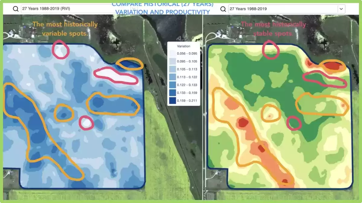
- locate spots with similar performance across the 5-10-20 years and place the trials in areas with similar conditions to reduce the probability of mistakes,
- track the changes during the season and evaluate crop performance during the growth,
- recognize the damaged areas after a weather disaster or a disease or a pest attack and calculate damaged areas,
- detect the difference between the last 2 images and control the crop performance.

And all that and even more cases are covered with GeoPard Field Stability Zones. Especially, it will provide more insights together in combination with in-season and historical management zones.
Simply choose your field and satellite images to track the changes across them, control crops, and get insights about every spot in your field.