GeoPard successfully passed the RootCamp accelerator program

About 300 companies applied for participation in the intense three-month Acceleration Program by RootCamp. But only 7 of them have been chosen as international AgriTech startups to join.

One of them is an agriculture intelligence platform based in Cologne, Germany called GeoPard. In short, GeoPard helps to automate the agronomic workflows like season planning, to fertilize, seeding, harvesting, and so on by streamlining them all in one system.

To do so, GeoPard uses cutting-edge spatial data analytics and AI algorithms and focuses on making sustainable and profitable precision agriculture solutions accessible and affordable to all agribusinesses.

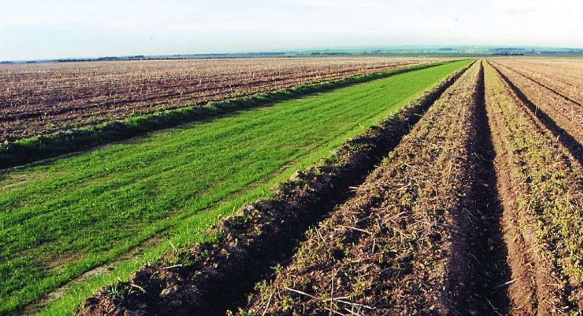
Data products provided by GeoPard include soil sampling analytics, crop monitoring, field benchmarking, and Variable Rate application maps for agricultural in-season operations (like seeding, fertilizing, crop protection, and herbicides).

Some Unique Data Products of GeoPard Presented in Rootcamp

GeoPard focuses on building a Digital Twin of any agricultural field by aggregating all available data layers obtained through various methods and technologies. Moreover, some of the salient advantages that make GeoPard stand out from a crowd of similar products include:

1. An attractive business model for all business sizes: GeoPard users only pay for consumed analytics with no extra costs. GeoPard offers several plans to choose from according to the customer’s size.

The pricing model is based on an AWS-like pay-as-you-go credits approach that ensures that our offer remains affordable for all sizes of agricultural businesses. GeoPard also boasts a service that ensures delivery of the branded precision agriculture solution in just 2 weeks.

2. Independence and non-biasedness: About 0.5M data points are generated per day per farm as of 2021 and this number will be x6 during the next 10 years.

As data becomes more and more valuable, their security and protection become equally important, especially while dealing with massive data like this. So it is noteworthy that GeoPard is not affiliated with any agricultural corporation and all the data is owned by the user and is definitely not for sale.

3. Level of automation and analytics capabilities: The whole point of precision agriculture is to optimize the usage of agricultural inputs and maximize yield via data-driven decisions.

Efficiently dealing with such a huge amount of data requires increasing automation and decreasing manual work. GeoPard achieves this by establishing a platform that automatically collects data layers, standardizes them, and streamlines agricultural field insights on top.

So GeoPard customers focus on efficient data-driven decisions instead of struggling with manual data processing.

Another highlight of GeoPard is its user-friendly web and mobile interfaces. Along with the web and mobile interfaces, GeoPard provides integration capabilities like API, widgets, White Label, and On-premise solutions.

GeoPard also provides a quick assistance service that can help customers anytime. Ongoing communication with the customers and partners, consultants, and business is of prime importance in both the past and future of this company.

GeoPard aims to improve the adoption of precision farming technologies, ensure efficient and sustainable crop production, and offer high-quality and adaptable data products.

The overall operation of GeoPard in the field of sustainable precision agriculture is based on using the most sophisticated technologies for data capturing, streamlining of analytics, and dissemination while ensuring that customers have the most practical experience and the highest ROI using data products from GeoPard.

Having specialized in precision farming technologies to maximize the efficiency of all agribusinesses, GeoPard plans to venture more into data products for sustainability, biodiversity, and carbon sequestration in the future.

To dive deeper into GeoPard, its services, its vision, and its plan for the future from one of the founders, you can watch this video or read more on this blog.

Precision Agriculture – Basics, Working, Benefits

Do you know how precision agriculture can help you as a farmer or someone related to agro-business? It can upsurge economic efficiency (15%) through the optimal distribution of agriculture input resources while also reducing your agriculture input costs in crop production to 40%.

At the same time, it also helps indicate crop productivity zones in terms of yield. It is worth noting that an average difference in yield in high and low crop productivity zones can go as far as 400%.

How It Works

GeoPard champions sustainability in the agriculture sector. Remember that there is no better alternative than big data analytics to achieve sustainability and precision agriculture in our times.

Our precision agriculture solution stores satellite data, machinery data, high-density scanner data, topography, drone imagery, and soil sampling data for accumulating big analytics.

As a result, our solution generates maps, automated recommendations, benchmarking, a complete land profile, sustainability such as carbon offsets, and biodiversity.

You can monitor it through the mobile, web, agriculture machinery and equipment, and other platforms and solutions.

As we know, agriculture entails different seasons throughout the year. Concerning that, GeoPard helps automate your agronomy workflows in all those seasonal activities.

These include season planning, soil sampling, seeding, fertilizing, spraying, desiccation, and post-harvest analysis.

GeoPard Precision Agriculture Tools and Their Benefits

Here we explore the tools and benefits GeoPard offers its clients as its services.

1. Multi-Layer Maps

GeoPard offers a combination of data layers. Depending on the available layers, you can delineate management zones with the flexibility to set a weight for each layer.

Let’s consider a quick example here. You can select 8 Years of historical Productivity as weight=1 andSlope as weight=-1.

Different layers combine and give valuable data for making appropriate decisions about precision agriculture. For example, satellite imagery can combine with soil EC (electrical conductivity) data as well as soil sampling can shake hands with topography. Alike there might also be a mix of multiple vegetation indices.

2. Automated Field Potential Maps and Heterogeneity

While benefiting from GeoPard, you can automate multi-year field-potential maps – for up to 30 years and the last five years stacked – that is very close to actual yield data. With the help of the heterogeneity index, you can prioritize agricultural activities and benchmark fields.

3. 3D Maps

3D maps help manage individual land parcels and grasp how topography impacts soil properties, vegetation, and yield. At the same time, geospatial dependencies can also be learned between data layers. You can also combine a base layer and a cover zones map to make informed decision about precision agriculture.

For the sake of your information, the base layer may include topographic, slope, relief positions, soil properties, or vegetation distribution.

On the other hand, the cover zones map may incorporate zones from yield, historical vegetation, organic matter, electrical conductivity, and pH distribution.

Furthermore, the exciting thing is that you can visualize the 3D model immediately in the browser and do not have to install any additional software or plugins.

4. Topography Profile

With the help of the topography profile, you can have a complete sense of the topographic profile, ranging from elevation, slope, aspect, and hillshade to relief position, ruggedness, and roughness.

The story doesn’t end here, and you can build the profile on top of remote sensing or machinery datasets. It also allows you to utilize all the given derivatives on pixel base in external Artificial-Intelligence models. Its examples include slope and local relief position zones.

5. Automated Scouting

When you leverage the automated scouting tool from GeoPard, locations needing the scouting and understanding of limiting factors are automatically detected. Valuable areas are also identified for comprehensive analytics.

Since you can monitor the results on the mobile application, you should also understand the features it can offer and the platforms it usually uses. The app can equally work offline for comments and photos and use both IOS and Android on smartphones and tablets.

6. Soil Sampling

Soil sampling at periodic intervals across the field is essential. Each field bears different soils with distinctive crop attributes and soil characteristics.

Therefore, it is crucial to delineate the landscape of the field into different zones of management. The complete step of soil sampling ranges from planning soil sampling (zonal and grid) to VRA maps based on soil data.

For the record, Variable Rate Application (VRA) maps are created by adding rates to management zone maps. Further, they are compatible with most agricultural machines and precision practices.

7. Zones Adjustments

You can split and merge zones through the GeoPard solution to make essential things. E.g., you can split polygons, merge polygons, and even assign a polygon or a complete zone to another class.

8. Soil Brightness Index

Understanding variations in soil conditions over time is significant. You can achieve it through soil brightness as it operates as a proxy for sands, organic matter, and salinity areas. What’s more, it helps measure and monitors soil erosion patterns and soil degradation.

9. Stability Maps / Change Detection

Do you want to understand the stability and variation of vegetation from season to season? While exploiting the GeoPard’s platform, you can detect the most stable and varying spots in the field during any period. It can vary from the last few weeks to a few months or even a couple of years.

10. The Intersection of Data Layers

GeoPard helps you identify the most valuable areas for extended analysis, such as soil, scouting, and plant sampling.

Likewise, it can also assist with enhancing precision agriculture practices. But the point to keep in mind is that it is possible through overlapping different management zones based on distinguished layers to define dependencies between data layers.

11. As-Applied and As-Planted Data Analysis

With the help of GeoPard, you can monitor the VRA (Variable Rate Application) execution results. It may include comparing planned and applied maps such as VRA maps. Other than that, it is also helpful for calculating the ROI of variable rate technology.

12. Clouds and Shadows Detection

With the help of proprietary algorithms, GeoPard offers high accuracy of clouds and shadow detections. You will be surprised to know that compared to around 80% accuracy provided by competitors, the accuracy of the GeoPard algorithm is about 95%.

Apart from the higher accuracy than competitors, we enable higher quality by automating more than our competitors. Our solution detects partially-cloudy and cloudy images through an advanced image filter to verify decisions.

13. Statistics for Zones

While utilizing GeoPard, you can calculate statistics on zone level based on data layers used in zone creation. It includes yield, satellite, ground sensors, topographic, multi-layer, etc. The covered metrics are Minimum, Maximum, Average, Median, Sum, and Standard Deviation.

14. Integrated Data Sources

GeoPard understands the formats in which both humans and AI models can interpret data. While providing data in relevant forms, the platform also delivers calibrated, corrected, and standardized data. Concerning that, GeoPard is developing an automated Radar Data processing pipeline.

Along these lines, it is also working on launching solutions related to the Carbon and Sustainability topics. These solutions will aid in estimating vegetation on cloudy days, detecting agricultural operations like tillage & sowing, analyzing cover crops, and estimating soil moisture & physical conditions.

GeoPard solution passed AWS certification

In February 2022 GeoPard* joined AWS Partner Network** as a Technology Partner. The community of AWS Partners includes strategic experts and experienced cloud engineers and architects, who help address specific business needs and build cost-effective scalable cloud solutions for organizations. Here the GeoPard team brings its 10+ years of experience in building cloud scalable digital solutions in Agriculture and ​​assists crop farming agribusinesses to keep pace with cloud cutting-edge technology.

AWS Partner

In March 2022 GeoPard platform successfully passed the Foundational Technical Review performed by AWS Solution Architects. The review included certifications according to the Center for Internet Security (CIS v1.2.0) and AWS Foundational Security Best Practices (v1.0.0).

In other words, the GeoPard Agriculture platform met AWS security and best practice requirements. And it is ready for On-premise/White Label installation in the customer AWS cloud.

AWS certification partner

GeoPard took additional steps to extend its market offer with certified on-premise solutions to be utilized either as a standalone data platform or as an automated data analytics extension to already existing digital farming suites. That makes integration to the customer’s cloud infrastructure faster and smoother.

* GeoPard is an agriculture intelligence platform that enables crop farming agribusinesses to increase ROI via data-driven agronomic decisions and integrate sustainable precision agriculture practices using cutting-edge spatial data analytics and AI algorithms.
AWS Startups Blog: Improving the Sustainability of Crop Farming Using a Data-driven Approach.

** The AWS Partner Network (APN) is a global community of partners that leverages programs, expertise, and resources to build, market, and sell customer offerings.

Digital Agriculture and carbon credits: how to reach your goals

The constant release of greenhouse gasses into the environment is accountable for climatic changes. There is a need to counterbalance the reaction of these gasses for the safety of living things. Lately, digital agriculture has been discovered to play a part in climatic changes around the world. To understand the in-depth of this analogy, stay glued to this article and read to the end.

How does agriculture fit into the broader issue of climate change?

To a layman, agriculture may seem unconnected to the issue of climate change. Going by facts and discoveries, it is impossible to neutralize the impact of greenhouse gasses or relieve the depletion of the ozone layers without the involvement of agriculture.

Discoveries have revealed that agricultural practices, especially soil activities, help to isolate dangerous carbon oxides such as carbon monoxides. Because of this huge feat, the soil is being referred to as a “carbon sink”.

Since it consigns harmful gasses to their extinction. However, not all agricultural operations neutralize the reaction of these harmful gasses. Therefore, it becomes a matter of necessity to differentiate between operations that alleviate them and those that elevate them.

The sector of Agriculture that deals with food processing, packaging, warehouse, transportation, forestry, food consumption, and different sectors relating to industrial agriculture contributes to about 25-30℅ of greenhouse gasses emission caused by humans.

And it has been estimated to increase in years to come if care is not taken. In 2018, IPCC outlined a summary of global warming. This summary showed that the habitat is at risk and also highlighted the need to neutralize the impact of global warming.

Deforestation, draining wetlands, and some land activities are the major spurs for harmful gasses emission related to agriculture.

The unused potential of a soil for carbon sequestration

Soil is an important tool for carbon isolation. Research has shown that soils contain about 2000-2500 tons of carbon on average. This indicates that the proportion of carbon in the soil is about 2 or 3 times more surplus than the proportion in the plants and atmosphere.

With this review, it is glaring that soil is truly a carbon sink. An exception to this is the arable soil. It has a much lower carbon content than usual soils because of the activities executed on them.

Research has shown that farming operations such as cultivation on soils amount to about 30-75% loss in the carbon content of the soils. But certain measures should be put in place to ameliorate the loss of soil carbon content.

The structure of the soil also determines the sustainability of carbon in the soil. Carbon may be washed away from the soil if it’s not well protected by soil aggregates. Soil aggregates are particles of soil, which clog together tightly. But still allows inflow of water and air despite the clogging.

Also, Decomposition as a result of microbial actions and respiration leads to a reduction in the carbon present in the soil. The good news is that the carbon lost can be recovered through certain activities. The activities include proper administration of soil, crop, and water.

The retention of carbon by the soil plays a big part in combating climate change. It also has ecological, economical, and civic advantages. In 2019, it was estimated by the intergovernmental panel on climate change (IPCC) that there would be a reduction in the capacity of lands and soil in years to come.

A recent report by IPCC shows that soil will isolate more carbon than the 2018 2019 report. The carbon content will rise to about 1.44 gigatons per annum.

What is carbon credits in agriculture?

Carbon credits in agriculture are a form of tradeable units that represent a reduction or removal of greenhouse gas emissions in farming practices. Farmers can earn carbon credits by implementing sustainable techniques like precision agriculture, conservation tillage, or agroforestry.

These credits can be sold to industries or organizations seeking to offset their carbon footprint. By incentivizing carbon-friendly farming, carbon credits promote environmental stewardship and encourage sustainable practices in the agricultural sector.

Carbon credit markets: the role of agriculture in their generation

A carbon credit is a new term that has generated waves among agricultural and industrialists around the world. Industries buy carbon credits from farmers to subdue the effect of greenhouse gasses on the environment. Generating a soil-based carbon credit takes up a long time and extra energy.

This is because some difficulties are associated with production. These difficulties include; controlling soil stock, data reliability, measurement disparities of stock, and the versatility of land.

The effective use of carbon credits helps to counterbalance the effect of greenhouse gas emissions and reduce climate change. But these innovations can not be used by all industries as a result of financial factors. The prices of carbon credits have increased since 2020.

This is why the voluntary carbon credit market was established. The voluntary credit market is a gigantic advantage to farmers, it serves as financial backing and improves farming practices. To enhance the sustainability of the voluntary credit market, it should have backing from corporations and governments.

Helping farmers access insights from precision agriculture data agriculture

Agriculture is a two-for-two tool used in addressing climate changes, it can be for it or against it. How soil operations elevate and alleviate harmful gas emissions has been explained earlier.

Recently, precision husbandry is being employed to iron out the issues of climate change and the role of precision husbandry in combating it. Precision husbandry is an aspect of digital farming that models, manages, and examines natural resources including land.

It has helped farmers decide how best to use their lands to solve climate changes. Geopard agriculture delivers analytics for the carbon and carbon credit market and how it helps the ecosystem.

Hyperspectral imagery for Agriculture. Grant from the state of North Rhine-Westphalia.

We are glad to announce that the “Artificial intelligence framework for quantitative estimation of soil properties using hyperspectral satellite imagery” project was selected for partial funding by the Ministry of the Environment of North Rhine-Westphalia and the European Union under the REACT-EU InnovationUmweltwirtschaft.NRW program. The grant is funded by the European Regional Development Fund / Europäischen Fonds für regionale Entwicklung (EFRE).

the European Regional Development Fund

The use of artificial intelligence and statistics in this project made it possible to determine the correlation between hyperspectral and soil data (e.g., N, pH), facilitating a more precise and scalable approach to soil analysis. The forthcoming launch of hyperspectral satellites with frequent revisit intervals and seamless access to new imagery without delays presents several advantages, particularly in nutrient management for sustainable agriculture. The technology helps assess nutrient content and availability in the soil, allowing farmers to tailor fertilisation strategies. This leads to better nutrient uptake by plants, reduced environmental impact, and cost savings.

What is Hyperspectral imagery?

Hyperspectral imagery is a powerful remote sensing technique that captures the electromagnetic spectrum with high spectral resolution.

Unlike traditional satellite imagery, which typically consists of three to four bands (red, green, blue, and sometimes near-infrared), hyperspectral imagery collects hundreds to thousands of narrow spectral bands across the visible, near-infrared, and shortwave infrared regions. Each band provides unique information about the surface properties of the imaged area.

It is acquired using sensors mounted on airborne or spaceborne platforms. These sensors use spectrometers to measure the intensity of reflected or emitted radiation across multiple narrow bands.

By collecting a wide range of spectral data, hyperspectral sensors can detect subtle differences in the spectral signatures of various materials, allowing for highly detailed and precise analysis.

Applications of Hyperspectral Imagery

  • Environmental Monitoring: It plays a vital role in monitoring and assessing the health of ecosystems. It helps identify vegetation stress, monitor land cover changes, detect invasive species, and measure water quality parameters like chlorophyll concentration or turbidity in lakes and rivers.
  • Agriculture: It aids in precision agriculture by providing detailed information about crop health, nutrient content, moisture levels, and disease detection. Farmers can make data-driven decisions regarding irrigation, fertilization, and pest management, resulting in optimized crop yields and reduced environmental impact.
  • Geology and Mineral Exploration: It is instrumental in mapping geological formations, identifying mineral deposits, and characterizing rock types. It helps geologists detect alterations in mineral composition and map potential areas for exploration, contributing to more efficient and targeted mining activities.
  • Forestry: It assists in forest management and monitoring. It enables the identification of tree species, quantification of forest biomass, detection of tree stress, and assessment of wildfire damage. This information aids in sustainable forest management, biodiversity conservation, and early warning systems for forest fires.

Benefits of Hyperspectral Imagery

Its main advantage lies in its ability to provide detailed spectral information, enabling the discrimination of materials with high accuracy.

This leads to improved classification and mapping of land cover types, enhanced identification of specific substances, and better understanding of environmental processes.

Hyperspectral data can also be analyzed using advanced algorithms and machine learning techniques to extract valuable insights and automate image interpretation.

GeoPard and Origin Digital partnership to provide precision farming solutions

The GeoPard agriculture and Origin digital company have entered into an alliance deal to unravel problems relating to farming.

The motive behind the alliance is to expand the agricultural market sphere with digital and data-driven methods such as precision agriculture, data analysis, and software development.

They also offer professional programs and suggestions to clients on how to choose viable seeds, the science of planting and harvesting crops, and soil sampling methods.

Many of these innovations are now obtainable in Ukraine since it’s the base of the companies. The Origin Digital company has incorporated farming consultancy, good farming strategies, and data-based methods to ease the process of making decisions.

Additionally, the program helps experts to drive through precision farming easily. The central focus of the allied groups is to look into the problems of farmers and proffer practical solutions.

The Chief Executive officer of Geopard Agriculture, Mr. Dmitry Dementiev mentioned in one of his statements:

“The Geopard’s team affiliation with Origin digitals is a milestone for the advancement of precision farming. Clients can now access digital remedies provided by the company easier and faster due to the alliance.”

He also added that his team is delighted with the recent development and they are ready to make things work out well.

The Head of Origin Digital Company, Mr. Jon Rhymes also said: “The alliance will promote precision farming in Ukraine. This is because the companies have incorporated programs such as data analysis and artificial intelligence in their scheme. These programs will ease the manner of disseminating information and making suggestions to prospective clients.”

Similarly, the crop growers in Ukraine will benefit from the program. It will also assist them to cut down production costs, increase their gains and guide them through the other processes.

What are precision farming solutions?

Precision farming solutions are technologies and techniques used to optimize crop production through data-driven decision-making and targeted input application. Some examples of precision farming solutions include:

  1. Variable-rate technology (VRT): This technology enables farmers to apply inputs such as fertilizers, pesticides, and seeds at varying rates across a field, based on factors such as soil fertility, crop growth stage, and yield potential.
  2. Remote sensing: This includes the use of satellites, drones, and other sensors to collect data on soil and crop conditions, which can be used to make informed decisions about input application and crop management.
  3. Geographic Information System (GIS): GIS is a tool that enables farmers to collect, store, analyze, and manage spatial data about their fields, such as soil type, elevation, and weather patterns.
  4. Precision irrigation: This includes technologies such as drip irrigation and soil moisture sensors, which enable farmers to optimize water use and reduce waste.
  5. Autonomous equipment: Autonomous tractors and other equipment can be programmed to perform tasks such as planting, fertilizing, and harvesting, allowing for greater precision and efficiency in crop management.

Overall, precision farming solutions enable farmers to make data-driven decisions that optimize crop yields, reduce input waste, and improve overall efficiency. By leveraging advanced technologies and techniques, precision farming solutions can help farmers meet the challenges of a rapidly changing agricultural landscape and achieve sustainable, profitable crop production.

How can a Data-driven Approach improve the sustainability of crop farming

It is a necessity to accomplish food sustainability and food security so that human beings can function well. And there is no way to achieve this except through sustainable crop farming. Sadly, it has become difficult to meet the demands for food due to the unavailability of resources.

Unlike in the primitive times when lands and other resources are deployed for agriculture. In recent times, most of the lands are now deployed for commercial and industrial uses. This has led to a shortage of resources for agricultural use. Apart from land, many resources like water, human, and manure have also depreciated greatly.

Improving agriculture sustainability through a data-driven approach involves automated data collection, data analytics, Artificial Intelligence, software innovation, e.t.c. Geopard Agriculture is an innovative body that focuses on collecting data on soil profiles, minerals, and properties.

Also, it uses the knowledge of weather, land topography, vegetation, executed agronomic operations, and more to improve the advancement of agriculture. It analyzes data on a large scale of land to determine its suitability for crop farming.

This information will help crop producers to calculate and manage risks, make crop farming easier, and ultimately improve crop and agricultural sustainability.

The Usefulness of GeoPard End Products

Geopard end-products including analysis of soil profile, nutrients, vegetation have helped improve the sustainability of crop farming in numerous ways. The following are the usefulness of Geopard end-products:

  • Precision Agriculture
  • Smart scouting and sampling
  • Biodiversity and ecosystem balance
  • Maps

Precision Agriculture: This is an act of predicting crop productivity. It is a way of managing crop production by noting seasonal changes, crop rotation, environment conditions, seed variability, genetics, e.t.c.

This will help farmers to know the right time to plow, plant, apply fertilizers, and harvest their crops. Making good precision is very important in crop production, and Geopard end-products make this easy.

Smart Scouting and Sampling Assist: These products help to recognize the right location where there are adequate quantities of minerals and materials needed for crop production. It makes use of sampling methods and techniques.

An important instrument for detecting locations on the map. VR application maps enable crop producers to apply the right amount of agricultural inputs at the right spots.

Rich Biodiversity and Ecosystem Balance

This is a natural or biological system of improving the environment. It doesn’t involve the use of chemicals or equipment. It creates a balanced ecosystem that reducing the effect of greenhouse gas emissions.

In conclusion, the use of data-driven methods has proven effective in ensuring crop and food sustainability. Geopard Agriculture helps to improve crop farming practices through automated data analytics, Artificial Intelligence, software innovations, e.t.c. The end products of Geopard Agriculture assist in improving the efficiency of crop production. Read the details.

World Soil Day 2022

World Soil Day, celebrated on December 5, brings people’s attention to the importance of soil and its sustainable management. The day aims to raise awareness about soil degradation.

It’s a serious environmental problem, caused due to the decline in soil condition. Industrialization or poor management of agricultural land worsens the condition of the soil.

The day highlights the importance of soil for all terrestrial life. Soil degradation leads to erosion, loss of organic matter and decline in soil fertility.

Why World Soil Day is so important?

Have you ever seen white crusts on soil? Yes, it is what you think. Soils can be salty. Salts are present naturally in soils and water, and they move freely through the soil.

Naturally, saline soils may support rich ecosystems, but natural processes such as droughts and human activities, especially improper irrigation, can increase how many salts are in soils, a process that is called salinization. Soil salinization breaks down our soils and reduces their ability to help our food grow.

Soil salinization and modification are major soil degradation processes threatening the ecosystem and are recognized as being among the most important problems at a global level for agricultural production, food security and sustainability in arid and semi-arid regions.

Salt-affected soils have serious impacts on soil functions, such as in the decrease in agricultural productivity, water quality, soil biodiversity, and soil erosion. Salt-affected soils have a decreased ability to act as a buffer and filter against pollutants.

Salt-affected soils reduce both the ability of crops to take up water and the availability of micronutrients. They also concentrate ions that are toxic to plants and may degrade the soil structure.

World Soil Day 2022

World Soil Day 2022 (#WorldSoilDay) and its campaign “Soils, where food begins” aims to raise awareness of the importance of maintaining healthy ecosystems and human well-being by addressing the growing challenges in soil management, fighting soil salinization, increasing soil awareness and encouraging societies to improve soil health.

A bit of history

The proposal for a global day to celebrate soil was first recommended in the year 2002 by the International Union of Soil Sciences (IUSS).

Under the framework of the Global Soil Partnership, and the leadership of the King of Thailand, the United Nations Food and Agricultural Organization (FAO) lent its support to the establishment of WSD.

The day was envisaged as a global platform to raise awareness about issues related to the management of soil resources.

In 2013, WSD was unanimously endorsed by the FAO Conference. The conference also requested the UN General Assembly (UNGA) for the official adoption of the WSD. The UNGA then designated the first World Soil Day on 5 December 2014.

Why was 5 December chosen as the date?

It was decided to mark WSD on 5 December as it was the official birthday of the late King of Thailand, H.M. King Bhumibol Adulyadej, who had officially sanctioned the event.

world soil day

What GeoPard Agriculture do to protect the soil

The rational use is the best soil protection. Therefore, before creating a load on any plots of land, we analyze it and make a detailed plan for planting determined crops.

Prescription Maps creation

GeoPard Software helps to create Variable Rate Application (VRA) fertilizer maps by providing a platform for collecting and analyzing data from various sources, such as soil testing, crop yield, and weather data.

This information is then used to create detailed maps that show the optimal fertilizer application rates for specific areas of the field, allowing farmers to apply the right amount of fertilizer at the right time, reducing costs and increasing yields.

What GeoPard Agriculture do to protect the soil

The software also includes tools for creating prescription maps for other inputs, such as seed, herbicides, and pesticides, providing a comprehensive solution for precision agriculture.

It also offers features for data management, record keeping, and reporting, helping farmers to stay organized and compliant with regulations. Overall, GeoPard Software helps farmers to optimize their fertilizer application and maximize their crop yields.

High-density Soil Scanners Data Analytics

Soil scanners provide a non-invasive way to analyze the physical and chemical properties of soil. By measuring factors such as pH, nutrient content, moisture levels, and organic matter, soil scanners can provide a detailed picture of soil conditions and help farmers to identify areas of the field that may require additional nutrients or other management practices.

Using soil scanners, farmers can create detailed maps of the variation in soil properties across their fields, allowing them to target their management decisions to specific areas.

For example, a farmer may discover that certain areas of the field have low pH levels, indicating that they need more lime to improve soil health. By applying lime to those specific areas, the farmer can optimize the nutrient availability for their crops and improve overall soil health.

An example of Electrical Conductivity data collected by our partners.

In addition to providing valuable information about soil conditions, soil scanners can also help farmers to reduce their input costs by allowing them to apply fertilizer and other inputs only where they are needed, avoiding over-application and waste.

Overall, the use of soil scanners can help farmers to improve soil health and increase the efficiency of their management practices.

Read more about Soil Scanners Data Analytics in GeoPard

Zonal or Grid based soil sampling planning

Grid soil sampling planning is a method of collecting soil samples from a field in a systematic, organized way. The first step in this process is to create a GeoPard Field Potential Map, which shows the variation in soil properties across the field.

Based on this map, the farmer can identify areas of the field that have similar soil conditions and group them into zones. The next step is to determine the number of soil samples that need to be collected from each zone, taking into account factors such as the size of the zone and the level of precision desired.

Zonal Soil Sampling Location

Once the number of samples per zone has been determined, the farmer can create a grid of sampling points within each zone, using a GPS-enabled device to ensure that the samples are collected from the correct locations. The soil samples are then collected using a soil probe or other tool, and the samples are labeled and stored for analysis.

After the soil samples have been collected and analyzed, the farmer can use the results to create a detailed soil map that shows the variation in nutrient levels and other soil properties within each zone.

This information can then be used to develop a customized fertility plan for each zone, based on the specific needs of the crops and the soil conditions.

Overall, the process of grid and zonal soil sampling planning based on GeoPard Field Potential Maps allows farmers to collect and analyze soil data in a precise and organized way, providing the information needed to make informed management decisions.

GeoPard showcased at FoodHub NRW expo

Last week GeoPard team presented at the Foodhub NRW expo in Neuss, Germany.

Our speaker session was about the state of Precision Agriculture, past, present, and the future.
In detail, we described a few examples of how decision support tools and data analysis helps to implement data-driven crop farming practices in different regions: the US, Canada, Europe.

GeoPard team presented at the Foodhub NRW expo in Neuss, Germany

We are proud to be in the epicenter of innovations in the crop farming industry.

It was great to meet a lot of food startups. Agriculture is one of the biggest industries in the world and we need more innovations and collaborations between corporates and startups across the value chain.


Integration with MyJohnDeere Ops Center

The team at GeoPard is pleased to announce their integration with the MyJohnDeere Operations Center (Ops Center). MyJohnDeere customers can now seamlessly upload their data into the GeoPard system, where they can do an advanced data analysis, compare information to other data sets, and create detailed Variable Rate Application (VRA) maps for seeding, fertilizing and spraying.

These maps can then be wirelessly sent back to the MyJohnDeere Operations center and subsequently to fleets and machinery via a cloud-to-cloud connection, with no need for a USB stick. A step-by-step tutorial about import/export capabilities is here.

Description of Geopard integration to John Deere

Moreover, GeoPard provides automated synchronization of crop monitoring, detailed topography analytics, machinery and soil scanner data for MyJohnDeere clients.

GeoPard provides automated synchronization of crop monitoring
3D composite based on Productivity Zones and Topography collected by fleets

Agronomists, agribusinesses, precision agriculture specialists, and equipment dealerships can all utilize the GeoPard platform as a means to collate many data sets for optimal analysis.

From the John Deere Operations Center, field boundaries, seeding (as-planted) data, as-applied fertilizer maps, as-applied crop protection, tillage data, and yield data can all be imported to GeoPard and cross-analyzed.

This integration has simplified the data streamline process for multiple parties and stakeholders by providing them with a smooth-running analytical engine to gain new insights about relevant land parcels and logistics. 

GeoPard platform as a means to collate many data sets for optimal analysis
Zoned (Classified) VS Original Harvest Data
LiDAR VS Machinery Topography collected by fleets

“Growers, JohnDeere dealerships, and ag consultants need solutions to get informed data-driven decisions. We are proud to be a software partner of MyJohnDeere platform to enable GeoPard precision agriculture analytics solutions for John Deere clients via wireless integration,” said Dmitry Dementiev, CEO & Co-Founder of GeoPard Agriculture.

This collaboration optimizes all the benefits of precision agriculture to users by making the creation of complex and personalized VRA maps increasingly accessible and simple to navigate and manage.

Prescription maps can be sent back to the John Deere Ops Center and to machinery in a streamlined process that promotes efficiency and accuracy for the VRA of multiple inputs.

About John Deere Ops Center: John Deere Ops Center is a digital platform of agricultural corporation John Deere, where users can manage the logistics and services of their machine fleets and equipment.

The data is stored securely in user accounts and allows customers to share and analyze their data systems via the internet and IoT devices, optimizing the efficiency of fleet and land management.  Learn more at: https://www.deere.com/en/technology-products/precision-ag-technology/data-management/operations-center/

About GeoPard Ag: Geopard is an AgTech company whose mission is to develop accessible and affordable enterprise-level analytics for sustainable agriculture.

Their platform allows you to simplify the complexities of precision agriculture through tools and services like VRA map creation and multi-layer yield, soil, topography, ground scanners and satellite data analytics. Learn more at: https://geopard.tech/.

wpChatIcon
wpChatIcon

    Request Free GeoPard Demo / Consultation


    By clicking the button you agree our Privacy Policy. We need it to reply to your request.

      Subscribe


      By clicking the button you agree our Privacy Policy

        Send us information


        By clicking the button you agree our Privacy Policy