
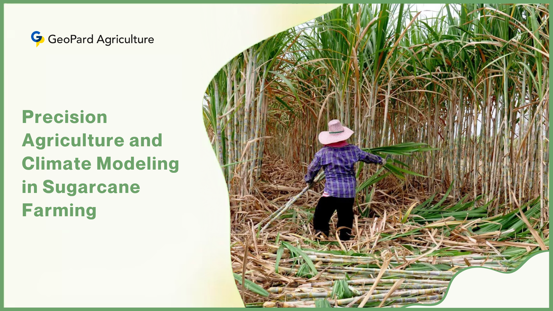


Precision agriculture models climate change impact on sugarcane yields by combining satellite imagery, IoT sensors, machine learning algorithms, and crop simulation platforms into a single decision-support system that translates raw environmental data into actionable farm management choices. Research published in peer-reviewed journals through 2024 and 2025 shows that temperature increases of just 2°C can cut sugarcane yields by 3 percent, and increases of 4°C by as much as 9 percent, making early and accurate modeling not a luxury but a necessity.
Sugarcane’s Global Importance and the Growing Climate Threat
Sugarcane is one of the most economically significant crops on the planet. As of 2024, global production reached approximately 1.9 billion metric tons harvested from fields spread across tropical and subtropical regions, with a market size estimated at USD 58.47 billion.
Brazil, India, and China together account for more than 67 percent of that output, but smaller producers in Thailand, Pakistan, Colombia, and Australia rely on the crop just as heavily for rural employment and export revenue.
Beyond food, sugarcane is the raw material for bioethanol — over 45 percent of Brazil’s fuel ethanol is derived directly from sugarcane — which makes yield stability a matter of both food security and clean energy supply.
Climate change is now disrupting the conditions that make sugarcane so productive. The crop grows best within a relatively narrow band of temperature, moisture, and solar radiation, and when any of those variables shifts outside its preferred range,
- sucrose accumulation,
- biomass production, and
- harvest timing all suffer.
Cyclone frequency is rising in cane-growing coastal belts, unpredictable monsoons are causing both flash flooding and prolonged drought within the same season, and multi-year warming trends are compressing the growing window in some regions while creating false productivity signals in others.
These pressures are not future projections — they are current realities that growers and agronomists must already manage year by year. This is precisely where precision agriculture enters the picture. By gathering high-resolution environmental data, feeding it into predictive models, and translating outputs into field-level decisions, precision agriculture systems give growers the ability to anticipate climate-driven yield loss before it happens.
Understanding Climate Change Effects on Sugarcane
1. Temperature Variability and Heat Stress
Sugarcane grows optimally when daytime temperatures stay between 25°C and 35°C. When temperatures climb above that ceiling, a biological process called heat stress begins to interfere with photosynthesis — the mechanism by which the plant converts sunlight into sugars.
At the cellular level, extreme heat denatures the enzymes responsible for sucrose synthesis in the stalk, reducing the concentration of recoverable sugar even when above-ground biomass appears healthy. This is a critical distinction: a field can look visually productive while carrying significantly reduced sucrose content, which only becomes apparent at the mill.
Research using the DSSAT CANEGRO model — a crop simulation system calibrated for sugarcane physiology — found that a 2°C temperature increase above baseline produced a 3 percent yield reduction, a 3°C rise caused a 5 percent reduction, and a 4°C increase resulted in a 9 percent reduction across five agroclimatic zones in Tamil Nadu, India.
These findings confirm that the yield penalty is not linear; the damage compounds as temperatures push further from the crop’s optimum range. Warmer nights also reduce the cool-period stress that triggers sucrose accumulation in the final ripening phase, directly lowering sugar recovery rates even where total biomass remains adequate.
PMC / DSSAT CANEGRO Model Study found that a 4°C temperature increase caused a 9% sugarcane yield reduction across five agroclimatic zones, with water requirements rising simultaneously in all zones. Growers in warming subtropical regions should begin modelling not just the next season but multi-decade temperature trajectories to prepare for compounding yield losses.
2. Rainfall Irregularities
Sugarcane requires between 1,500 mm and 2,500 mm of water per growing season, and the timing of that water matters as much as the total volume. Drought during the grand growth phase — the period of maximum biomass accumulation between the 3rd and 9th month of the crop cycle — directly caps stalk height and fibre weight.
Conversely, waterlogging during the early tillering stage deprives roots of oxygen, kills beneficial soil microbes, and creates entry points for fungal disease. Climate change is producing more of both extremes within the same growing region, sometimes within the same season, making traditional calendar-based irrigation schedules increasingly unreliable.
Projected future rainfall declines of 3 to 11.5 percent in major growing regions by the end of the century (AdaptNSW, 2024) mean that even regions currently benefiting from warmer temperatures will face water deficits that partially or fully cancel the photosynthetic gains.
Shifts in monsoon onset dates in South Asia — now regularly delayed by one to three weeks — are already forcing farmers to extend irrigation periods and revise planting calendars without scientific tools to guide the adjustments.
3. Extreme Weather Events and Soil Integrity
Cyclones, tropical storms, and late-season frost events cause damage that goes beyond crop loss in a single season. Physical lodging — the bending and toppling of stalks by high winds — makes mechanical harvesting difficult and promotes rotting at the stalk base.
More damaging over the long term is soil erosion triggered by intense rainfall events, which strips the topsoil layer that holds the organic matter, microbial life, and nutrient reserves sugarcane roots depend on. Once topsoil is eroded beyond a threshold depth, the land’s yield potential drops permanently unless costly rehabilitation practices are applied.
4. CO2 Concentration and Its Double-Edged Effect
Elevated atmospheric CO2 — currently above 420 ppm and rising — provides a mild photosynthetic stimulation to C4 crops like sugarcane, theoretically increasing water-use efficiency. However, agronomists have found that this benefit is largely conditional.
Under drought conditions or nitrogen-deficient soils, the plant cannot utilize the additional CO2 effectively because other biological inputs are the limiting factor. The net result in most real-world growing environments is a modest positive effect that is routinely overwhelmed by the negative impacts of heat stress and erratic rainfall operating simultaneously.
What Is Precision Agriculture?
Precision agriculture is a farm management approach built on the principle that a single field is not a uniform environment. Soil moisture, nutrient levels, pest pressure, and microclimate conditions vary meaningfully from one part of a paddock to another — sometimes across distances of just a few meters. Site-specific crop management (SSCM) is the operational expression of this principle.
In SSCM, decisions about irrigation, fertilization, pesticide application, and harvest timing are made at the sub-field level, informed by real-time sensor data and predictive models rather than by calendar dates or uniform rules. This is the framework through which climate impact modeling is applied: by understanding exactly
- where in a field drought stress is developing,
- where soil temperature has crossed a threshold, or
- where rainfall has saturated the subsoil,
growers can respond with precision rather than guesswork. The technology stack underlying modern precision agriculture in sugarcane includes several interconnected systems:
1. GPS and GIS mapping provide the spatial coordinate system on which all field data is registered. Every sensor reading, yield measurement, and soil sample is tied to a precise geographic location, allowing the system to build cumulative spatial intelligence about each zone of the farm over multiple seasons.
2. Remote sensing via satellite and drone imagery delivers periodic snapshots of crop health across large areas using spectral indices. The most widely used is the Normalized Difference Vegetation Index (NDVI), which measures the contrast between near-infrared and red light reflectance to infer chlorophyll content and biomass density.
3. IoT sensors (Internet of Things devices — networked instruments that continuously measure and transmit environmental data) are deployed in-field to monitor soil moisture at multiple depths, air temperature, relative humidity, and leaf wetness in real time.
4. Drones and UAVs perform low-altitude multispectral surveys that capture spatial variation at resolutions down to a few centimetres, enabling agronomists to identify stress hotspots weeks before they become visible to the naked eye.
5. AI and machine learning algorithms process the combined streams of sensor, satellite, and historical climate data to produce yield forecasts, stress alerts, and resource allocation recommendations.
6. Variable Rate Technology (VRT) executes the prescription decisions generated by the models, automatically adjusting irrigation volumes, fertilizer rates, and other inputs as farm machinery moves across spatial management zones.
How Precision Agriculture Models Climate Impact on Sugarcane Yields
1. Data Collection Systems That Feed the Models
A precision agriculture system is only as accurate as the data flowing into it, and for sugarcane climate modeling that means continuous data from multiple sources. Soil moisture sensors — typically capacitance probes buried at 15 cm, 30 cm, and 60 cm depths — track the water available to the root zone throughout the season.
When a drought event begins draining those reserves, the model detects the depletion rate and can project when the crop will hit the stress threshold days before visible wilting appears in the canopy. On-farm automated weather stations record air temperature, relative humidity, wind speed, solar radiation, and precipitation at intervals as short as fifteen minutes.
These real-time records feed directly into evapotranspiration calculations — the combined rate at which water evaporates from the soil surface and transpires through crop leaves — which is the most accurate measure of the crop’s actual daily water demand.
Historical climate datasets, going back decades in many sugarcane regions, provide the long-term baseline against which current anomalies are assessed and future trend lines are projected.
2. Predictive Modeling Techniques Used in Sugarcane
Two families of models dominate climate impact assessment in sugarcane: crop simulation models and machine learning models. Crop simulation models, such as the DSSAT CANEGRO and APSIM-Sugarcane platforms, are process-based tools that simulate the biological mechanisms of plant growth, soil water dynamics, and sucrose accumulation at a daily time step.
They require calibrated genetic coefficients for the specific sugarcane variety being grown, but once calibrated they can run forward simulations under hypothetical climate scenarios with high physiological accuracy. Machine learning models take a different approach: instead of encoding biological processes explicitly, they identify statistical patterns across large datasets of historical
- climate records,
- soil data,
- management practices, and
- measured yields.
Algorithms such as Random Forest, XGBoost, and CatBoost have shown strong predictive accuracy in recent studies. A 2025 study published in the journal Sugar Tech demonstrated that a blended machine learning model integrating weather variables, soil characteristics, and agricultural management data produced reliable sugarcane yield estimates at district scale in South India.
Climate forecasting outputs from general circulation models (GCMs) — the large atmospheric simulation models maintained by meteorological agencies — can be downscaled and integrated into both crop simulation and machine learning frameworks to project yields under future climate pathways.
3. Spatial Analysis and Field Mapping for Vulnerability Assessment
Not every part of a sugarcane farm responds identically to the same climate event. Lower-lying zones with clay-heavy soils are more vulnerable to waterlogging during heavy rain events, while sandier elevated zones face faster water depletion during dry spells.
Spatial analysis uses GIS overlays — combining soil texture maps, elevation data, historical yield records, and sensor readings — to classify each part of the farm into vulnerability zones that can be managed differently in response to the same climate trigger.
Microclimate analysis is a particularly important output of spatial mapping for sugarcane. In large commercial fields stretching several kilometres, temperature gradients of 2°C to 4°C can exist between shaded valley floors and exposed ridge tops.
A model operating at field-average scale will miss these differences entirely, but a precision system with sufficient sensor density will detect them and apply differentiated management decisions accordingly.
4. Real-Time Monitoring and Support for Growers
The practical value of precision agriculture lies in its decision support outputs. When soil moisture sensors detect stress developing in a specific management zone, the system generates an irrigation trigger that specifies which zone to water, how much water to apply, and at what time — rather than simply alerting the farmer that the field is dry.
When a forecast model predicts that an incoming hot dry spell will push canopy temperatures above the sucrose-accumulation threshold, the decision support tool can recommend a preventive fertigation application to reduce metabolic stress before the event arrives.
Major Climate Variables Included in Sugarcane Yield Models
A comprehensive precision agriculture yield model for sugarcane integrates the following environmental variables, each of which influences a distinct biological process in the crop:
- Temperature trends — both daily maximum and minimum values — are the primary determinants of photosynthetic rate, enzyme activity, and the duration of each growth stage from germination through to ripening.
- Rainfall patterns — captured as intensity, duration, and seasonal distribution — determine soil water replenishment and, when modelled against drainage rates, the likelihood of both drought stress and waterlogging.
- Humidity levels affect transpiration demand and create the conditions for fungal pathogen establishment, especially during the grand growth phase when dense canopies trap moisture near the base of the stalks.
- Solar radiation drives the rate of photosynthesis and is particularly important during the early growth phase when leaf area is still expanding. Overcast or smoky conditions reduce radiation receipt and directly suppress biomass accumulation.
- Soil moisture at multiple depths tracks the actual water status of the root zone and serves as the primary real-time stress indicator for irrigation scheduling algorithms.
- Wind patterns inform lodging risk assessments and influence evapotranspiration calculations. High winds accelerate moisture loss from both soil and canopy surfaces.
- Evapotranspiration rates synthesize temperature, humidity, wind, and radiation into a single daily water demand figure that is the most operationally useful climate variable for irrigation management decisions.
Technologies Driving Climate-Smart Sugarcane Farming
1. Satellite and Drone Monitoring
Satellite-based monitoring of sugarcane fields has advanced significantly with the wider availability of free Sentinel-2 imagery from the European Space Agency and commercial high-resolution platforms.
A study published in Precision Agriculture (Springer, 2024) demonstrated that combining UAV-derived multispectral data with Sentinel-2 satellite imagery improved sugarcane yield estimation accuracy significantly in northeastern Thailand, where field-level variability is high and ground-based sampling is logistically difficult.
The integration of these two data sources — high-resolution drone coverage for within-field spatial detail and satellite coverage for regional temporal patterns — represents the current best-practice approach for large commercial sugarcane operations.
NDVI (Normalized Difference Vegetation Index) remains the most widely used vegetation index in sugarcane monitoring. It is calculated as the ratio of the difference between near-infrared and red reflectance to their sum: NDVI = (NIR – RED) / (NIR + RED).
Values approaching 1.0 indicate dense, healthy green biomass, while declining values signal stress, pest damage, or senescence. Seasonal NDVI trajectories, plotted from multiple satellite overpass dates, allow agronomists to compare a field’s current canopy development against historical baseline growth curves and flag deviations caused by climate stress.
2. Artificial Intelligence and Big Data for Yield Forecasting
AI models have moved from research tools to commercially deployed platforms in sugarcane production over the last three to four years. Machine learning algorithms trained on multi-decade datasets of climate variables, soil records, management history, and mill-certified yield data can now produce pre-harvest yield estimates with error rates below 10 percent in well-calibrated systems.
More importantly for climate adaptation, these models can be run prospectively under multiple climate scenarios — generating probability distributions of yield outcomes rather than single-point predictions — giving farm managers a risk-adjusted view of the upcoming season.
A 2025 study in Agronomy (MDPI, March 2025) evaluated Random Forest, Artificial Neural Networks, and gamma regression models for sugarcane yield prediction using satellite-derived vegetation indices and environmental variables across two growing seasons, finding that machine learning models integrating GNDVI and accumulated precipitation achieved prediction accuracy suitable for commercial harvest planning applications.
Growers who combine satellite-derived vegetation indices with seasonal rainfall accumulation data can generate harvest timing and yield estimates weeks earlier than conventional field-scouting methods allow.
3. IoT and Smart Sensors for Monitoring
IoT sensors have transformed the data collection bottleneck in precision sugarcane management. A network of in-field sensors — typically communicating via LoRaWAN (long-range, low-power wireless protocol) or cellular connectivity — can transmit soil moisture, temperature, electrical conductivity, and canopy humidity data to a central cloud platform every 15 to 30 minutes.
Automated precision irrigation systems connected to these sensors can open and close irrigation valves without human intervention, applying water at exactly the volume and timing prescribed by the yield model.
Field trials in irrigated sugarcane in India have reported water use reductions of 20 to 35 percent compared to conventional schedule-based irrigation, with yield maintained or improved, because the system eliminates both under-irrigation stress and over-irrigation leaching.
4. Digital Twins and Simulation for Scenario Testing
A digital twin is a virtual replica of a real farm or field, continuously updated with real-time sensor data, that can be used to simulate management decisions before they are applied in the physical environment.
In sugarcane climate modeling, digital twin platforms running crop simulation engines like DSSAT or APSIM allow agronomists to test questions such as: “If rainfall is 30 percent below average next quarter, which irrigation strategy will best protect yield in the clay-loam zones?” The answer arrives in minutes rather than seasons, and the risk of the wrong decision stays in the simulation, not the field.
The CSM-SAMUCA-Sugarcane model, which has been incorporated into the DSSAT framework, was used in a 2025 ScienceDirect study to simulate sugarcane growth, water productivity, and nitrous oxide emissions across Brazil’s main production zones under multiple future climate pathways.
This type of scenario testing is not merely academic — it directly informs investment decisions about irrigation infrastructure, variety selection, and land-use planning for agribusinesses managing thousands of hectares.
How GeoPard Agriculture Supports Climate-Smart Sugarcane Management
For sugarcane growers dealing with the climate pressures described above, GeoPard removes the biggest practical barrier to adoption: the need to stitch together separate tools from separate vendors into a coherent workflow. On the data side, GeoPard stores and layers,
- multi-year farm records,
- soil sampling results,
- yield monitor data,
- as-applied inputs, and
- satellite crop monitoring,
so that climate-driven yield patterns become visible across seasons, not just within one. Its 3D mapping and topography analytics identify drainage risk zones before a heavy rainfall event turns them into waterlogged losses.
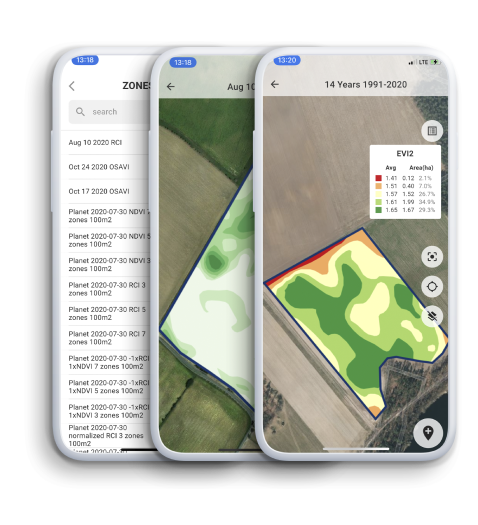
Soil scanning outputs feed directly into site-specific fertilizer and irrigation prescriptions, so when a drought forecast arrives mid-season, the system already knows which management zones will run out of available water first. For in-season stress detection, GeoPard’s crop monitoring tracks NDVI and other vegetation indices from satellite imagery and flags anomalies against the field’s own historical baseline.
Its Smart Scouting feature then directs field scouts to the exact GPS coordinates where the satellite data has identified a potential problem, combining remote-sensing scale with boots-on-ground accuracy.
Variable Rate Application maps translate all of this analysis into machine-ready prescriptions for fertilizer, irrigation, seeding, herbicides, fungicides, and growth regulators — closing the gap between climate intelligence and physical field action.
Post-harvest, GeoPard generates profit maps and Fertilizer Use Efficiency maps that show exactly where on the farm a climate event cost money and whether the management response was correctly calibrated. That economic feedback is what turns a single season’s climate experience into a better prescription for the next one.
Benefits of PA in Climate Impact Modeling
The case for precision agriculture in climate adaptation goes beyond yield protection. When climate models are integrated into a full precision management system, the benefits compound across multiple dimensions of farm performance:
- Improved yield prediction accuracy allows mills and agribusinesses to plan crushing schedules, ethanol production quotas, and logistics in advance, reducing the costly operational disruptions that come from unexpected harvest shortfalls.
- Reduced resource waste follows directly from site-specific management. Water, fertilizer, and fuel inputs are applied where and when the model says they are needed, not uniformly across the entire field, cutting input costs while reducing environmental runoff.
- Better water management through soil moisture-guided irrigation scheduling has cut water consumption by 20 to 35 percent in field trials without reducing yield — a critical benefit as freshwater availability tightens in many cane-growing regions.
- Lower production costs per tonne result from avoided crop losses, reduced input wastage, and more efficient labour deployment directed by data-driven alerts rather than routine scouting schedules.
- Early warning systems that detect stress development two to three weeks before visible symptoms appear give farmers enough lead time to intervene effectively, turning potential yield loss events into manageable stress episodes.
- Enhanced sustainability and long-term resilience are built into systems that reduce erosion, optimize soil health, and maintain yield stability across a wider range of climate conditions than conventional farming can tolerate.
Challenges of Precision Agriculture in Sugarcane
1. Data Accuracy and Availability Gaps
Climate models are only as reliable as the data inputs that calibrate them. In many developing-country sugarcane regions, historical climate records are sparse, soil surveys are incomplete, and on-farm yield data is never digitized.
Sensor networks, when installed without regular maintenance schedules, drift in their readings over time and introduce systematic errors into the model outputs they are meant to improve. Incomplete spatial coverage — relying on two or three sensors to represent a 200-hectare field, for example — misses the sub-field variability that makes precision management valuable in the first place.
2. High Costs and Accessibility Barriers
A full precision agriculture system for a mid-size commercial sugarcane farm — including sensor networks, satellite subscriptions, drone survey services, and decision support software — can require an upfront investment of tens of thousands of dollars, plus ongoing operational costs.
For large Brazilian or Australian agribusinesses managing thousands of hectares, this investment is economically justified by yield protection and input savings.
For smallholder sugarcane farmers in India or Southeast Asia managing two to five hectares, the cost barrier is prohibitive without cooperative models, government subsidies, or service-based pricing that spreads the cost across many users.
3. Technical Knowledge and Training Needs
Deploying a precision agriculture system and deploying it well are two different things. A poorly configured model with incorrect soil parameters or an uncalibrated sensor network will produce confident-looking outputs that are simply wrong.
Agronomists and farm managers need training not only in how to operate the technology but in how to interpret model outputs critically — recognizing when a predicted yield figure is outside its accuracy range, when a sensor reading looks anomalous, and when local field knowledge should override a model recommendation.
4. Climate Uncertainty and the Limits of Forecasting
Climate models provide probability ranges, not certainties. A seasonal forecast that assigns a 70 percent probability of below-average rainfall is correct 70 percent of the time — and 30 percent of the time it is wrong.
Extreme events like one-in-fifty-year cyclones or multi-year droughts fall in the tails of the probability distribution where model skill is weakest. Growers and agronomists using precision agriculture tools need to hold these outputs with appropriate epistemic humility, treating them as decision support aids rather than deterministic predictions.
Case Studies and Real-World Applications
1. Brazil: Precision Monitoring at Continental Scale
Brazil is the world’s largest sugarcane producer, with approximately 754 million metric tons produced in 2024, and it is also the most advanced country in deploying precision agriculture tools for the crop.
Large agribusinesses in São Paulo and Mato Grosso states use satellite NDVI time-series, APSIM-based crop simulation, and automated weather station networks to manage
- planting calendars,
- irrigation scheduling, and
- harvest logistics across hundreds of thousands of hectares.
The CSM-SAMUCA model has been used by Brazilian research institutions to simulate yield and greenhouse gas emission outcomes under multiple IPCC climate scenarios, directly informing government policy on sugarcane area expansion and biofuel production planning.
2. India: Smart Irrigation and Drought Stress Prediction
India produces over 465 million metric tons of sugarcane annually, largely from rain-fed and partially irrigated smallholder farms in Uttar Pradesh, Maharashtra, and Tamil Nadu.
Government-backed precision farming programs in Maharashtra have piloted soil moisture sensor networks and weather-based advisory systems that deliver SMS-based irrigation scheduling recommendations to smallholder farmers whose fields are too small for full sensor deployment.
Early-season drought stress detection — using NDVI anomalies from Sentinel-2 satellite imagery — has allowed district agricultural offices to identify water-stressed zones before the crop reaches a yield penalty threshold, enabling targeted emergency irrigation support to the most vulnerable areas.
3. Australia: Satellite-Based Yield Forecasting
Sugarcane production in coastal Queensland and northern New South Wales operates under increasing climate pressure from both warming temperatures and altered rainfall seasonality. Climate projections for the region suggest temperature increases of approximately 1.7°C by 2059 and 3.4°C by 2099 under high emissions scenarios, with rainfall declining by 3 to 11.5 percent over the same period.
Australian research institutions have been using simulation models — particularly the APSIM-Sugarcane platform — to project that warming could allow some growers to shift from a two-year crop cycle to a one-year cycle, potentially increasing annual yield per hectare, but only if adequate irrigation infrastructure compensates for the projected rainfall decline.
Satellite-based monitoring systems integrated with mill-side yield recording are now routinely used by Queensland’s large commercial growers to validate pre-harvest model predictions against actual crush data and continuously improve model calibration.
Future Trends in Precision Agriculture for Sugarcane Climate Adaptation
The next generation of precision agriculture tools for sugarcane is advancing along several parallel tracks. Autonomous AI-driven field management systems — where sensors, models, and machinery operate in a continuous feedback loop with minimal human intervention — are moving from experimental trials to early commercial deployment on large-scale operations.
These systems apply the precision agriculture logic not just to irrigation and fertilization but to harvest timing, varietal selection, and ratoon management, all informed by real-time climate data and predictive yield modelling.
The future of sugarcane farming is not a farmer checking a phone app for advice — it is a fully integrated system where climate data flows continuously from atmosphere to algorithm to irrigation valve, with human expertise applied at the strategic level rather than the operational one.
Hyperlocal weather prediction — using high-density sensor networks and short-range atmospheric modelling to forecast conditions at the paddock level with two- to four-hour lead times — will dramatically improve real-time decision making for irrigation and spray operations.
Blockchain-based farm data management platforms are beginning to provide the secure, tamper-proof yield and input records that precision agriculture systems generate, enabling traceability from field to mill and supporting premium market access for sustainably produced cane.
Regenerative agriculture practices — cover cropping, minimum tillage, and biological soil management — are increasingly being integrated into precision management systems, using sensor data to monitor soil carbon and microbial health alongside conventional yield metrics.
Best Practices for Farmers and Agribusinesses Adopting Precision Agriculture
Implementing precision agriculture effectively requires a phased and strategic approach rather than an all-at-once technology adoption. The following steps reflect the most effective implementation pathways observed in commercial sugarcane operations:
1. Start with high-quality baseline data. Before deploying sensors or models, invest in a comprehensive soil survey that maps texture, pH, organic matter, and drainage class across the farm. This spatial soil baseline is the foundation on which every subsequent model layer is built, and poor soil data is the most common source of model miscalibration.
2. Deploy sensor networks at appropriate density. A minimum of one soil moisture monitoring station per distinct soil management zone is needed for reliable stress detection. Under-deploying sensors to save cost is a false economy that produces spatially averaged readings that miss the within-field variability the system is designed to capture.
3. Integrate local knowledge with model outputs. Experienced growers and local agronomists hold decades of field-specific knowledge about drainage hot spots, microclimate patterns, and pest cycles that no remote sensing system has yet observed. This tacit knowledge should be used to cross-check model outputs during the first one to two seasons of deployment, and to flag anomalies that suggest a model parameter needs recalibration.
4. Maintain continuous climate monitoring. The value of a precision agriculture system accumulates with time. Multi-year sensor records allow the model to distinguish genuine climate-driven yield anomalies from normal seasonal variation, and to improve its predictions as the local calibration dataset grows deeper.
4. Invest in scalable tools with clear expansion pathways. For smaller operations, entry-level platforms that begin with satellite NDVI monitoring and a single automated weather station provide immediate value without requiring full sensor network investment from day one. Growers can expand sensor density and model sophistication incrementally as the return on investment from early deployments is demonstrated.
Conclusion
Climate change is not a future risk for sugarcane farming — it is a current operating condition that is already reducing yields, increasing input costs, and compressing the reliability of growing seasons across every major production region. Precision agriculture models climate change impact on sugarcane yields by converting environmental complexity into actionable farm intelligence.
Whether through crop simulation platforms that project the biological response to a temperature anomaly, machine learning models that synthesize decades of yield and climate data into a pre-harvest forecast, or IoT sensor networks that detect root-zone moisture stress before the canopy shows a symptom — these tools give growers the ability to act on climate risk rather than simply absorb it. But the trajectory is clear.
As precision agriculture tools become more affordable, more connected, and more accurate, climate-smart sugarcane production will shift from a competitive advantage held by the largest agribusinesses to the standard operating model for commercial and smallholder growers alike.
Precision Farming





 English
  German
  Ukrainian
  French
  Kazakh
  Portuguese
  Spanish
  Arabic
  Swedish
  Serbian
  Romanian
  Norwegian
  Finnish
  Lithuanian
  Estonian
  Latvian
  Croatian
  Slovenian
  Slovak
  Japanese
  Polish