How GeoPard Automation Cuts Manual Data Processing in Precision Agriculture

Manual data entry drains your time and invites costly errors in precision agriculture automation. GeoPard’s tools cut this burden by syncing your yield data, soil tests, and satellite imagery automatically. You’ll see how streamlined agronomic data integration speeds decisions and boosts ROI while reducing tedious tasks. Keep reading to learn how GeoPard transforms your precision ag workflow into a faster, smarter process.

Streamlining Precision Agriculture Workflows

Precision agriculture is evolving rapidly, and automation is at its core. Let’s explore how this shift benefits your farm’s efficiency.

Precision Agriculture Automation Benefits

Imagine a world where you spend less time on data entry and more on actual farming. Automation tools make this possible. They sync yield data, soil tests, and imagery without manual effort. This means fewer errors and faster decisions. By using tools like GeoPard, you reduce tedious tasks. Automation not only saves time but also boosts accuracy, giving you peace of mind.

Agronomic Data Integration Explained

Integrating agronomic data is crucial. Without it, making informed decisions is challenging. GeoPard brings your data together in one place. Think yield data, soil tests, and satellite imagery, all synced automatically. This integration speeds up decision-making and reduces errors. You can focus on what’s important: farming. By having all your data in a single platform, you streamline operations and enhance productivity. Discover more on how to streamline your farm data workflows.

ROI Analysis After Season

Once the season ends, evaluating your return on investment (ROI) is key. GeoPard’s tools help you assess this with precision. By analyzing data collected throughout the season, you can pinpoint areas of improvement. This insight allows for better planning in the next season. Understanding your ROI empowers you to make smarter financial decisions. The longer you wait to analyze, the more potential insights you might miss.

Key Features of GeoPard Automation Tools

GeoPard offers several features designed to optimize your farming operations. Let’s dive into the standout tools that set GeoPard apart.

Automated Management Zones

Creating management zones is now simpler than ever. GeoPard automates this process, using data like soil composition and crop performance. By doing so, you can apply the right resources to the right areas. This targeted approach maximizes effectiveness and minimizes waste. With automated zones, you have more control over your farm’s productivity.

Variable Rate Prescriptions and VRA Maps

Variable rate applications (VRA) are game-changers in precision farming. GeoPard provides tools to create VRA maps effortlessly. These maps let you apply inputs at varying rates based on field conditions. The outcome? Better resource utilization and healthier crops. VRA maps are compatible with most agricultural equipment, making integration smooth.

Bi-directional Data Sync with John Deere

Integrating with existing systems is crucial. GeoPard syncs bi-directionally with the John Deere Operations Center. This means seamless data flow between platforms. You gain access to high-quality data without manual input. This integration enhances decision-making and streamlines your operations. Check out more about GeoPard’s John Deere integration.

Enhancing Agronomic Decision-Making

Decision-making in agriculture is data-driven. GeoPard enhances this process with advanced tools and insights.

Yield Data Processing and Soil Test Analytics

Processing yield data can be a task, but with GeoPard, it’s straightforward. The platform analyzes yield data and soil tests to provide actionable insights. This analysis helps you understand crop performance and soil health better. With these insights, you can make informed decisions about planting and fertilization strategies. The result is improved crop yields and healthier soil.

Topography Modeling and Satellite Imagery

Understanding your land’s topography is vital. GeoPard uses satellite imagery to model your farm’s terrain accurately. This modeling helps you identify areas that require more attention or resources. With better topography understanding, you can optimize irrigation and reduce erosion risks. Satellite imagery offers a clear view of your fields, helping you plan more effectively.

AI Powered Agronomy and Crop Monitoring

AI is revolutionizing agronomy. GeoPard leverages AI to monitor crops and provide real-time insights. This technology predicts potential issues before they become problems. With AI-powered monitoring, you can react quickly to changes in your fields. It also helps in resource allocation, ensuring that your efforts are productive. Learn more from this GeoPard product tour.

By adopting GeoPard’s automation tools, you unlock a world of benefits. From reduced manual data entry to enhanced decision-making, the advantages are clear. Take the initiative to streamline your operations and boost your farm’s productivity today.

Explore automation and API solutions designed for scalable precision ag success.
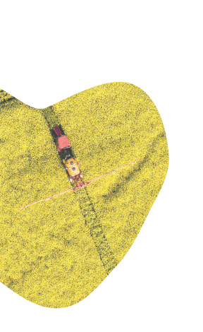
Taming Precision Ag Data: Common Challenges and How to Overcome Them

Taming Precision Ag Data: Common Challenges and How to Overcome Them

Taming precision agriculture data management feels like wrestling a storm. You wrestle with messy yield data, scattered soil data layers, and tangled topography analytics that slow your progress. This guide breaks down those common challenges and shows how to turn complex data into clear, actionable insights—so you can build precise management zones, create VRA maps, and boost ROI with confidence. For more insights, visit this resource.

Navigating Precision Ag Data Challenges

Precision agriculture promises efficiency and higher yields, but managing the data can feel overwhelming. You might think that more data would always be a good thing, but too much information can slow you down. Let’s break down these challenges and see how you can overcome them.

Understanding Data Overload

In precision agriculture, the term “data overload” is all too familiar. With multiple sources like satellite imagery, yield monitors, and sensors, the sheer volume of data can paralyze decision-making. Imagine trying to organize a library with no cataloging system. It’s essential to prioritize what information truly impacts your decisions.

To manage this, focus on the data that provides actionable insights. For instance, historical NDVI analysis can spotlight trends that matter most to your fields. By narrowing your focus, you can transform data overload into a streamlined operation.

Tackling Data Inconsistencies

Data inconsistencies can derail even the best-laid plans. You may find discrepancies between yield monitors and manual measurements, leading to mistrust in the data. This inconsistency often arises from varying equipment calibrations or environmental factors affecting sensors.

Addressing these gaps requires a systematic approach. Start by calibrating your devices regularly to ensure accurate readings. Consistent data cleaning practices also play a vital role in maintaining reliable datasets. By doing this, you can restore trust in your data management process.

Streamlining Data Interoperability

Interoperability stands as a significant hurdle in data management. Different systems often fail to communicate effectively, leading to siloed information and missed opportunities. Imagine trying to solve a puzzle with pieces from different sets. This is where seamless integration becomes essential.

You can overcome this challenge by adopting platforms that support interoperability. For instance, connecting systems like GeoPard with the John Deere Operations Center can create a bi-directional data sync that enhances overall efficiency. Embrace open standards to ensure your systems speak the same language.

Strategies for Effective Data Management

Harnessing the full potential of your data requires practical strategies. Let’s explore techniques to optimize each step of your data management journey—starting with cleaning yield data, integrating soil data layers, and leveraging topography analytics.

Yield Data Cleaning Techniques

Cleaning yield data is the first step toward reliable insights. Dirty data can lead to inaccurate yield maps and flawed decision-making. Imagine trying to read a map with smudged labels.

  1. Calibration: Ensure your equipment is calibrated to provide consistent readings.

  2. Filtering: Remove outliers and noise to get a clear picture of actual yield patterns.

  3. Validation: Cross-reference yield data with other datasets to confirm accuracy.

By refining your data, you create a solid foundation for all subsequent analyses.

Integrating Soil Data Layers

Soil data is crucial for understanding field conditions. However, integrating multiple soil data layers can be challenging. Think of it like layering a cake with different textures and flavors.

  1. Layer Consolidation: Combine data from soil sensors, lab tests, and historical records into a unified format.

  2. Visualization: Use tools that visualize soil variability to identify management zones effectively.

  3. Validation: Compare integrated data with real-world observations to ensure accuracy.

With a clear approach, soil data can become a powerful tool in your management strategy. For more on the importance of soil data, check out this article.

Leveraging Topography Analytics

Topography analytics provide insights into field variations that affect crop growth. Understanding elevation, slope, and aspect can significantly influence your field management strategies, much like knowing the terrain before setting out on a hike.

  1. Mapping: Utilize topographic maps to understand field gradients and water movement.

  2. Analysis: Assess how topography impacts soil moisture and erosion risk.

  3. Integration: Combine topography data with other variables for comprehensive insights.

Topography analytics can reveal hidden opportunities and risks in your fields. Dive deeper into this topic with this guide.

Unlocking Potential with GeoPard

GeoPard can be your ally in navigating data challenges. With its comprehensive tools, you can create management zones, develop VRA maps, and enhance API integration for seamless data flow.

Building Multi-Layer Management Zones

Creating effective management zones is key to precision farming. These zones allow you to tailor inputs like water and nutrients according to specific field needs.

  • Data Integration: GeoPard combines various data layers to form accurate management zones.

  • Customization: Adjust zones based on real-time data to optimize resource use.

  • Efficiency: Target inputs more precisely, improving yields and reducing waste.

Creating Efficient VRA Maps

Variable Rate Application (VRA) maps are critical for precise input application. With GeoPard, you can create detailed VRA maps that guide equipment for optimal resource distribution.

  • Real-Time Updates: Adjust VRA maps with current data to ensure accuracy.

  • Cost Reduction: Apply inputs only where needed, saving on costs.

  • Yield Improvement: Enhance crop performance with tailored input applications.

Enhancing API Integration for AgTech

Integration is vital for a smooth workflow. GeoPard’s API capabilities allow seamless data exchange with other AgTech platforms, boosting your overall efficiency.

  • Flexibility: Connect with existing systems for streamlined operations.

  • Scalability: Easily integrate new technologies as your needs grow.

  • Data Flow: Ensure continuous data exchange for real-time insights.

By adopting these strategies and tools, you can transform your data challenges into opportunities, unlocking the full potential of your precision agriculture efforts.

Identify your biggest precision agriculture challenges and start building solutions.

wpChatIcon
wpChatIcon

    Request Free GeoPard Demo / Consultation


    By clicking the button you agree our Privacy Policy. We need it to reply to your request.

      Subscribe


      By clicking the button you agree our Privacy Policy

        Send us information


        By clicking the button you agree our Privacy Policy