Insuring crops is becoming more expensive as a result of climate change. Crop losses can be caused by floods, hail, and droughts, and farming insurance companies can assist farmers and crop producers to recover. Crop insurance can be obtained for a variety of reasons.
According to a new analysis of the agricultural industry, the international farm subsidy market was valued at $34.05 billion in 2019 and is expected to reach $53.02 billion by 2027, growing at a compound annual growth rate (CAGR) of 6.1 percent between 2020 and 2027.
Its coverage usually covers hail and other natural disasters that may adversely affect productivity. Farming insurance companies are leveraging IoT, drones, and satellites to improve the coverage of their policies.
What is crop insurance?
It is a type of insurance policy designed to protect farmers and agricultural producers from financial losses caused by events such as weather-related disasters, pest infestations, and other risks that can affect crop yields.
Insurance policies typically provide coverage for a range of risks, including yield loss, crop damage, and revenue loss, and are typically tailored to the specific needs and risks of the individual farmer or producer.
In exchange for paying a premium, the farmer or producer receives financial protection against potential losses, which can help to mitigate the risks and uncertainties associated with farming and agricultural production.
It is often subsidized by governments and is an important tool for promoting the stability and sustainability of agricultural production.
Agricultural insurance encourages critical crop investment decisions by protecting farmers and communities from unplanned losses. Those purchasing it faces obstacles such as a lack of rate information and significant wait times for claim settlements.
Direct sales from insurance carriers will continue to be the most profitable income stream during the projection period. Meanwhile, it is looking into new and intriguing ways to reach out to certain market segments through insurance.
Crop insurance businesses in this industry collaborate with agents, brokers, internet markets, and banks (banks).
Its increases in North America led to worldwide market growth in 2019 and are projected to continue. Its coverage has grown in recent years as farmers and ranchers attempt to protect and increase crop production.
Agri-insurers also work to improve the safety of food and fiber crops grown in the region for human use.
Its expansion has been hampered by international laws. As a result of this negative impact, agricultural production in certain nations has stalled, delaying its expansion of coverage.
By the middle of the decade, the global economic recovery, new legislation, and changes to existing insurance plans are expected to strengthen the insurance industry.
Why is crop insurance important for farmers?
It is crucial for farmers for several reasons. Firstly, it provides financial protection against potential losses caused by natural disasters, pests, diseases, or adverse weather conditions, reducing the financial risks associated with farming.
Secondly, it helps farmers secure loans and financing by providing a safety net for lenders. It enhances the stability and sustainability of farming operations, ensuring farmers can recover and continue farming after a significant loss.
Lastly, it promotes confidence and peace of mind for farmers, allowing them to make informed decisions, invest in their farms, and adopt innovative practices without the fear of devastating financial setbacks.
How does precision agriculture help in crop insurance?
Precision farming technology has advanced significantly in recent years, resulting in major advances in agricultural effectiveness and profitability. Precision agricultural technology is expected to be used by approximately six out of every ten production farmers.
Farmers now have a plethora of innovative alternatives at their disposal to improve agricultural productivity, ranging from auto-steer to variable-rate applications.
As members of the federal crop insurance program, some farmers have recently turned to precision farming technologies to simplify – and improve the quality of – the data they collect about their crop planting and production in order to submit mandatory government reports.
Instead of utilizing traditional paper records such as plantation logs and scale tickets, growers can gather and record cultivated and produced acres by using the apparatus GPS monitor and agricultural management system, rather than by hand.
In summary, farmers can “digitize” their planting and production records by utilizing existing precision farming technological capabilities, making important planting and production information more accurate and controllable.
Furthermore, digitizing farm data can bring a considerable increase in understanding of farming processes, including the capacity to better assess crop production risk, especially when combined with other data sources such as conditions of the soil, weather, and geography.
When insurers have a better understanding and insight into agricultural production risk, they may be able to not only offer additional risk management solutions but also underwrite and price the risk more effectively.
While it is distinct from many other types of insurance, it shares certain fundamental principles with homes and auto insurance. The usage of telematics/GPS data from the automobile has resulted in a substantial change in the underwriting and pricing of auto insurance compared to ten years ago.
Because the automobile’s telematics/GPS data provides a more complete picture of driving risk, vehicle insurers can more precisely assess and value auto insurance risk (i.e. speed, braking, etc.).
When automobile data is integrated with other standard driver risk data, better estimations of possible accident risk are obtained.
Similarly, the technology of precision agriculture can provide insurers with more accurate and detailed information on planting and production activity (such as seed spacing, etc.), allowing for more accurate crop output projections beyond what weather alone can affect.
As a result, what does the future hold for precision agriculture and crop insurance solutions? There are already a number of options.
Farmers Mutual Hail Insurance, for example, gives customers a discount on crop hail insurance coverage if they utilize a combined head equipped with GPS technology.
The GPS-enabled combine head is more effective at “picking up” falling corn during a windstorm due to the precision with which the combine is guided along the row line masked by flat corn stalks.
Insurance risk is decreased due to the lower risk of production loss connected with the GPS-guided head, allowing for a lower insurance premium to be imposed.
Farmers have a lot of potential to use precision farming technologies to improve agricultural risk management, particularly crop insurance. We can acquire a better knowledge of agricultural production risk by gathering and organizing field data with precision farming tools.
Trusted advisors can assist farmers in identifying and acquiring new solutions, such as enhanced risk management tools that more accurately reflect individual farmer risk and the solutions desired to mitigate the risk of loss, by working within a clearly defined environment in which the farmer retains control and ownership of their data.
How farming insurance companies can assess and predict field productivity
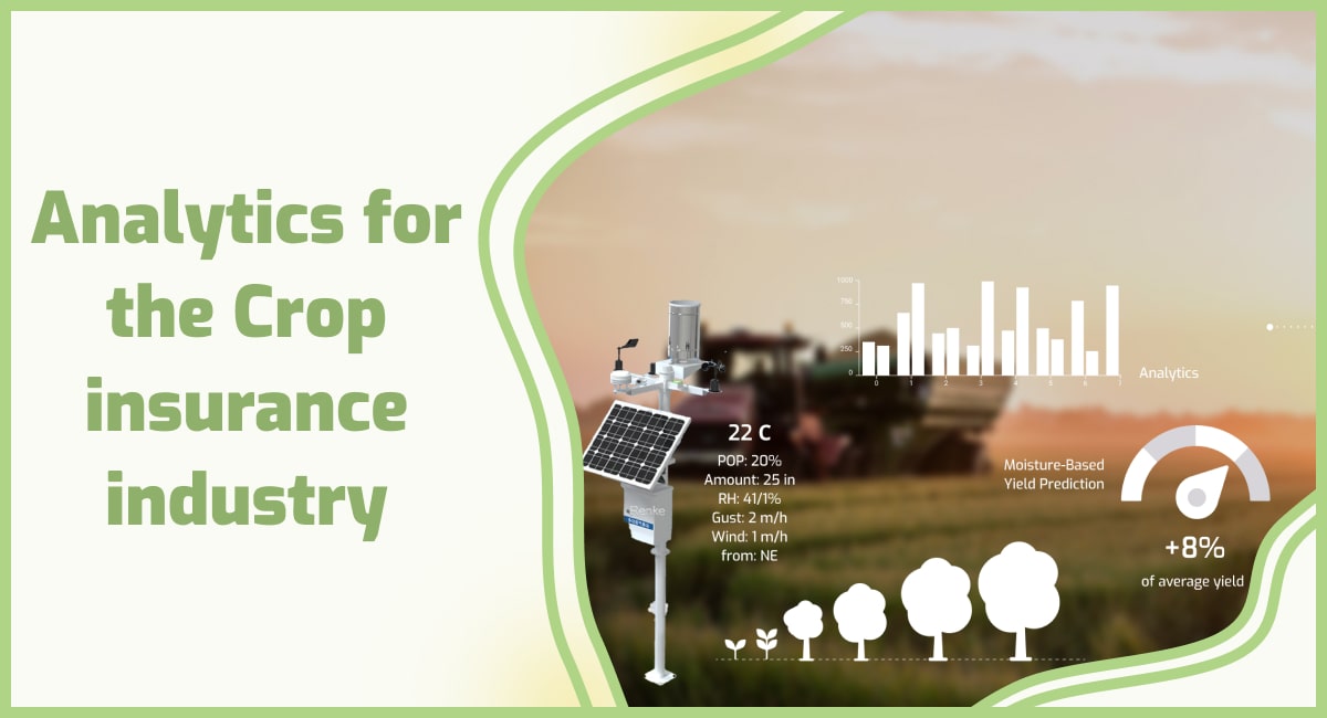
Satellite monitoring is an efficient method of observing crop health because it is cost-effective. This is an opportunity for agricultural insurance businesses. Satellites are multitasking operating systems capable of doing a variety of tasks, including the following:
- exact field area assessment
- identifying seedlings
- The ID of the accumulated dirt (whether a field has been harvested or not)
All of this is occurring concurrently. Agricultural insurance offers the following significant benefits:
- speed
- precision
- cost-cutting initiatives
All of this is possible because of remote sensing, a capability possessed by the majority of current satellites. We’re not talking about snapping images on the fly here; we’re talking about photographing beyond the visible spectrum, into the realm of infrared photography.
When viewed via various wavelengths, the world appears very different. We are only a little sensitive to these rays, and we experience them mostly as heatwaves with no accompanying sensations.
On the other hand, satellites are capable of precisely studying them and providing breathtaking images that shed light on the natural world’s mysteries.
The application of vegetation indices, most notably the Normalized Difference Vegetation Index, exposes the true condition of crops (NDVI).
Farming insurance companies would significantly profit from incorporating this technology into their operations since it would significantly reduce costs while also saving vital time and resources.
Due to the orbital speed of satellites, they can examine vast areas of land and sea in a couple of minutes. Indeed, one orbit can last as little as two hours, implying that the entire circumference of the Earth can be covered in that time!
Crop insurance firms can precisely quantify the area of a field in seconds due to the extraordinary breadth of coverage provided by satellite imagery data. The data is promptly uploaded to the Crop Monitoring platform, which enables users to view the exact contours of any field on any screen, at any time of day or night, via an interactive map.
Another method worth mentioning is the high resolution of satellite images, which enables the detection and monitoring of seedlings and harvest status, among other things.
This technology, when combined with remote sensing data, enables agricultural insurance firms to forecast weather risks and quantify soil and crop damage from natural and man-made disasters.
Waterlogging can be detected through soil moisture monitoring, and critical temperatures can be monitored to detect natural detrimental events such as cold stress.
However, the precise assessment of a field’s production based on historical and present data is unquestionably the most critical feature that any insurance business can profit from.
Additionally, insurers can forecast the future potential production of any certain location by utilizing this skill. Consider each of these in greater detail.
What can GeoPard do for the crop insurance industry?
Because it provides a single platform for field health monitoring, climate change analysis, fertility management, and crop yield prediction, agricultural crop monitoring is a universal tool for all agro-industry participants.
It is impossible to tell whether or not decisions are paying off without a reliable instrument for analyzing results, so:
Farmers can also use the platform to monitor weather conditions to reduce associated risks, plan and manage fieldwork, prevent field losses, make informed decisions using powerful analytic tools such as vegetation indices (you can select the time period for analysis), and stay on the cutting edge of farming technology through yield prediction.
GeoPard allows insurers to have immediate access to a field’s history data, farming records, and land usage without physically visiting the field; all of this information can be tracked straight from the platform.
Agribusiness merchants can evaluate a location’s eligibility for safer agricultural crop supply transactions, optimize logistical planning, manage land utilization, anticipate yields to forecast future revenues and expenses, and monitor climatic conditions to reduce crop failure risks.
It is a highly valuable tool for farming insurance companies to utilize when deciding who to insure. It is a web-based platform that provides agricultural insurance firms with accurate and up-to-date data that is saved in the system and available at any time, online or offline. Crop Monitoring is offered online as well as offline.
Furthermore, GeoPard includes a number of analytical tools that help insurers access and/or validate relevant data as quickly and efficiently as feasible. What is its main advantage? All of the processes aid in the reduction of time, money, and resources while boosting precision and accuracy, after all, the application is convenient.
Frequently Asked Questions
1. How to get crop insurance?
To obtain insurance, follow these general steps. Firstly, contact your local agricultural insurance provider or the agricultural department in your country to understand the available insurance programs.
Secondly, gather necessary information such as crop details, acreage, historical yield data, and production practices. Thirdly, complete the application process, providing accurate information about your crops and farming practices.
Finally, pay the premium as required by the insurance provider. It’s crucial to consult with experts or insurance agents who can guide you through the specific requirements and options available in your region.
2. How to sell crop insurance?
To sell crop insurance, individuals typically need to follow certain steps and meet specific requirements. Firstly, become licensed as an insurance agent in your country or region by completing the necessary education and training programs.
Secondly, partner with an insurance company or agency that offers insurance products. Thirdly, build relationships with farmers and agricultural communities to understand their needs and provide them with information on its benefits and coverage options.
Lastly, market and promote it through various channels such as networking, advertising, and attending agricultural events. Developing trust, expertise, and effective communication skills are essential for its successful selling.
Precision Farming