There has been an increase in the utilization of advanced tech type systems like remote sensing in agriculture recently. Agricultural practices today are significantly more effective, coherent, and streamlined in contrast with conventional agrarian practices.
The use of advanced methods, for instance, crop yield estimation in all aspects of the cultivating process can produce an ideal yield and a better harvest.
To guarantee a higher yield, farmers need to ensure the best health of their crops. While the use of customary systems restricted the observation of bigger regions, as the farmers were relied upon to physically visit all parts of the land.
The most recent innovation has given an assortment of ways through which farmers can without much of a stretch screen the quality of crops in bigger regions.
What is remote sensing?
Define: Remote sensing is a field of study and technology that involves gathering information about the Earth’s surface or other objects from a distance. It utilizes various devices and sensors, such as satellites, airplanes, and drones, to collect data without making physical contact with the target.
Simply, it involves the checking of land from advanced equipment from far distances. The checking includes the physical characteristics of a piece of land.
The process works by estimating the produced and reflected radiation from the land, which helps structure a picture of the land and assists specialists with passing judgment on specific parts of the land.
These electromagnetic waves include visible light, infrared, and microwave radiation. By analyzing the characteristics of the radiation, it enables scientists to extract valuable information about the Earth’s features and processes.
It has a wide range of applications across various disciplines, including environmental monitoring, agriculture, urban planning, and disaster management. It provides a means to observe and study large areas of the Earth’s surface, which would be challenging or impossible to access directly.
What is Remote Sensing used for?
To augment crop development and increase yield in a tough market, producers tend to exploit the most recent tech accessible. To guarantee the greatest yield, farmers need the harvests to remain in the most ideal health.
Observing the strength of harvests over a huge region becomes significantly simpler with the utilization of remote sensing in agriculture.
The data gathered from the process supports precision growing, empowering farmers to accomplish higher yields from their harvests. Some common remote sensing applications include:
- Land cover and land use mapping: It can identify and classify different types of land cover, such as forests, crops, water bodies, and urban areas. This information helps in monitoring changes in land use, assessing deforestation, managing natural resources, and planning urban development.
- Environmental monitoring: It allows for the observation and analysis of environmental parameters like vegetation health, water quality, air pollution, and climate change indicators. It aids in monitoring and understanding natural phenomena, such as wildfires, droughts, and the melting of polar ice caps.
- Agriculture and crop management: Agricultural remote sensing can assess crop health, estimate crop yields, and identify areas affected by pests or diseases. This information assists farmers in making informed decisions about irrigation, fertilization, and pest control, leading to improved crop productivity and resource management.
- Disaster management: It plays a crucial role in disaster response and recovery efforts. It helps in mapping the extent of natural disasters like hurricanes, floods, and earthquakes, enabling efficient allocation of resources and aid distribution. It also aids in assessing post-disaster damages and planning reconstruction activities.
- Geology and mineral exploration: Its techniques, such as hyperspectral imaging and radar, can detect and characterize geological features and mineral deposits. This information supports geological mapping, mineral exploration, and resource assessment.
Remote sensing techniques continue to evolve with advancements in sensor technology, image processing algorithms, and data analysis methods.
With the increasing availability of high-resolution satellite imagery and the integration of remote sensing data with geographic information systems (GIS), its applications and potential are expanding, contributing to a better understanding of our planet and facilitating informed decision-making processes.
How does Remote Sensing Work?
It works by capturing and analyzing electromagnetic radiation emitted or reflected by objects or surfaces on Earth from a distance. Here is a simplified explanation of how remote sensing operates:

- Energy source: It begins with an energy source, which can be natural (e.g., sunlight) or artificial (e.g., active sensors like radar). The energy source emits electromagnetic radiation towards the Earth’s surface.
- Interaction with the target: The emitted energy interacts with the target objects or surfaces. Some of the energy is absorbed, some is reflected, and some may be transmitted through the target. The interaction depends on the properties of the target, such as its composition, texture, and moisture content.
- Sensor detection: Sensors, typically located on satellites, aircraft, or drones, detect the energy that is reflected or emitted by the target. These sensors can capture a wide range of wavelengths, including visible, infrared, and microwave.
- Data acquisition: The sensors collect data in the form of digital images or measurements. The data acquired may include the intensity of reflected or emitted energy at different wavelengths.
- Data transmission and storage: Once collected, the data is transmitted to ground stations or stored on-board the sensor platform. It is then processed and made available for further analysis.
- Data processing and analysis: Remote sensing data is processed using specialized algorithms and techniques. This includes corrections for atmospheric interference, geometric distortions, and radiometric calibration. The processed data is then analyzed to extract meaningful information about the Earth’s surface.
- Interpretation and application: The analyzed data is interpreted by experts, such as scientists, geographers, or agronomists. They identify and classify objects, map land cover types, monitor changes, and extract relevant information for various applications.
- Visualization and communication: The final results are often visualized through maps, images, or other graphical representations. These visual outputs make it easier for decision-makers, scientists, and the public to understand and interpret the information.
It’s important to note that it can utilize both passive and active sensing techniques. Passive sensors detect the naturally occurring energy (e.g., sunlight) that is reflected or emitted by the Earth’s surface. Active sensors, on the other hand, emit their own energy (e.g., radar pulses) and measure the energy that is reflected back.
How It Works In Agriculture?
The process of remote sensing in agriculture works through information gathered by different devices over a period. The gathered data can then be used to analyze different aspects of the crop and yield.
This analysis is used for making changes to the crops to ensure maximum output. The process can be used to conduct a variety of analyses and implement measures accordingly. Common threats faced by farmers are pest infestation and weeds in the crops.
In agriculture, it can help detect those early on and warn the farmers to take the necessary countermeasures to ensure the health of crops. To carry out the process over different areas of land fluctuating in sizes and sorts of harvests, various kinds of devices and sensors are utilized.
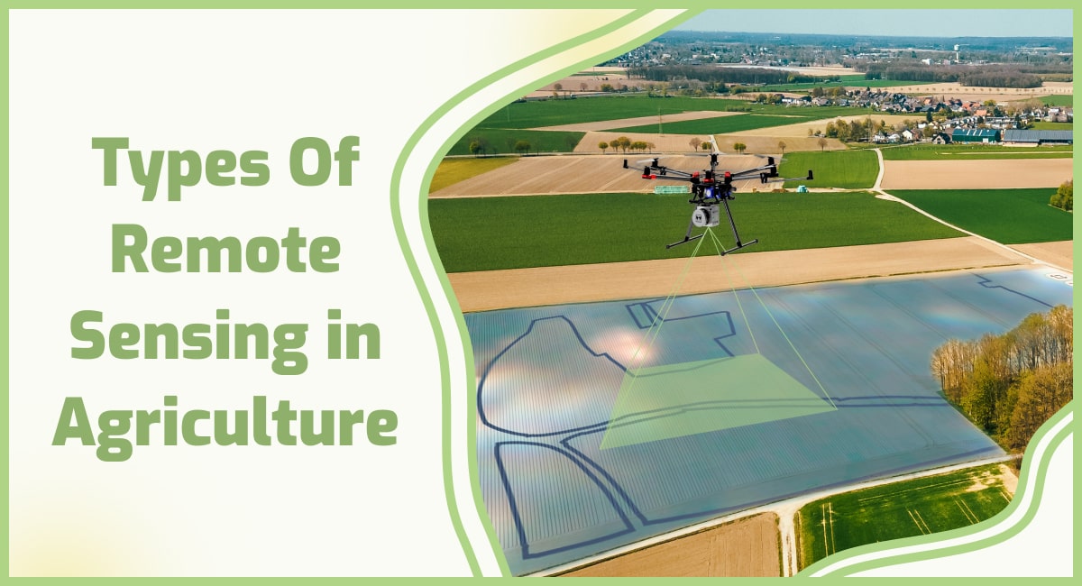
Types Of Remote Sensing in Agriculture
In agriculture, remote sensing techniques encompass various methods for collecting and analyzing data about crops and agricultural landscapes. Here are some common types of remote sensing used in agriculture:
1. Optical sensing: Optical sensors capture electromagnetic radiation in the visible, near-infrared (NIR), and thermal infrared (TIR) regions of the electromagnetic spectrum. They provide valuable information about crop health, vegetation indices, and land cover. Optical sensing data is commonly acquired through satellite imagery or aerial photography.
2. Multispectral sensing: Multispectral sensors capture data in several discrete bands within the electromagnetic spectrum. They enable the analysis of specific wavelengths relevant to vegetation health and crop monitoring. Multispectral data is commonly used to calculate vegetation indices like NDVI (Normalized Difference Vegetation Index) and EVI (Enhanced Vegetation Index) for assessing crop conditions.
3. Hyperspectral sensing: Hyperspectral sensors capture data in hundreds of narrow and contiguous spectral bands across the electromagnetic spectrum. This high spectral resolution allows for detailed analysis and identification of specific materials and vegetation characteristics. Hyperspectral data is valuable for disease detection, nutrient assessment, and detailed crop classification.
4. Thermal sensing: Thermal sensors capture data in the TIR region of the electromagnetic spectrum. They measure the emitted radiation from objects, including crops and soil, which is related to their temperature. Thermal sensing is useful for assessing water stress, detecting irrigation efficiency, and monitoring crop health based on temperature variations.
5. Radar sensing: Radar sensors utilize microwave radiation to penetrate cloud cover, vegetation, and soil, allowing for data acquisition regardless of weather conditions. Radar sensors measure the backscattered signal, which provides information about the structure and moisture content of crops and the terrain. Radar data is valuable for mapping topography, monitoring soil moisture, and assessing crop growth stages.
6. LiDAR sensing: LiDAR (Light Detection and Ranging) sensors emit laser pulses and measure the time it takes for the reflected light to return. LiDAR data provides highly accurate three-dimensional information about crop height, canopy structure, and terrain elevation. It is useful for precision agriculture applications, including crop height estimation, terrain modeling, and canopy characterization.
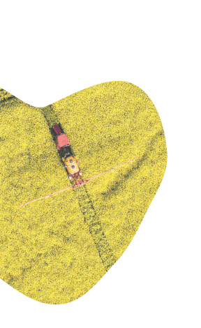
7. Unmanned Aerial Vehicles (UAVs): UAVs equipped with various sensors, such as RGB cameras, multispectral sensors, or thermal sensors, enable high-resolution and flexible data collection at a localized scale. UAVs provide detailed and timely information for crop monitoring, disease detection, and precision agriculture practices.
These different types of remote sensing techniques offer complementary data sources and capabilities, allowing for a comprehensive understanding of agricultural systems.
By integrating and analyzing data from multiple sources, farmers, agronomists, and researchers can gain insights into crop health, growth, nutrient status, water management, and other essential factors that contribute to effective agricultural management.
Types of Sensors
Sensors of various sorts are utilized together to gather various kinds of information over fluctuating sizes of grounds. Sensors are fundamentally categorized into their logistical types. There are satellite sensors, Aerial sensors, and ground-based sensors.
These sensors can be further categorized such as the ground sensors and can come in varying configurations. There are handheld ground sensors, there are vehicle-mounted ground sensors, such as the ones mounted to tractors and there are free-standing ground sensors that are typically mounted to posts and bigger trees.
Ground-based sensors are commonly used for checking the nutrient levels, the moisture content in the soil, and the weather. Using these many changes regarding the use of fertilizers and irrigation can be made to keep the yield high.
The next category of sensors is Aerial sensors. Through the availability of drones, aerial sensors have become quite affordable and accessible.
These aerial sensors can take high-resolution pictures of the land, as well as collect other sensor data cruising at low altitudes for longer periods of time over the crops. The data collected through these sensors can help with weed detection, estimating yield, and other detailed analyses such as measuring the soil salinity and the chlorophyll content.
While they have become accessible and affordable, they are still rendered inoperable in strong winds and cloudy weather, which is a downside of their use.
The farthest of all the sensor platforms for imaging is the satellite sensor. The use of satellites for any kind of imaging was traditionally for governments and militaries. Using satellite imaging in agriculture helps cover a vast area of land and can help with checking crop status.
After an event of a natural disaster, it can help calculate the loss and help estimate crop yield. While there are many upsides to using satellite sensor data, there are many caveats attached to it, for starters, it is expensive and even if you put the cost aside, the imaging must be requested for a specific time typically months in advance.
Which could all be for nothing if there is cloud cover in the requested area at the requested time. Governments across the world have started to open satellite imaging for the public, which could make the process a lot easier in the future.
Working of the Sensor
By identifying the colors in a field of crops, sensors relay information that can be helpful in deducing the status of a plant’s health. Looking at the color of the plant through precise data provided by the sensors, the chlorophyll levels of a plant can be measured through which a farmer can determine any lack in nutrition or a problem with a plant’s health.
The simple data can be extracted through common color sensors, but to get complex information, infrared and short-wave sensors are used.

The reflection of light from leaves changes in the infrared spectrum if the leaf is damaged internally, this can also show if there isn’t sufficient water content. One of the most reliable models in agricultural remote sensing is known as the normalized difference vegetation index or NDVI.
Using infrared and Red-Edge sensors, the NDVI model can easily identify damaged crops, which gives farmers more reaction time to take effective countermeasures to save the crops.
These sensors can likewise be utilized to check soil health and measure soil saltiness. Soil with unnecessary salt substances will in general be brighter in the infrared range, which can assist with identifying the soil which needs more water system and treatment.
The utilization of thermal sensors can assist in optimizing the irrigation framework. The heat emitted from any source is displayed as a lighter tone in the infrared range.
After irrigation a farmer can send an aerial Long-frequency Infrared sensor or LWIR over his fields to check which regions are radiating heat due to poor water systems, so the issues with the irrigation framework can be fixed.
Satellite sensors can cover a wide assortment of capacities. As they can bypass climate conditions, they are ideal for horticultural observing. Aside from the Radar and microwave sensors, the GPS from the satellites gives exact location information which is fundamental in new agricultural innovations like self-operated farming hardware and self-driving farm vehicles.
Role and Advantages of Remote Sensing and GIS in Agriculture
It plays a vital role in agriculture by providing valuable information and insights that contribute to improved crop management, increased productivity, and sustainable farming practices. Here are some key ways in which remote sensing is important in agriculture:
Crop Sown Area Estimation
One of the critical uses of remote sensing in horticulture is the assessment of the Crop sown region. Data from aerial and satellite sensors give a precise analysis of planted regions and helps with risk evaluation if there ought to be an event of disaster or catastrophe.

Crop health assessment
It allows farmers and agronomists to monitor the health and vigor of crops over large areas. By analyzing satellite or aerial imagery, they can detect early signs of stress, nutrient deficiencies, disease outbreaks, or pest infestations. This early warning system enables timely interventions and targeted treatments, reducing crop losses and optimizing resource allocation.
Yield estimation and forecasting
The data, combined with statistical models, can help estimate and predict crop yields. By analyzing vegetation indices and monitoring factors like canopy cover and biomass, farmers can anticipate potential yield variations and make informed decisions regarding harvesting, storage, and marketing of their produce.
Crop Disease Identification
Gis remote sensing in agriculture makes it simpler to recognize contaminations and pest attacks in crops over huge areas at starting stages. This gives producers an adequate opportunity to apply any counter means to safeguard the harvests from any tremendous losses. This becomes possible through satellite imaging and examination.
Soil Properties
Perhaps the primary element in ensuring a sound yield of harvests is the appropriate support of soil. It directly influences the harvest. Any progressions in farm management or farming system cause soil changes, which in turn influence soil capacity of production.
Characteristics, for instance, Soil salinity, Soil pH, organic substance level, and soil texture can be recognized using remote detection and that data can be analyzed to carry out any significant soil treatment.
Soil moisture mapping gives a precise assessment of water content in the soil which can help with carrying out any upgrades in the irrigation system structure.
Irrigation management
Water is a critical resource in agriculture, and it plays a crucial role in optimizing its usage. By assessing vegetation moisture levels and evapotranspiration rates, it helps farmers determine the precise water requirements of their crops.
This information enables them to implement efficient irrigation strategies, reducing water waste, and ensuring that crops receive adequate moisture for optimal growth.
Flood Impact
Through satellite-based sensors and the data assembled through ground sensors, it can help with giving a ton of definite information to decide an accurate loss assessment.
In case of flooding due to excess rainfall, the areas of land with poor drainage frameworks are at risk of waterlogging which causes basic loss of harvests and yield.
The loss assessment can help with further planning for the damage control and countermeasures for keeping losses to a minimum.
NATCAT Modeling
Remote Sensing in agriculture can assist with assessing current and forecasting Natural Catastrophe hazards. Utilizing the information relayed by sensors and the behavior of regular risks.
This requires risk mapping and calculating hazards through estimating hazards which are finished by PC simulated disaster models.
Remote sensing maps prepared with the assistance of historic information and present information gathered from various sensors help in assigning areas of high capability of flooding with high hazard ratings.
This aids in farming as regions with higher risk ratings are not planted on and get treated for better flood protection for the subsequent season.
Drone Image Analysis for Crop Damage Assessment
Drone picture analysis is utilized in crop assessment for damages because of hailstorms, tree counting, and invasions. The drone imagery is as accurate as the input spatial resolution. Which can be increased as per the requirement.
Nutrient management
It can assist in assessing nutrient deficiencies and managing fertilization practices. By analyzing spectral reflectance patterns, farmers can identify areas of the field with varying nutrient levels.
This allows for targeted application of fertilizers, minimizing excess use and potential environmental contamination while maximizing crop nutrient uptake and productivity.
Environmental impact assessment
It provides a means to assess the environmental impact of agricultural practices. It helps in monitoring soil erosion, evaluating the effectiveness of conservation measures, and identifying areas of potential pollution, such as excessive fertilizer runoff or pesticide drift.
This information supports the implementation of sustainable farming practices, minimizing negative environmental effects and promoting long-term agricultural sustainability.
By leveraging the power of remote sensing technologies, farmers and agricultural professionals can make more informed decisions, optimize resource allocation, and implement sustainable practices. This leads to increased productivity, reduced environmental impact, and improved food security, ultimately benefiting both farmers and consumers.
Whats