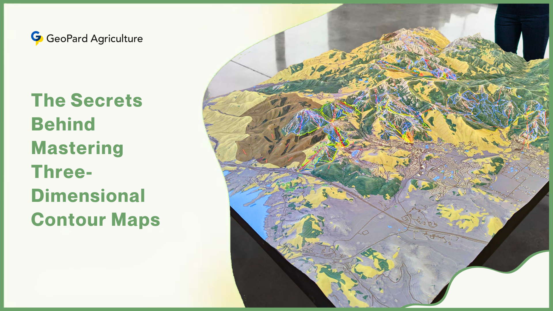
Three-dimensional contour maps are more than just lines on paper—they are gateways to understanding the shape of our world. These maps, which use curved lines to represent elevation, challenge us to imagine hills, valleys, and slopes in three dimensions.
For many, this skill feels intuitive, but for others, it requires careful practice. A 1998 study by Margaret Lanca explored how people mentally convert flat contour maps into vivid 3D landscapes, while also investigating whether men and women approach this task differently.
Recent advancements in technology and psychology have expanded our understanding of these processes, offering new insights into how we learn and remember terrain.
The Challenge of Reading Contour Maps
Contour maps are 2D diagrams that use lines (contours) to represent elevation. Each line corresponds to a specific height above sea level, and the spacing between lines indicates the steepness of a slope. For example, tightly packed lines suggest a cliff, while widely spaced lines represent flat terrain.
These maps are essential in fields like geography, geology, and urban planning because they provide a compact way to visualize complex landscapes.
However, interpreting them requires terrain visualization, the ability to mentally reconstruct a 3D model of the land from 2D lines.

Imagine looking at a series of concentric circles on paper and picturing them as a hill or a crater. This mental leap is not easy, and researchers have long debated how people achieve it.
Some argue that forming a 3D mental image is essential for accurate map reading. This process, often called spatial processing, involves mentally rotating or “slicing” the map to infer cross-sectional views of the terrain.
Others believe verbal-analytical strategies—such as memorizing labels (e.g., “peak” or “valley”) or analyzing slope angles step-by-step—can work just as well. Lanca’s study aimed to resolve this debate while also exploring gender differences in strategy use.
Science Behind Three-Dimensional Contour Map Interpretation
Three-Dimensional Contour Maps begin as 2D diagrams using lines (contours) to represent elevation. Each line corresponds to a specific height, with spacing indicating slope steepness.
Translating these 2D lines into a mental 3D landscape—Three-Dimensional Contour Map Visualization—is a complex cognitive skill.
Learners often struggle with this process, as it requires spatial reasoning to infer hills, valleys, and slopes from abstract lines. Prior research debated two strategies:
- Spatial Processing: Mentally rotating or “slicing” the map to construct a 3D model.
- Verbal-Analytical Processing: Using labels, step-by-step analysis, or mnemonics.
Lanca’s study sought to resolve whether Three-Dimensional Contour Map Visualization is essential for accuracy or if verbal strategies suffice. She also examined gender differences, given men’s historical edge in spatial tasks like mental rotation.
How the Study Was Conducted
Lanca recruited 80 participants—40 men and 40 women—from the University of Western Ontario. None had prior experience with contour maps, ensuring that the results reflected genuine learning rather than existing knowledge. The participants were divided into four groups.
- Contour → Contour: Studied 2D maps, recognized 2D maps.
- Contour → Landsurface: Studied 2D maps, recognized 3D landsurface maps.
- Landsurface → Landsurface: Studied 3D maps, recognized 3D maps.
- Landsurface → Contour: Studied 3D maps, recognized 2D maps.
The first group studied traditional 2D contour maps and later took a recognition test with the same type of maps. The second group studied 2D contour maps but were tested on 3D drawings called landsurface maps, which show terrain in a more visual, realistic style.

The third group studied landsurface maps and were tested on the same format, while the fourth group studied landsurface maps and were tested on 2D contour maps. Each participant completed two tasks.
First, they took a cross-section test. After studying a map for 40 seconds, they answered questions about the terrain’s profile along specific lines. For example, they might be shown three cross-sectional diagrams and asked which one matched a line drawn across the map.
Second, they took an incidental recognition test, where they viewed pairs of maps—one they had studied and one new—and identified the familiar one.
Reaction times and accuracy were recorded for both tasks. Afterward, participants described the strategies they used, such as mentally rotating the map or memorizing labels.
3D Visualization in Contour Map Findings
The results revealed clear patterns. Participants who studied 3D landsurface maps performed better on the cross-section test, scoring an average of 58% accuracy compared to 45% for those who studied 2D contour maps. This suggests that 3D visuals make it easier to infer the shape of the terrain.
However, reaction times were similar for both groups—around 10 seconds per question—indicating that once a map was understood, answering questions took the same effort regardless of format.
Gender differences emerged in the recognition tests. Men outperformed women when tested on the same format they had studied.
- Contour → Landsurface Group: Men scored 62.5% (SD = 8.1) vs. women’s 47.5% (SD = 9.7).
- Contour → Contour Group: Men recognized 84.2% (SD = 10.7) of maps vs. women’s 73.3% (SD = 17.5).
For example, men who studied 2D contour maps recognized 84% of them later, compared to 73% for women. Men also excelled when tested on 3D landsurface maps after studying 2D contour maps, scoring 63% accuracy versus 48% for women.
These differences suggest that men relied more on spatial processing, building 3D mental images, while women used verbal or analytical strategies. Post-test reports supported this: men described “imagining the entire hill and rotating it,” while women focused on “counting contour lines” or “naming valleys.”
Long-term memory also favored 3D processing. Men who used spatial strategies showed stronger recognition of maps they had answered correctly in the cross-section test.
For example, they recognized 74% of landsurface maps linked to correct cross-section answers, compared to 52% for incorrect ones. Women, however, showed no such difference, implying their strategies—while effective for the test—did not create lasting mental models.
Recent Advancements in Spatial Cognition and Technology
Since Lanca’s study, new research has deepened our understanding of how people visualize 3D maps. For instance, a 2021 meta-analysis confirmed that spatial skills can be improved with practice, reducing gender gaps.
Women who trained for 10 hours on mental rotation tasks improved their accuracy by 30–40%, showing that these skills are not fixed. Modern tools like virtual reality (VR) and augmented reality (AR) have also transformed map learning.

A 2022 study found that students using VR to “walk through” terrain scored 65% higher on tests than those using traditional 2D maps. These tools allow users to interact with 3D landscapes, making abstract concepts like elevation and slope more tangible.
Advancements in artificial intelligence (AI) have further changed the field. Programs like Esri’s ArcGIS Pro now generate 3D terrain models from 2D contour maps in seconds, helping professionals predict flood risks or plan infrastructure without relying solely on manual visualization.
Brain imaging studies, such as a 2020 project using fMRI scans, have shown that spatial processing activates areas of the brain linked to spatial awareness, while verbal strategies engage regions associated with language. This aligns with Lanca’s findings that men and women often use different parts of the brain for the same task.
Gender Differences in Map Reading Strategies
The gender differences observed in Lanca’s study align with broader research on spatial cognition. Men often excel in tasks requiring mental rotation, such as imagining how an object looks when turned sideways.
This skill is closely tied to 3D visualization, which explains their advantage in recognizing maps. Women, on the other hand, tend to use verbal-analytical strategies, breaking down problems into smaller steps or relying on labels.
Both approaches worked for the cross-section test, but spatial processing gave men an edge in long-term memory. These differences are not about ability but about strategy.
For instance, a woman might excel at remembering the names of landmarks on a map, while a man might better recall the overall shape of a hill.
This has important implications for education and training. If instructors focus only on one method—say, spatial visualization—they might overlook students who thrive with verbal or analytical techniques.

These differences are not about ability but about cognitive style, or preferred ways of thinking. However, they have real-world implications. A 2023 report found that women make up only 28% of the workforce in fields like geology and cartography, which rely heavily on spatial skills.
Organizations like Girls Who Code and GeoFORCE are working to bridge this gap by introducing young women to 3D visualization tools and spatial training programs.
Contour Map Applications in Education
Lanca’s findings, combined with modern technology, offer valuable lessons for educators and professionals. First, integrating 3D tools early in education can help beginners grasp contour maps faster.
For example, a geography teacher might show students a 3D model of a mountain before introducing its 2D contour map. Virtual reality apps now allow students to “explore” terrain in immersive environments, turning abstract lines into interactive landscapes.
Second, training programs should encourage multiple strategies. Spatial learners might benefit from exercises like mentally rotating maps or building clay models, while verbal learners could use mnemonics or descriptive labels. For instance, a simple phrase like “Close contours mean cliffs!” helps students remember how line spacing relates to slope steepness.
Third, addressing gender gaps in spatial training is crucial. Women entering fields like engineering or geology might benefit from early exposure to 3D tools. Activities like using AR apps to “walk through” virtual terrain can build confidence and spatial awareness.
Finally, professionals who rely on maps—such as surveyors or emergency responders—can improve their skills with mental rotation drills.
For example, visualizing how a hill would look from different angles enhances efficiency in tasks like flood modeling or disaster planning. In Bangladesh, emergency teams now use AI-powered 3D maps to predict flood patterns, reducing decision-making time by 40% during crises.
Limitations and Unanswered Questions
While Lanca’s study provided important insights, it had limitations. For example, all participants were novices, so experts like geologists might process maps differently due to years of experience.
Additionally, the 40-second study time per map does not reflect real-world learning, where people often spend hours analyzing terrain.
Recent research has explored these gaps. A 2021 study found that combining spatial imagery with verbal descriptions improved retention by 25% in geography students.
Another project in 2023 showed that older adults experience a 20% decline in mental rotation accuracy, highlighting the need for lifelong spatial training.
Interactive tools like VR are also being tested in classrooms, with early results showing that students learn contour maps 50% faster using immersive simulations compared to textbooks.
Conclusion
Margaret Lanca’s research reminds us that contour maps are more than lines—they are invitations to explore the world in three dimensions. While spatial processing isn’t strictly necessary for basic tasks, it unlocks stronger memory and efficiency, especially in professions that depend on precise terrain analysis.
Gender differences in strategy underscore the importance of flexible teaching methods. By embracing 3D tools, encouraging diverse learning styles, and addressing gaps in spatial training, we can help everyone—from students to professionals—navigate the complexities of contour maps with confidence.
In a world where maps guide everything from hiking trails to disaster response plans, understanding how we think about terrain is as vital as the terrain itself. Whether you’re a visual learner who “sees” hills in your mind or an analytical thinker who breaks down slopes step-by-step, the goal remains the same: to turn lines on paper into a living, three-dimensional landscape.
Reference: Lanca, M. (1998). Three-dimensional representations of contour maps. Contemporary educational psychology, 23(1), 22-41. https://doi.org/10.1006/ceps.1998.0955
Blog


