Topography is one of the major factors affecting yield and nutrition content in the soil. Thus slope can be a major yield-limiting factor especially for undrained spots or eroded elevated spots, flow accumulation can impact yield significantly depending on dry or wet years.
In some regions, topographical land features can explain even mid-double-digit percentage of yield variability.


As GeoPard is moving towards becoming a powerhouse for ag data analytics, we’ve added advanced topography analysis in the system.
All you need to do is to create a field boundary (draw, import or batch import). GeoPard automatically creates Digital Elevation Model (DEM) for your field, and calculates the following topographic models and combined maps:
- elevation – absolute numbers;
- slope – the measure of steepness or the degree of inclination of a feature relative to the horizontal plane;
- aspect – the compass direction that a slope faces;
- hillshade – a shaded relief effect for terrain visualization;
- elevation and hillshades;
- slope and aspect.
We calculate all these models since only DEM is not enough to accurately determine the field topography, for example, there may be a hilltop in the lowland that will differ in soil characteristics and productivity from other parts of the field with the same height in absolute values – e.g. slopy area, depression.
These are screenshots reflecting the correlation of topography and multi-year crop development pattern:


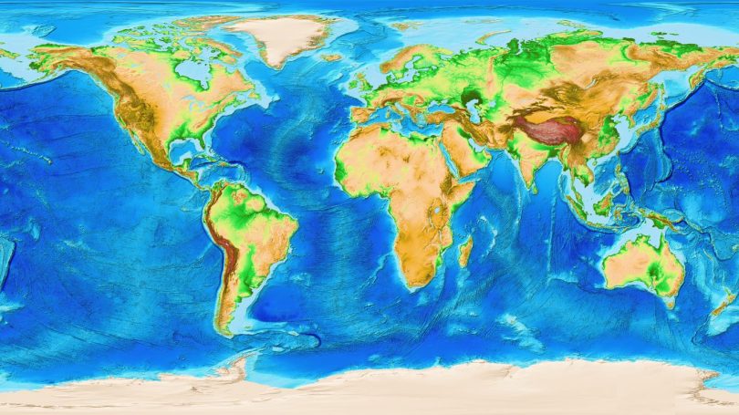
GeoPard incorporated various digital elevation datasets globally, from LIDAR with 2m spatial resolution in the UK to 30m SRTM, to provide the best possible topography analytics.
Let us know what other ag data analytics or other elevation derivatives you would like to see in GeoPard Agriculture as the next piece of a yield understanding puzzle!
What are topography factor?
Topography factors in agriculture refer to the characteristics of the land’s surface and its influence on agricultural practices. These factors play a significant role in determining the suitability of an area for farming, as well as influencing various management decisions. Here are some topography factors in agriculture:
Slope
Slope is a crucial topography factor that affects water drainage, erosion, and the accessibility of agricultural machinery. Steep slopes increase the risk of soil erosion and water runoff, requiring erosion control measures such as contour plowing or terracing.
Slope also affects the availability of sunlight, as steeper slopes may cast shadows and influence microclimates within a field.
Elevation
Elevation is the vertical distance of a point or location above a reference point, often mean sea level. It influences temperature, atmospheric pressure, and the types of crops that can be grown in an area.
Higher elevations generally experience cooler temperatures, which may limit the types of crops that can thrive. Elevation also affects the length of the growing season and influences the choice of appropriate crop varieties.
Drainage
The topographic relief of an area determines its natural drainage patterns. Proper drainage is essential for soil aeration, nutrient availability, and preventing waterlogging.
Low-lying areas or depressions may retain excess water, leading to waterlogged conditions that can be detrimental to crop growth.
Understanding the drainage characteristics of the land helps farmers implement effective drainage systems to optimize water movement and prevent water-related issues.
Aspect
Aspect refers to the orientation of a slope in relation to the cardinal directions (north, south, east, west). It affects the distribution of sunlight, wind patterns, and temperature gradients within a field.
South-facing slopes receive more sunlight and heat, creating warmer microclimates and potentially influencing the choice of crops or planting strategies. Aspect can also impact the risk of frost or cold air drainage in certain regions.
Soil Depth and Texture
Topography can influence the depth and texture of the soil in an agricultural area. Slopes can lead to variations in soil depth, with thinner soils found on steeper slopes. The soil texture, such as the proportion of sand, silt, and clay, may also vary based on the topographic relief.
Understanding these variations helps farmers make informed decisions about soil management practices, such as irrigation, fertilization, or tillage.
These topography factors in agriculture demonstrate the importance of considering the characteristics of the land’s surface when making agricultural decisions.
By understanding and managing these factors, farmers can optimize crop growth, prevent soil erosion, and implement appropriate farming practices to ensure sustainable and productive agricultural systems.
What is topographic or local relief?
Topographic relief or local relief in the context of agriculture, refers to the variation in elevation or slope of a piece of land. It is a measure of the vertical difference between the highest and lowest points within a given area. In simpler terms, it represents the topographical features and contours of the land.
In agriculture, understanding topographic relief or local relief is crucial as it directly influences various farming practices and management decisions. Here are a few key points to consider:
- Soil Erosion: It plays a significant role in determining the risk of soil erosion. Steep slopes are more prone to erosion, as water runoff can quickly carry away fertile topsoil and nutrients. Farmers need to adopt appropriate erosion control measures such as contour plowing, terracing, or buffer strips to minimize soil erosion.
- Water Management: The topographic relief of a field affects water drainage and distribution. It determines how water flows across the land, potentially causing waterlogging in low-lying areas or excessive runoff in steep slopes. By understanding it, farmers can implement proper drainage systems, such as ditches, swales, or tile drainage, to manage water effectively and prevent water-related issues.
- Crop Selection: Different crops have varying tolerances to slopes and elevation. The relief of a field can dictate which crops are suitable for cultivation. For instance, on steep slopes, erosion risk and water runoff might limit the choice of crops to those that can anchor the soil effectively. On the other hand, flat or gently sloping areas can accommodate a wider range of crops.
- Machinery Operations: Local relief also influences machinery operations and field accessibility. Steep slopes might be challenging or unsafe for certain machinery, limiting the scope of mechanization. In such cases, farmers may need to consider alternative farming techniques, such as manual labor or specialized equipment designed for steep terrains.
Difference between elevation and relief
Elevation and relief are two distinct concepts related to the topography of agricultural land. Here’s the difference between the two:
Elevation
Elevation refers to the height or vertical distance of a point or location above a reference point, typically mean sea level (MSL). It is an absolute measure that provides information about the vertical position of a specific point on the Earth’s surface.
Elevation is typically measured in units such as meters or feet. In agriculture, elevation data is important for understanding the overall height of the land, which can influence factors like temperature, atmospheric pressure, and water movement.
Relief: What is the it on a topographic map?
Relief, on the other hand, refers to the variation in elevation between different points on the map. It represents the difference between the highest and lowest points in that area.
It is a relative measure that provides information about the vertical differences or changes in elevation across a particular landscape of an agricultural area.
It is typically depicted using contour lines, which connect points of equal elevation, allowing us to visualize the hills, valleys, and slopes present in the landscape. The closer the contour lines are to each other, the steeper the relief, while widely spaced contour lines indicate gentler slopes.
In summary, elevation is an absolute measure of the vertical distance above a reference point (such as MSL), while it is a relative measure that describes the variation in elevation within a specific area or region.
Elevation provides information about the height of a point, whereas it provides insights into the topographic features and slopes of a given agricultural landscape.
Both elevation and relief are important considerations in agriculture as they influence factors such as water drainage, temperature gradients, and suitability for specific crops.
What is an example of topography?
An example of topography in agriculture is the presence of terraced fields on hilly or mountainous terrain. Terracing is a technique commonly used in such areas to create level platforms or steps on the slopes, effectively transforming steep land into cultivable fields.

Terraces help mitigate soil erosion by reducing water runoff and allow for efficient water management.
Terraced fields utilize the natural topographic relief to control water movement and maximize agricultural productivity. Each terrace acts as a small flat area that can retain water, preventing it from rapidly flowing downhill and causing erosion.
The walls of the terraces serve as barriers, holding the soil in place and preventing it from being washed away. This method helps to maintain fertile topsoil on the terraces, ensuring optimal conditions for crop growth.
Terracing also allows for better utilization of limited land resources in hilly or mountainous regions. By creating flat areas on slopes, farmers can cultivate crops that would otherwise be challenging or impossible to grow due to steep gradients.
Terraced agriculture has been practiced for centuries in various parts of the world, such as the rice terraces of the Philippines, the vineyard terraces in the Douro Valley of Portugal, or the tea terraces in the hills of China.
Frequently Asked Questions
1. Why is topography important in agriculture? How does it affect food production?
Topography is vital in agriculture as it has a direct impact on food production. It affects water drainage, soil erosion, and crop suitability. It helps plan irrigation systems, manage slopes, and optimize land use. Understanding topography is crucial for efficient and sustainable farming practices.
2. How to identify the aspect of a slope?
Identifying the aspect of a slope can be done using a compass or compass app on a smartphone. Stand on the slope and hold the compass level in front of you, making sure the needle is pointing north.
Read the degree at the direction where the needle points to determine the aspect. For example, if the needle points to 180 degrees, the aspect is south-facing.
This method allows you to determine the cardinal direction of the slope, aiding in understanding sun exposure and microclimate variations.
3. How does relief influence agriculture?
It, or the variation in elevation and slope across a landscape, has significant impacts on agriculture. Steeper slopes can affect water drainage and increase erosion risks, requiring appropriate soil conservation measures.
Slopes can also influence microclimates, with different temperature and moisture conditions on different aspects. Additionally, it can affect soil depth and fertility, influencing crop selection and productivity.
Therefore, properly understanding and managing relief is crucial in optimizing irrigation, minimizing erosion, and selecting suitable farming practices for different areas of a landscape.
4. Why are valley slopes the preferred sites for agriculture in mountainous regions?
Valley slopes are preferred sites for agriculture in mountainous regions due to several reasons. Firstly, valley slopes offer relatively flatter terrain, making it easier for farming activities such as cultivation, irrigation, and mechanization.
Secondly, valleys tend to have better access to water sources, such as rivers or streams, which can be used for irrigation. Additionally, valley slopes provide good sun exposure and protection from strong winds, creating favorable microclimates for crop growth.
Lastly, the natural drainage patterns of valleys help prevent waterlogging, ensuring proper water management. Overall, these factors make valley slopes ideal for agriculture in mountainous regions.
5. How are relief and topography related?
Relief and topography are closely related in the context of geography. Topography refers to the physical features and variations of the Earth’s surface, including elevation, slopes, and landforms.
It, on the other hand, specifically refers to the difference in elevation between the highest and lowest points in a given area.
In other words, it is a measure of the vertical differences in the topography. Together, both provide a comprehensive understanding of the surface characteristics and terrain of a particular region.
6. How to measure elevation of land?
Measuring the elevation of land can be done using various methods. One common approach is to use a Global Positioning System (GPS) device, which can provide accurate elevation readings.
Another method is to use a digital elevation model (DEM), which is a dataset containing elevation information for different locations.
Specialized surveying equipment, such as total stations or laser levels, can also be used for precise measurements. In some cases, traditional methods like barometric pressure measurements or using an altimeter can provide rough estimates of elevation.
Topography