
Q1 Precision Agriculture Playbook to Enhance Spring Crop Management
Spring crop management can make or break your season, especially when timing and precision matter most. You’ve got the data, but turning it into clear action often feels like a maze. This Q1 precision agriculture playbook cuts through the noise with proven steps on planting readiness, nitrogen management, and early crop monitoring—all powered by GeoPard’s AI-driven insights and seamless John Deere Operations Center integration. For further insights, see this resource.
Planting Readiness with Precision Tools

Starting the planting season with precision tools makes a huge difference. Let’s explore how to prepare your fields for the planting window.
Preparing for the Planting Window
Timing is essential when it comes to planting. You need to be ready when the optimal window arrives. Start by checking local weather forecasts and soil conditions. This will help you determine the best time to plant. Aiming for the right window ensures your seeds have the best environment to germinate.
Next, utilize GeoPard’s precision agriculture software to gather data on your field’s current state. This data may include soil moisture and temperature, both critical factors for successful planting. By being proactive, you are positioning your crop for a strong start, which can lead to increased yields.
Equipment Calibration and Data Sync
Your equipment must be in peak condition. Ensure that planters and seeders are calibrated according to manufacturers’ guidelines. Misalignment can lead to uneven planting, affecting crop health. Regular maintenance checks can prevent these issues.
Data synchronization is equally important. Sync your equipment with John Deere Operations Center integration. This allows real-time updates and precise planting. Keeping data in sync reduces errors and optimizes your planting strategy.
Soil Zone Mapping and Field Variability
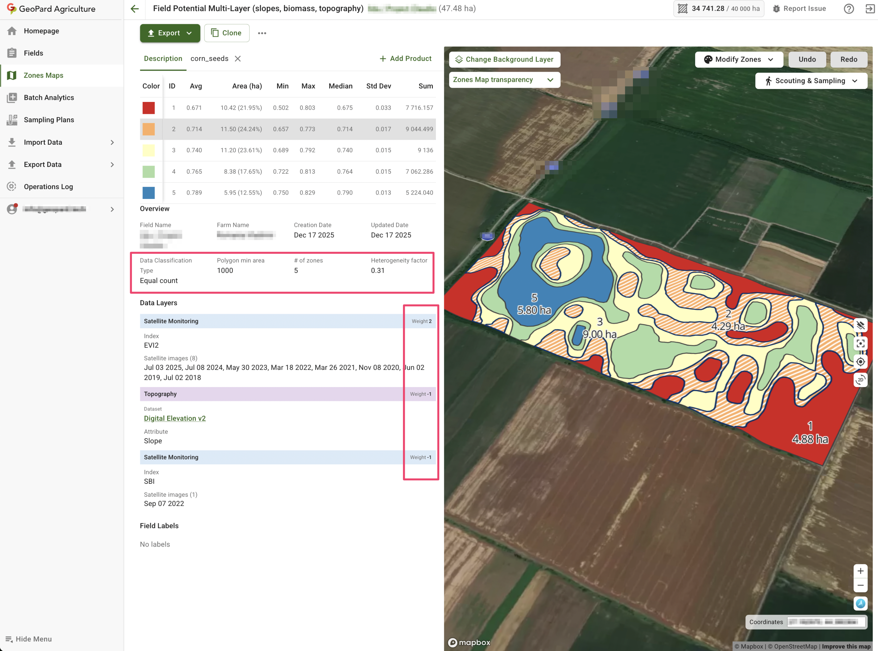
Not all parts of your field are the same. Soil zone mapping helps identify different conditions within your field. Use GeoPard’s satellite imagery and topography analytics to create detailed maps. These maps highlight areas of high and low productivity.
Understanding field variability lets you apply the right amount of seed and nutrients where needed. This targeted approach not only boosts crop potential but also cuts costs. By focusing on specific zones, you maximize efficiency and increase your return on investment.
Optimizing VRA Seeding and Nitrogen Management

Once your field is ready, it’s time to optimize seeding and nitrogen management. Let’s dive into creating effective management zones.
Building Effective Management Zones
Creating management zones is crucial for efficient resource use. Begin by analyzing historical yield data and current soil conditions. GeoPard’s software offers insights by combining these data points.
These zones guide where to focus your efforts. Zones with poor soil can receive more attention, while zones with rich soil require less intervention. This approach conserves resources and enhances productivity.
Creating VRA Seeding and Nitrogen Maps
Variable Rate Application (VRA) is a game-changer. It ensures precise distribution of seeds and nitrogen. Use GeoPard’s VRA maps to tailor applications according to management zones.
By applying the right amount of input, you prevent waste and increase crop vitality. This precision leads to higher yields and better resource management. A well-executed VRA strategy can transform your agricultural outcomes.
Leveraging John Deere Operations Center
Integrating your data with the John Deere Operations Center simplifies your workflow. This platform provides a seamless connection between your equipment and data analytics.
By leveraging this integration, you can access real-time data and make informed decisions quickly. This streamlined process saves time and enhances your overall farming strategy.
Early Crop Monitoring and Data-Driven Decisions

After planting and optimizing inputs, focus on monitoring your crop growth. Early detection of issues is key to successful farming.
Satellite Imagery NDVI and NDRE Insights
Satellite imagery provides an aerial view of crop health. NDVI and NDRE indices are valuable tools for monitoring plant vigor and nutrient status. Regularly reviewing these indices helps spot problems before they escalate.
Healthy crops reflect in a more vibrant NDVI, signaling optimal growth conditions. If NDRE readings indicate nutrient deficiencies, you can address them promptly. This proactive monitoring ensures your crops stay on track.
Topography Analytics and Yield Data Analysis
Understanding your field’s topography is essential for managing water flow and erosion. GeoPard’s topography analytics offer detailed insights. By analyzing these, you can implement measures to manage water efficiently.
Yield data analysis helps track progress and plan for future seasons. Evaluating past yields combined with current data helps refine your strategies. This continuous improvement cycle enhances productivity year after year.
In-Season Scouting and Agronomic Support
Field scouting is vital for ongoing crop health. Regularly walk your fields to identify potential issues like pests or diseases. Use GeoPard’s agronomic support tools to log observations and take corrective actions.
In-season scouting allows you to react swiftly to challenges. Collaborate with agronomists when needed, ensuring your crops receive expert care. Staying vigilant helps secure a bountiful harvest.
In conclusion, embracing precision tools and data-driven strategies can significantly enhance your spring crop management. By preparing thoroughly and leveraging advanced technology, you set the stage for success.
Reflect on the quarter’s precision ag insights and prepare to adopt smarter strategies.


 English
  German
  Ukrainian
  French
  Kazakh
  Portuguese
  Spanish
  Arabic
  Swedish
  Serbian
  Romanian
  Norwegian
  Finnish
  Lithuanian
  Estonian
  Latvian
  Croatian
  Slovenian
  Slovak
  Japanese
  Polish