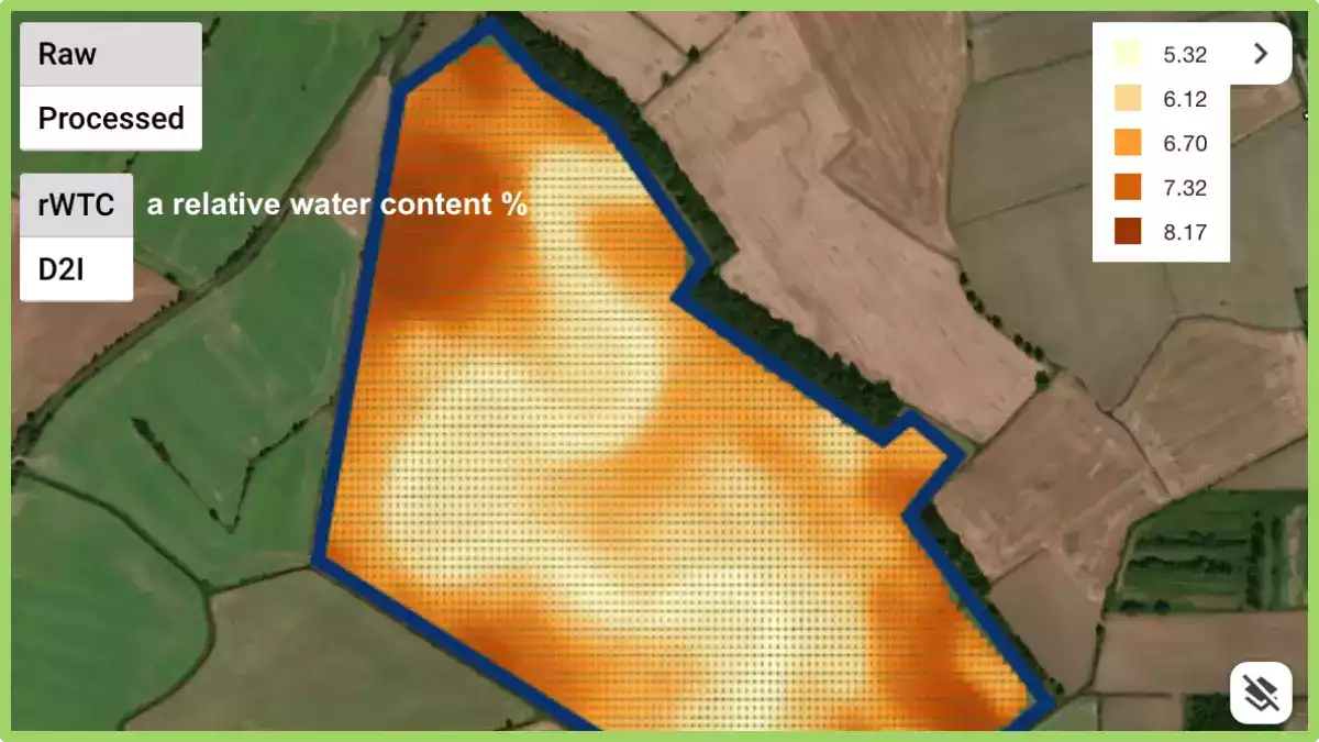
GeoPard is capable of processing and analyzing various types of ag spatial data. This is an example of working with high-density sensor datasets with a great spatial variability provided by Geoprospectors GmbH.
After importing a data captured by TopsoilMapper, you can see
- a relative water content
- a depth to interface with information about compaction
- electrical conductivity on 4 cumulative depth

Geopard lets you see points with raw values and continuous surface; compare different data layers; delineate soil zones for zonal soil sampling and VRA; combine TopsoilMapper data with data available in GeoPard such as historical, current vegetation, and elevation into one Zones Map.

Curious to know what low EC values represent on the map as a curve? This is an ancient riverbed, buried underground.