Agriculture in Turkmenistan accounts for a modest share of the country’s gross domestic product (GDP), yet it holds significant strategic importance. A large portion of the population resides in rural areas, with over 40% of the workforce employed in the agricultural sector.
Since gaining independence in 1991, Turkmenistan has faced challenges in modernizing its agricultural practices, including the absence of a contemporary crop monitoring system capable of delivering reliable and timely data. Such a system is crucial for informed decision-making, sustainable land management, and enhancing productivity.
To address this gap, Turkmenistan has partnered with the Food and Agriculture Organization of the United Nations (FAO) to introduce advanced remote sensing technologies and expertise in land use monitoring.
This collaboration, under the newly launched FAO Technical Cooperation Programme (TCP) project, aims to optimize processes related to crop monitoring, forecasting, and statistical reporting, as well as to test new methodologies through field applications. The project is set to run until late 2026.
On January 7, 2025, the project was officially signed by Viorel Gutu, FAO Assistant Director-General and Regional Representative for Europe and Central Asia, and Charyyar Chetiyev, Turkmenistan’s Minister of Agriculture.
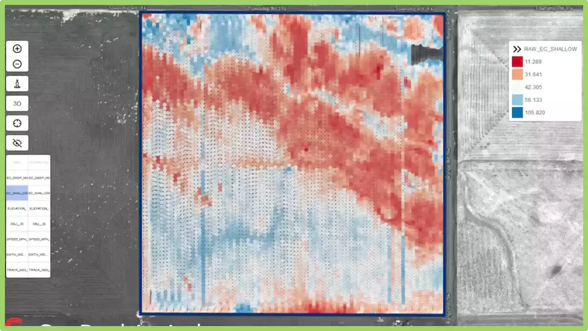
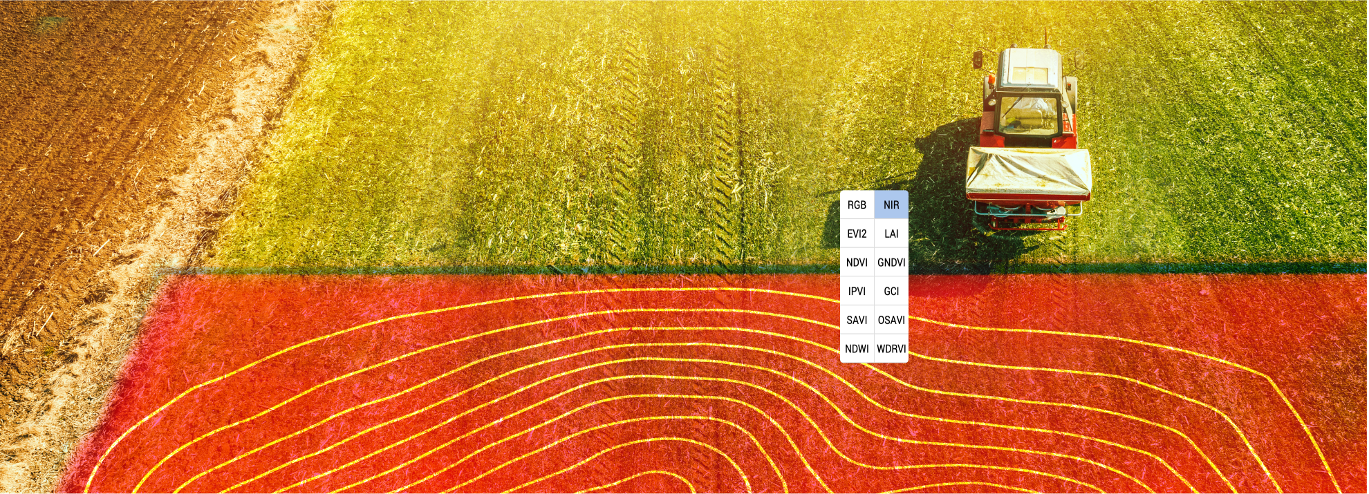
“Remote sensing offers innovative methods for data collection and analysis that can benefit various sectors, including agriculture, water resource management, and disaster response,” said Maxim Gorgan, FAO Lead Technical Officer for the project. “In agriculture, it provides near-real-time insights into sown areas, vegetation dynamics, yield estimates, water stress, irrigation planning, and even pest and disease monitoring.”
The initial phase of the project will involve a thorough review of existing regulations and institutional frameworks related to crop monitoring and remote sensing, with recommendations for necessary improvements. The methodology will integrate advanced technology with traditional statistical methods, sampling, and data collection.
FAO will also develop a customized training program for Ministry personnel and the Land Resources Service to equip them with the skills needed to implement and operate the new remote sensing-based crop monitoring system. Additionally, the initiative will explore integrating remote sensing into higher education curricula.
To demonstrate the system’s potential, pilot plots with various crops and agroclimatic conditions will be established. These demonstration areas will generate data to refine the methodology and inform the development of a concept for scaling up the approach nationwide.
“For farmers, this technology can help identify the specific needs of different areas within a field, enabling more efficient use of water, fertilizers, and other inputs, ultimately leading to better yields,” added Gorgan.
Throughout the project, FAO will adhere to its regional and global guidelines, emphasizing gender equality and responsible land governance.
FAO Technical Cooperation Programme projects provide member countries access to the organization’s technical expertise and support, contributing to the Sustainable Development Goals and fostering long-term agricultural development.
Noticias