What does it mean? Historical (multi-year) management zones are built based on 30+ years archive of satellite imagery.
Images with peak vegetation during every season are automatically selected as inputs for analytics. Otherwise, every such image represents a potential yield file for the related year.
Historical (multi-year) management zones provide insights about every spot in the field.
How can you use it? The field crop development pattern helps to know the agricultural area better and to apply the right decision with the right input rates in the right spots.
Historical management zones could be used as a blueprint for prescription (Rx) files for seeding, fertilization, zones based soil sampling.
We support all regions by request.
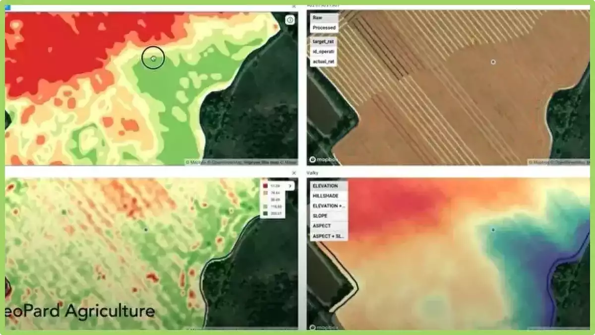
What are Multi-Year Zones?
Multi-Year Zones in precision agriculture refer to specific areas within a field that exhibit consistent and distinguishable patterns of crop growth and yield over multiple growing seasons.
These zones are identified using various technologies such as remote sensing, GPS mapping, and soil sampling.
By analyzing the data collected from these technologies, farmers and agronomists can identify patterns of variability within a field and create maps that distinguish areas of high productivity from those with lower yields.
This information can then be used to optimize crop management practices, such as varying planting density, adjusting irrigation and fertilization rates, and even implementing precision harvesting techniques.
They provide a valuable tool for precision agriculture as they allow farmers to make informed decisions about resource allocation and crop management, resulting in improved efficiency, reduced costs, and increased yields.
By understanding the variability within a field and tailoring management practices to each specific zone, farmers can maximize the potential of their land and resources.