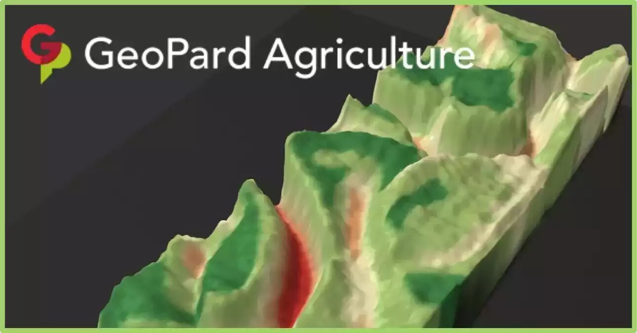
GeoPard is making history by being the first company to automate the online creation of high-resolution 3D topography maps with their new 3D mapping tool.
In just a few seconds, users can generate maps that explain the complex variability. For example, the maps help to learn how the topography and relief data of a given area influence crop development.
 3d topography model overlaid with the Field Potential map
GeoPard is continuing its mission to make such tools more accessible for crop growers. There is no need for a powerful computer or specialized skills to start with data-driven decisions.
What are Topography maps?
Topography maps, also known as elevation maps, are maps that depict the shape and elevation of the Earth’s surface. These maps use contour lines to show the different elevations of the land, with each line representing a constant elevation above sea level. T
he closer together the contour lines, the steeper the slope of the land, while widely spaced contour lines indicate flatter terrain.
In precision agriculture, they can be used to identify variations in slope and terrain, which can affect the distribution of water, nutrients, and other inputs across a field.
By understanding the 3d topographic maps of their fields, farmers can make informed decisions about planting, irrigation, and drainage, and can implement precision farming techniques such as variable-rate application of inputs.
They can be created using various technologies, including LiDAR (Light Detection and Ranging) and satellite imagery. These maps can be overlaid with other data, such as soil maps and yield data, to create customized prescription maps for precision agriculture applications.
Overall, they are an important tool for precision agriculture, as they provide farmers with a detailed understanding of the terrain and landscape of their fields, enabling them to optimize yields and reduce input costs.
What is 3D mapping in precision agriculture?
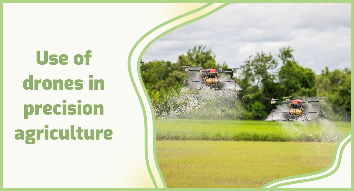
3D mapping in precision agriculture is a technique that uses various sensors and imaging technologies to create a detailed three-dimensional map of a farm or field.
The process typically involves the use of drones, airplanes, or ground-based vehicles equipped with sensors that capture images of the area from different angles.
These images are then processed to create a high-resolution 3D map of the field or farm that can be used to identify variations in terrain, soil types, and crop health.
This information can be used to create customized prescription maps for variable-rate application of inputs such as fertilizers, herbicides, and pesticides, and to optimize irrigation and drainage systems.
3D mapping can also be used to identify potential problem areas such as soil erosion or drainage issues, allowing farmers to take proactive measures to address them.
3D topography maps integration with GeoPard precision tool
The 3D mapping tool can be used with any GeoPard base layer in addition to LIDAR topography and its derivatives. Among the additional available layers, there are soil agrochemical properties, yield/as-applied/as-planted datasets, ground scanners data, and even vegetation indices.
Any cover map like zones from принос, historical vegetation, organic matter, electrical conductivity, or pH distribution can be utilized on top of the base layer. The 3D maps help users better understand how relief and topography influence soil properties, vegetation, and yield.
And they contribute to a better visual and analytical understanding of how to manage individual land parcels in the most efficient way.
It is important to mention, that this Live 3d Model works directly in the browser without any 3rd party pre-installed programs or extensions. You can rotate, zoom in and zoom out, and change cover maps to understand fields better.
The latest improvement includes the capabilities to save the preferred datalayers sets for 3D maps and fastly access them later. This enables saving your current investigation state and continuing further review later.
An additional benefit here is the capability to trace changes through agricultural crop seasons within saved snapshots.
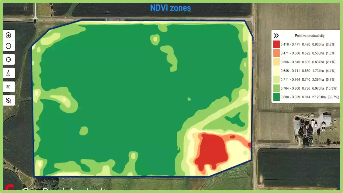
The way topography affects crop vegetation has a significant impact on crop yield (more details are in a previous blog post post here).
The marked areas represent the value of the GeoPard 3D mapping tool, which improves the understanding of the reasons for yield distribution and informs about the necessary changes in planting patterns.
Whatsmore, the 3D topographic maps model provides insight into how watersheds feed into your land and which pathways water takes.
GeoPard’s 3d topographic maps can relay essential information about surface and subsurface drainage inefficiencies, allowing irrigation and drainage systems to be reworked to optimize soil water availability for your crops.
GeoPard is aiming high with the development of new tools like this and is constantly improving and refining its own global understanding related to precision agriculture digital solution demand.
If you are interested in knowing more about how the data is collected and analyzed, feel free to check out this post to learn more!
Најчешћа питања
1. How to turn on topography in google earth?
To enable topography in Google Earth, follow these simple steps. First, open Google Earth on your device. Next, navigate to the “Layers” panel located on the left side of the screen.
Click on the “Primary Database” folder, and then select the checkbox next to “Terrain” or “3D Buildings” to display topographic features. You can further customize the appearance by adjusting the transparency or other settings.
With these steps, you’ll be able to view and explore the topography in Google Earth, enhancing your virtual experience of the Earth’s terrain.
2. How to make a 3d model from a topographic map?
Creating a 3D model from a topographic map involves a few steps. First, obtain a high-resolution topographic map of the desired area. Next, digitize the elevation contours from the map using specialized software or by tracing them manually.
Then, import the digitized contours into a 3D modeling software and extrude them vertically based on their elevation values. Finally, add texture and other details to the model to enhance its appearance.
With these steps, you can transform a topographic map into a 3D model, allowing for a more immersive representation of the terrain.


 Variable rate Lime application based on SoilOptix® pH levels. The cost of product is calculated by GeoPard


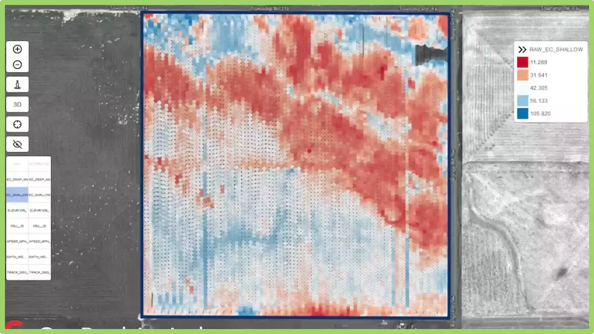


 An example of Electrical Conductivity data collected by our partners.

